List of listed objects in Dunkelsteinerwald (municipality)
The list of listed objects in Dunkelsteinerwald contains the 24 listed , immovable objects of the Lower Austrian community of Dunkelsteinerwald .
Monuments
| photo | monument | Location | description | Metadata |
|---|---|---|---|---|

|
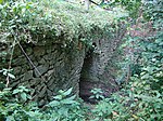
Römerbrücke Oberlanzing ObjectID : 130268 |
Seegraben location KG: Eckartsberg |
The so-called Roman bridge over the Seegraben is an ancient arch bridge made of stone. The Altstraße Hochstraße leads over them . The Römerbrücke Oberlanzing extends over the cadastral communities Eckartsberg, Lanzing and Umbach. |
ObjectID : 130268 Status : Notification Status of the BDA list: 2020-02-29 Name: Römerbrücke Oberlanzing GstNr .: 142 Römerbrücke (Lanzing) |

|
Grabenhof Castle ObjectID : 31683 |
Grabenhof 1 location KG: Gansbach |
A two-story building with core substance from the 15th / 16th centuries. Century. From 1490 referred to as "Grabenhof" with frequently changing owners; privately owned since 1969. |
ObjectID : 31683 Status : Notification Status of the BDA list: 2020-02-29 Name: Schloss Grabenhof GstNr .: 770/1 |

|
Gurhof Castle ObjectID : 31684 |
Gurhof 1 KG location : Gansbach |
A sprawling complex, the first construction of which was built between 1483 and 1493. A penal institution was housed in it from 1948 to 1968 and has been in private use ever since. |
ObjectID : 31684 Status : Notification Status of the BDA list: 2020-02-29 Name: Gurhof Castle GstNr .: .55 / 1; .79 |

|
Marian column and pillory ObjectID : 90240 |
Marktplatz location KG: Gansbach |
The statue of the Virgin Mary, a Madonna and Child from the 18th century, stands on the chamfered shaft of the former pillory from 1643. |
ObjectID : 90240 Status: § 2a Status of the BDA list: 2020-02-29 Name: Mariensäule and pillory GstNr .: 1129/1 |

|
Catholic parish church hl. Bartholomäus ObjectID : 53747 |
Marktplatz location KG: Gansbach |
Choir from the 14th century, main nave and the south tower in the core probably from the 15th century. |
ObjectID : 53747 Status: § 2a Status of the BDA list: 2020-02-29 Name: Catholic parish church hl. Bartholomäus GstNr .: .14 Parish Church Gansbach |

|
Parsonage Object ID: 90211 |
Marktplatz 1 KG location : Gansbach |
The parsonage next to the church dates back to the core of the 16th and 18th centuries; it was rebuilt in 1855–1860. The hook-shaped, one to two-story building has baroque window baskets and is partially vaulted inside. A baroque St. The grave with painted board cut figures of angels and guardians was restored in 1983. The garden with the pier wall dates from the 19th century. |
ObjectID : 90211 Status: § 2a Status of the BDA list: 2020-02-29 Name: Pfarrhof GstNr .: .13 / 1 |

|
Prangermandl statue ObjectID : 90242 |
Marktplatz 14 KG location : Gansbach |
The fragmented Prangermandl statue of the former pillory, built in 1643, stands on the market square near the Marian column . Note: In September 2012 there was no “Prangermandl statue” at the address given or according to the description; In July 2014 it stands on a newly erected pillar in front of the northwest corner of the elementary school, Marktplatz 15. |
ObjectID : 90242 Status : Notification Status of the BDA list: 2020-02-29 Name: Prangermandl statue GstNr .: .16 / 1 Prangermandl Gansbach |

|
Shrine Object ID: 90247 |
Location KG: Gansbach |
ObjectID : 90247 Status: § 2a Status of the BDA list: 2020-02-29 Name: Bildstock GstNr .: 1148 Gansbach Bildstock Langeggerweg |
|

|
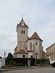
Catholic parish church hl. John the Baptist and Cemetery ObjectID : 53802 |
Am Kirchenberg location KG: Gerolding |
The Roman Catholic parish church of Gerolding ( patronage : St. John the Baptist ) is a Gothic hall church with a Romanesque core and a neo-Gothic porch. |
ObjectID : 53802 Status: § 2a Status of the BDA list: 2020-02-29 Name: Catholic parish church hl. John the Baptist and cemetery GstNr .: .1; 10 Gerolding parish church |

|
Vicarage ObjectID : 90290 |
Am Kirchenberg 6 KG location : Gerolding |
The rectory was built in 1861, two-story under a hipped roof. It is connected to the churchyard by a wall. |
ObjectID : 90290 Status: § 2a Status of the BDA list: 2020-02-29 Name: Pfarrhof GstNr .: .2 |

|
Former Elementary school ObjectID : 90291 |
Community square 1 KG location : Gerolding |
ObjectID : 90291 Status : Notification Status of the BDA list: 2020-02-29 Name: Former Primary school GstNr .: 14 |
|

|
Wegkapelle ObjektID : 90296 |
Location KG: Häusling |
The niche chapel from the 19th century contains a copy of a medieval statue of a Madonna and Child, probably from the 20th century. |
ObjectID : 90296 Status: § 2a Status of the BDA list: 2020-02-29 Name: Wegkapelle GstNr .: 252/4 |

|
Römerbrücke Oberlanzing ObjectID : 49477 |
Oberlanzing location KG: Lanzing |
The Römerbrücke Oberlanzing extends over the cadastral communities Eckartsberg (see there), Lanzing and Umbach. |
ObjectID : 49477 Status : Notification Status of the BDA list: 2020-02-29 Name: Römerbrücke Oberlanzing GstNr .: 158; 1/1; 65/1; 142 Roman Bridge (Lanzing) |

|
Hochstraße ObjektID : 105331 |
Location KG: Lerchfeld |
The old street “Hochstraße”, which starts at the eastern foot of the Brackersberg, is probably part of the Roman imperial road Vienna- Mautern - Melk , the Hochstraße crosses the Seegraben with the so-called Roman bridge . The Hochstraße is a 1900 meter long dirt road in the cadastral communities of Lerchfeld and Pfaffing . |
ObjectID : 105331 Status: § 2a Status of the BDA list: 2020-02-29 Name: Hochstraße GstNr .: 369/3 Historic road Hochstraße, Dunkelsteinerwald |

|
Catholic parish church Mariae Namen and Friedhof ObjektID : 54956 |
Dunkelsteinerstraße 28, 30 KG location : Mauer |
The Gothic parish and pilgrimage church of Mauer was built on the 14th and 15th centuries. Dated century. It has a carved altar that is considered a masterpiece of the late Gothic period. Its baroque high altar is also remarkable. |
ObjectID : 54956 Status: § 2a Status of the BDA list: 2020-02-29 Name: Catholic parish church Mariae names and cemetery GstNr .: 1386 Wallfahrtskirche Mauer near Melk |

|
Shrine Object ID: 90685 |
at Dunkelsteinerstraße 3 KG location : Mauer |
On the pedestal from 1942 a late Gothic tabernacle with a keel arch, branches and pinnacles; dated 1520. |
ObjectID : 90685 Status: § 2a Status of the BDA list: 2020-02-29 Name: Bildstock GstNr .: 1298/4 |

|
Shrine Object ID: 90686 |
Kirchengasse KG location : Wall |
ObjectID : 90686 Status: § 2a Status of the BDA list: 2020-02-29 Name: wayside shrine GstNr .: 1383 wayside shrine Kirchengasse, Mauer near Melk |
|

|
Parsonage Object ID: 90683 |
Kirchengasse 5 KG location : Wall |
A single-storey building from the 2nd half of the 18th century. In 1970 there was a renovation. |
ObjectID : 90683 Status: § 2a Status of the BDA list: 2020-02-29 Name: Pfarrhof GstNr .: 1386 |

|
Hofanlage Object ID: 90682 |
Loosdorferstrasse 4, 6 KG location : Mauer |
A building with a core substance from the 14th / 15th centuries. Century and across the corner placed support pillars. |
ObjectID : 90682 Status : Notification Status of the BDA list: 2020-02-29 Name: Hofanlage GstNr .: 22/1 |

|
Historic stone bridge ObjectID : 114237 |
Location KG: Mauer |
Note: The stone bridge connects the cadastral communities Neuhofen and Mauer. |
ObjectID : 114237 Status: § 2a Status of the BDA list: 2020-02-29 Name: Historische Steinbrücke GstNr .: 1477 |

|
Shrine Object ID: 90690 |
Location KG: Neuhofen |
ObjectID : 90690 Status: § 2a Status of the BDA list: 2020-02-29 Name: Bildstock GstNr .: 742/1 Wayside shrine 90690, Neuhofen |
|

|
Historic stone bridge ObjectID : 90940 |
Location KG: Neuhofen |
The stone bridge connects the cadastral communities Neuhofen and Mauer (see there). |
ObjectID : 90940 Status: § 2a Status of the BDA list: 2020-02-29 Name: Historische Steinbrücke GstNr .: 758; 765 |

|
Hochstraße ObjektID: 90698 |
KG location : Pfaffing |
The Hochstraße is a dirt road in the cadastral communities Lerchfeld (see there) and Pfaffing. |
ObjectID: 90698 Status: § 2a Status of the BDA list: 2020-02-29 Name: Hochstraße GstNr .: 229 Historic road Hochstraße, Dunkelsteinerwald |

|
Local chapel ObjectID : 90694 |
KG location : Thal |
ObjectID : 90694 Status: § 2a Status of the BDA list: 2020-02-29 Name: Ortskapelle GstNr .: .10 Ortskapelle Thal |
Former monuments
| photo | monument | Location | description | Metadata |
|---|---|---|---|---|

|
Römerbrücke Oberlanzing ObjectID : 130268 to 2012 |
Seegraben location KG: Umbach |
The part of the Römerbrücke Oberlanzing, which is in the KG Umbach, has not been declared a monument, but is no longer specially managed. |
ObjectID : 130268 Status : Notification Status of the BDA list: 2012-06-06 Name: Römerbrücke Oberlanzing GstNr .: 65/1 Römerbrücke (Lanzing) |
Web links
Commons : Listed objects in Dunkelsteinerwald - collection of images, videos and audio files
Individual evidence
- ↑ a b Lower Austria - immovable and archaeological monuments under monument protection. (PDF), ( CSV ). Federal Monuments Office , as of February 14, 2020.
- ↑ a b Bundesdenkmalamt (Ed.): The art monuments of Austria - Lower Austria south of the Danube, in two parts. Part 1: A-L . Verlag Berger, Horn 2003, ISBN 3-85028-364-X , p. 1146 .
- ↑ a b Bundesdenkmalamt (Ed.): The art monuments of Austria - Lower Austria south of the Danube, in two parts. Part 1: A-L . Verlag Berger, Horn 2003, ISBN 3-85028-364-X , p. 518 .
- ↑ Bundesdenkmalamt (Ed.): The art monuments of Austria - Lower Austria south of the Danube, in two parts. Part 1: A-L . Verlag Berger, Horn 2003, ISBN 3-85028-364-X , p. 516 .
- ↑ Bundesdenkmalamt (Ed.): The art monuments of Austria - Lower Austria south of the Danube, in two parts. Part 1: A-L . Verlag Berger, Horn 2003, ISBN 3-85028-364-X , p. 524 .
- ↑ Bundesdenkmalamt (Ed.): The art monuments of Austria - Lower Austria south of the Danube, in two parts. Part 1: A-L . Verlag Berger, Horn 2003, ISBN 3-85028-364-X , p. 728 .
- ^ Lower Austria - immovable and archaeological monuments under monument protection. ( Memento from June 1, 2016 in the Internet Archive ) . Federal Monuments Office , as of June 6, 2012 (PDF).
- ↑ § 2a Monument Protection Act in the legal information system of the Republic of Austria .
