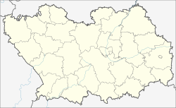
Lunino (Pensa)
| Urban-type settlement
Lunino
Лунино
|
||||||||||||||||||||||||||||||||||||
|
||||||||||||||||||||||||||||||||||||
|
||||||||||||||||||||||||||||||||||||
Lunino ( Russian Лу́нино ) is an urban-type settlement in the Penza Oblast in Russia with 7905 inhabitants (as of October 14, 2010).
geography
The village is just 50 km straight line north of Oblastverwaltungszentrums Penza , about three kilometers from the left bank of the right Volga -Nebenflusses Sura removed.
The settlement is the administrative center of the Luninsky district and the seat and only locality of the municipality (gorodskoje posselenije) Rabotschi possjolok Lunino.
history
The place emerged in the middle of the 17th century (the year of foundation is 1665) and was initially known under the name Archangelskoje , after the Archangel Church there. In 1780 the village became the administrative seat of a Volost under its current name .
On July 16, 1928, the place became the administrative seat of a newly created Rajons named after him. In 1938, Lunino received urban-type settlement status.
Population development
| year | Residents |
|---|---|
| 1897 | 2414 |
| 1926 | 2527 |
| 1939 | 7332 |
| 1959 | 7577 |
| 1970 | 9047 |
| 1979 | 8591 |
| 1989 | 9086 |
| 2002 | 8324 |
| 2010 | 7905 |
Note: census data
traffic
Lunino has a station at kilometer 93 of the Rusajewka - Pensa railway line, which opened on this section in 1895 and has been electrified since 1969 .
The regional road that follows the left bank of the Sura from Penza and branches off further downstream towards the northwestern Mordovian capital Saransk runs through the settlement . Until the construction of the R158 , which ran 30 km to the west, this was the main road connection between the two administrative centers.
Web links
Individual evidence
- ↑ a b Itogi Vserossijskoj perepisi naselenija 2010 goda. Tom 1. Čislennostʹ i razmeščenie naselenija (Results of the All-Russian Census 2010. Volume 1. Number and distribution of the population). Tables 5 , pp. 12-209; 11 , pp. 312–979 (download from the website of the Federal Service for State Statistics of the Russian Federation)


