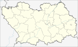
Bashmakovo (Penza)
| Urban-type settlement
Bashmakovo
Башмаково
|
||||||||||||||||||||||||||||||||||
|
||||||||||||||||||||||||||||||||||
|
||||||||||||||||||||||||||||||||||
| List of large settlements in Russia | ||||||||||||||||||||||||||||||||||
Bashmakowo ( Russian Башмако́во ) is an urban-type settlement in Penza Oblast ( Russia ) with 10,416 inhabitants (as of October 14, 2010).
geography
The settlement is located about 130 km west of the Oblastverwaltungszentrums Penza at the headwaters of Poim, a right tributary of Worona .
Bashmakovo is the administrative center of the Rajons Baschmakowski and seat and only town of the municipality (gorodskoje posselenije) Possjolok Bashmakovo.
history
The settlement was founded in 1875 by a railway station on the 1874 opened distance Morshansk - Penza - Syzran between the northern village Koljossowka and the southern, known since 1860 Weiler Michailowka (both were incorporated later). The station was named after two shareholders of the Morshansk-Sysran Railway as well as the Ryashsk- Morzhansker Railway, which was built in 1867 and adjoined the west , the brothers Alexander and Sergei Bashmakov (also engineer in route construction).
In 1928 Bashmakowo became the administrative seat of a Rajon and since 1959 it has had the status of an urban-type settlement.
Population development
| year | Residents |
|---|---|
| 1939 | 3,866 |
| 1959 | 11,245 |
| 1970 | 7,642 |
| 1979 | 8,876 |
| 1989 | 9,935 |
| 2002 | 9,783 |
| 2010 | 10,416 |
Note: census data
traffic
Bashmakovo is located at kilometer 541 (from Moscow ) on the Ryashsk - Syzran route, part of the oldest connection between central Russia and the Urals .
Road connection exists via regional roads to the south to the federal trunk road R208 Tambov - Belinsky - Pensa, about 25 km away , to the northeast, initially along the railway line to Patschelma and further to Nizhny Lomov on the M5 Ural Moscow - Chelyabinsk and in a northwest direction to the neighboring district center Semettschino and further also to the M5.
Individual evidence
- ↑ a b Itogi Vserossijskoj perepisi naselenija 2010 goda. Tom 1. Čislennostʹ i razmeščenie naselenija (Results of the All-Russian Census 2010. Volume 1. Number and distribution of the population). Tables 5 , pp. 12-209; 11 , pp. 312–979 (download from the website of the Federal Service for State Statistics of the Russian Federation)
- ↑ Bashmakowo on the website of the Geographical Institute of the RAN (Russian)
Web links
- Bashmakovo on the website inpenza.ru (Russian)


