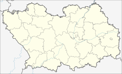
Issa (Penza)
| Urban-type settlement
Issa
Исса
|
||||||||||||||||||||||||||||||||||||
|
||||||||||||||||||||||||||||||||||||
|
||||||||||||||||||||||||||||||||||||
Issa ( Russian И́сса ) is an urban-type settlement in the Penza Oblast in Russia with 5418 inhabitants (as of October 14, 2010).
geography
The village is located approximately 75 km crow flies north of Oblastverwaltungszentrums Penza . It is located a good seven kilometers from the border with the Republic of Mordovia and a few kilometers from the left bank of the right-hand Moksha tributary, Issa, from which it is named.
Issa is the administrative center of the Rajons Issinski and seat of the municipality (gorodskoje posselenije) Rabotchi possjolok Issa, which also includes the villages Kostyljai (4 km northeast) and (5 km to the north) include Simanki.
history
The place was founded at the end of the 17th century and was first mentioned in a document in 1717. From 1780 he belonged to the Ujesd Insar of the Penza governorate . After the Spasskaya Church (from Russian Spas for " Savior ") built in the village in 1764 , the alternative name Spasskoye was also in use.
On July 16, 1928 Issa became the administrative seat of a newly created Rajons named after him. Since August 23, 1979 the place has the status of an urban-type settlement.
Population development
| year | Residents |
|---|---|
| 1897 | 4141 |
| 1939 | 3944 |
| 1959 | 2735 |
| 1970 | 3082 |
| 1979 | 4533 |
| 1989 | 5907 |
| 2002 | 5606 |
| 2010 | 5418 |
Note: census data
traffic
To the west of the settlement, the federal trunk road R158 leads from Nizhny Novgorod via Saransk on via Penza to Saratov . A regional road branches off in an easterly direction via the village of Bulytschowo , which is just under 10 km away , where the nearest train station is on the Rusajewka - Pensa route , to the south-east neighboring district of Lunino .
Web links
Individual evidence
- ↑ a b Itogi Vserossijskoj perepisi naselenija 2010 goda. Tom 1. Čislennostʹ i razmeščenie naselenija (Results of the All-Russian Census 2010. Volume 1. Number and distribution of the population). Tables 5 , pp. 12-209; 11 , pp. 312–979 (download from the website of the Federal Service for State Statistics of the Russian Federation)


