Russky Kameshkir
| Village
Russki Kameshkir
Русский Камешкир
|
||||||||||||||||||||||||||||||||||
|
||||||||||||||||||||||||||||||||||
|
||||||||||||||||||||||||||||||||||
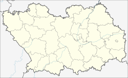
Russki Kameschkir ( Russian Ру́сский Камешки́р ) is a village (selo) in the Penza Oblast in Russia with 5369 inhabitants (as of October 14, 2010).
geography
The town lies on the Volga Upland 80 km straight line southeast of the Oblastverwaltungszentrums Penza . It is located on the Kameshkir river, which flows a good 10 km north of the left into the left Sura tributary Kadada .
Russki Kameschkir is the administrative center of the Kameschkirski Rajons and the seat and only locality of the rural community (selskoje posselenije) Russko-Kameschkirskoje selsowet.
history
The village arose around 1700 on land that belonged to the Trinity Monastery of Sergiev Posad and was initially called Sergievskoye after the local church consecrated to Saint Sergius of Radonezh . Russian peasants belonging to the monastery and Mordvins newly converted to Christianity lived in the village . As a result, after the name of the river and the majority of the population, the current place name with the meaning "Russian Kameshkir" became popular, in contrast to the old Mordovian village near the mouth of the river, originally called Kimishkir , which to this day Mordovsky Kameshkir, i.e. "Mordovian -Kameshkir "means.
The village became the seat of a Volost in Ujesd Kuznetsk , which from 1780 belonged to the Saratov governorate, from December 1796 to March 1797 briefly to the then temporarily disbanded Penza governorate and then to the Saratov governorate .
On July 16, 1928, Russki Kameshkir became the administrative seat of a newly created Rajon. This was in the meantime dissolved from 1963 to 1965, and its territory was annexed to the Kuznetsky rajon.
Population development
| year | Residents |
|---|---|
| 1939 | 5306 |
| 1959 | 4045 |
| 1970 | 3911 |
| 1979 | 5265 |
| 1989 | 5555 |
| 2002 | 5376 |
| 2010 | 5369 |
Note: census data
traffic
Russki Kameshkir is east of the regional road (on its section in the Kameshkirsky rajon referred to as 58K-113), which begins about 25 km north in Nizhnyaya Jeljusan on the M5 Ural federal trunk road and continues via the neighboring district administrative center of Lopatino to Petrovsk in Saratov Oblast leads where it reaches federal highway R158 from Nizhny Novgorod - Saransk - Penza - Saratov . To the south there is a connection to Basarny Karabulak via the 58N-117 ; to the east the 58K-110 leads to the Verkhozim settlement , where there is a connection to the neighboring district center of Kuznetsk and Newerkino .
The nearest train station is located a further 10 km after Nischnjaja Jeljusan in the settlement Tschaadajewka at the track Ryazhsk - Penza - Syzran .
Web links
Individual evidence
- ↑ a b Itogi Vserossijskoj perepisi naselenija 2010 goda. Tom 1. Čislennostʹ i razmeščenie naselenija (Results of the All-Russian Census 2010. Volume 1. Number and distribution of the population). Tables 5 , pp. 12-209; 11 , pp. 312–979 (download from the website of the Federal Service for State Statistics of the Russian Federation)


