Miasteczko Śląskie
| Miasteczko Śląskie | ||
|---|---|---|

|
|
|
| Basic data | ||
| State : | Poland | |
| Voivodeship : | Silesia | |
| Powiat : | Tarnowskie Góry | |
| Area : | 68.30 km² | |
| Geographic location : | 50 ° 30 ′ N , 18 ° 56 ′ E | |
| Residents : | 7437 (Jun. 30, 2019) |
|
| Postal code : | 42-610 | |
| Telephone code : | (+48) 32 | |
| Economy and Transport | ||
| Street : | Bytom - Częstochowa | |
| Rail route : | Katowice – Herby Nowe / Kluczbork | |
| Next international airport : | Katowice | |
| Gmina | ||
| Gminatype: | Borough | |
| Residents: | 7437 (Jun. 30, 2019) |
|
| Community number ( GUS ): | 2413021 | |
| Administration (as of 2007) | ||
| Mayor : | Bronislaw Drozdz | |
| Address: | Rynek 8 42-610 Miasteczko Śląskie |
|
| Website : | www.miasteczko-slaskie.pl | |
Miasteczko Śląskie [ mʲaˈstɛtʃkɔ ˈɕlɔ̃skʲɛ ] (German Georgenberg ) is a town with 7,000 inhabitants in Poland . It is located nine kilometers north of Tarnowskie Góry (Tarnowitz) and belongs to the Powiat Tarnogórski , Silesian Voivodeship .
history
Around 1530, rich silver and lead deposits were discovered in the Tarnowitzer Heights in Upper Silesia . In the corridors of Groß Zyglin (Żyglin) a mine was built near the road from Tarnowitz to Czestochowa , where the miners settled.
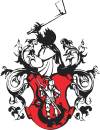
In 1548, the mining of iron ore also came up, in a complaint from the silver works the name of the Georgenberg settlement is used for the first time . In 1561, the owner of the Beuthen estate , Margrave Georg Friedrich von Brandenburg , granted the Georgenberg settlement town rights and the privilege of holding a weekly market and two annual markets . At the same time, the city was given a coat of arms that shows St. George fighting the dragon . In 1562 Georgenberg was raised to the status of a mining town and was given a mining regime under Saxon mining law .
The mining industry brought a rich yield in 1574 was made the presumption of 79 mountain buildings. The town was Protestant and predominantly German-speaking, while the residents of the neighboring towns spoke Polish and called the town Miasteczko (the town). The Thirty Years War brought severe devastation to the city, and mining also ceased in 1627.
In 1632 the Counter Reformation began. In 1666 Georgenberg received its own church for the first time, the scrap wood church of St. Georg and Maria, which however remained a branch church of Groß Zyglin.
Georgenberg became an agricultural town and its population became mostly Polish.
In 1742 the city came to Prussia and lost its city charter due to its insignificance. In 1866 Georgenberg was raised to town again. The iron ore mining was resumed in 1876, the mine came to a standstill again due to the First World War .
The economic upswing in Upper Silesia passed Georgenberg, the only factories being a brick factory and a quarry . In 1905 the new church was consecrated in the city, which was detached from Groß Zyglin in 1913 and given its own parish.
In the referendum in Upper Silesia in 1921, the population of Georgenberg voted for Poland with almost 56% . In 1922 the town in the Tarnowitz district became part of Poland and was named Miasteczko Śląskie. After the attack on Poland in 1939, it was part of the German Reich in violation of international law until 1945 . When he returned to Poland in 1945, Georgenberg got the Polish name back from the interwar period.
In 1946 the villages Żyglin (Groß Zyglin), Żyglinek (Klein Zyglin) and Brynica (Brinitz) were incorporated and the area of the municipality increased to 26.66 km². At the same time Miasteczko Śląskie lost the town charter again. In 1961 a zinc works was built in the place . In 1963 Miasteczko Śląskie became a town again. The incorporation into Tarnowskie Góry , which took place during the municipal reform of 1975, has now been repealed and the town of Miasteczko Śląskie has existed again since 1995.
Population development
|
traffic
The MIASTECZKO ŚLĄSKIE station is on the " carbon highway " mentioned railway Chorzów-Tczew , the MIASTECZKO ŚLĄSKIE Wąskotorowy station on the partially operated even as tourists web Schmalspurbahn poles Północne-Bibiela , the MIASTECZKO ŚLĄSKIE Żyglin station and the breakpoint MIASTECZKO ŚLĄSKIE Brynica at the decommissioned here railroad Tarnowskie Góry – Zawiercie .
Gmina
The municipality of Miasteczko Śląskie covers an area of 68 km² with 7585 inhabitants. It consists of the places Miasteczko Śląskie and Żyglin.
Web links
Individual evidence
- ↑ a b population. Size and Structure by Territorial Division. As of June 30, 2019. Główny Urząd Statystyczny (GUS) (PDF files; 0.99 MiB), accessed December 24, 2019 .
- ↑ For June 30, 2005; Głównego Urzędu Statystycznego na rok 2005 ; http://www.stat.gov.pl/dane_spol-gosp/ludnosc/stan_struk_teryt/2005/30_06/Tablica8.xls

