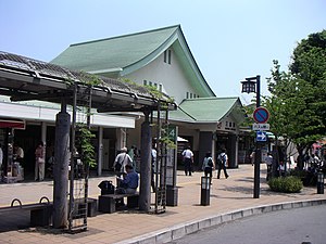
Mishima (Shizuoka)
| Mishima-shi 三島 市 |
||
|---|---|---|
| Geographical location in Japan | ||
|
|
||
| Region : | Chūbu | |
| Prefecture : | Shizuoka | |
| Coordinates : | 35 ° 7 ' N , 138 ° 55' E | |
| Basic data | ||
| Surface: | 62.13 km² | |
| Residents : | 108,118 (October 1, 2019) |
|
| Population density : | 1740 inhabitants per km² | |
| Community key : | 22206-2 | |
| Symbols | ||
| Flag / coat of arms: | ||
| Tree : | ginkgo | |
| Flower : | Mishima sakura | |
| Bird : | kingfisher | |
| town hall | ||
| Address : |
Mishima City Hall 4 - 47 , Kitatamachi Mishima -shi Shizuoka 411-8666 |
|
| Website URL: | http://www.city.mishima.shizuoka.jp | |
| Location of Mishimas in Shizuoka Prefecture | ||
Mishima ( Japanese 三島 市 , - shi ) is a city on the Izu Peninsula in Shizuoka Prefecture in Japan .
The Japanese narrator Hiraoka Kimitake named himself Mishima Yukio after this city .
geography
Its population has been growing steadily since the Shinkansen allowed people to commute to Tokyo, around 100 km away, in about an hour .
history
Under the Ritsuryō system of the Nara period , Mishima became the capital of the Izu province . After that, the city was a post office ( 宿 場 町 Shukuba-machi ) of the Tōkaidō during the Edo period .
The city was founded on April 29, 1941 .
traffic
At Station Mishima trains stop from JR Central , both on the high-speed line Tōkaidō Shinkansen and on the Tōkaidō Main Line , both of Tokyo with Osaka connect. Mishima is also the terminus of the Sunzu line of the Izuhakone Tetsudō railway company to Shuzenji . Mishima can be reached by road from the Tōmei Highway , as well as National Road 1 and National Road 136. From 1906 to 1963, the tram operated to Numazu .
Town twinning
-
 Pasadena , California since July 24, 1957
sons and daughters of the town
- Makoto Ōoka (1931–2017), poet and literary scholar
- Naohiro Takahara (* 1979), soccer player
- Shōhei Matsunaga (* 1989), football player
- Kyōhei Uchida (* 1992), football player
- Seiya Niizeki (* 1999), soccer player
- Yūta Taki (* 1999), soccer player
Neighboring cities and communities
Web links


