Montrose (Town)
| Montrose | ||
|---|---|---|
|
Location in Wisconsin
|
||
| Basic data | ||
| State : | United States | |
| State : | Wisconsin | |
| County : | Dane County | |
| Coordinates : | 42 ° 54 ′ N , 89 ° 33 ′ W | |
| Time zone : | Central ( UTC − 6 / −5 ) | |
|
Inhabitants : - Metropolitan Area : |
1,081 (as of 2010) 568,593 (as of 2010) |
|
| Population density : | 12.1 inhabitants per km 2 | |
| Area : | 89.5 km 2 (approx. 35 mi 2 ) | |
| Height : | 271 m | |
| Area code : | +1 608 | |
| FIPS : | 55-54100 | |
| GNIS ID : | 1583750 | |
| Website : | townofmontrose.com | |
| Mayor : | Roger Hodel (Chairperson) | |
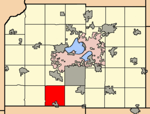
 Location of the Town of Montrose in Dane County |
||
The Town of Montrose is one of 34 Towns in Dane County in the US -amerikanischen State Wisconsin . In 2010 the Town of Montrose had 1,081 residents.
Town has a fundamentally different meaning in Wisconsin than in the rest of the English-speaking area. Rather, it corresponds to the usual townships in the other US states , which form the next smaller administrative unit after the county .
The area of the Town of Montrose is part of the metropolitan area of Madison .
geography
The Town of Montrose is located in southern Wisconsin, in the southwestern suburb of its capital, Madison . The town is traversed in a north-south direction by the Sugar River , which belongs to the Mississippi river basin via the Pecatonica River and the Rock River . The intersection of the three states of Wisconsin, Iowa and Minnesota, located on the Mississippi, is about 190 km to the west-northwest; to Illinois it is around 45 km south.
The coordinates of the geographic center of the Town of Montrose are 42 ° 54'06 "north latitude and 89 ° 32'49" west longitude. It extends over an area of 89.5 km².
The Town of Montrose is located in southwest Dane County and is bordered by the following neighboring towns and independent communities:
| Town of Springdale | Town of Verona | City of Fitchburg |
| Town of Primrose |

|
Town of Oregon |
|
Town of New Glarus ( Green County ) |
Village of Belleville Town of Exeter (Green County) |
Town of Brooklyn (Green County) |
traffic
US Highways 18 and 151 run through the area of the Town of Montrose in a west-east direction on a four-lane joint section . The Wisconsin State Highway 92 runs through the southwest, the County Highway G through the southeast and the County Highway S through the northwest of the Town. All other roads are subordinate country roads and some unpaved roads.
The Badger State Trail, a rail trail for hikers and cyclists, runs through the Town of Montrose area . In winter, the hiking trail can also be used with snowmobiles.
The nearest airport is Dane County Regional Airport in Wisconsin's capital Madison (around 40 km northeast).
population
According to the 2010 census , the Town of Montrose had 1,081 people in 434 households. The population density was 12.1 inhabitants per square kilometer. Statistically, 2.49 people lived in each of the 434 households.
The racial the population was composed of 96.9 percent white, 0.3 percent African American, 0.3 percent Asian and 1.9 percent from other ethnic groups; 0.6 percent were descended from two or more races. Hispanic or Latino of any race was 2.6 percent of the population regardless of ethnicity.
29.9 percent of the population were under 18 years old, 58.8 percent were between 18 and 64 and 13.3 percent were 65 years or older. 48.5 percent of the population was female.
The average annual income for a household was 75,000 USD . The per capita income was $ 35,085. 4.2 percent of the population lived below the poverty line.
Towns in the Town of Montrose
In addition to scattered settlements, the following non-parish settlements exist in the Town of Montrose :
Individual evidence
- ↑ a b American Fact Finder. Retrieved December 17, 2013
- ^ Map from Google Maps on Histopolis.com.Retrieved December 5, 2013
- ^ Wisconsin Department of Natural Resources - Badger State Trail.Retrieved December 17, 2013
