
Murach (Schwarzach)
| Murach | ||
 The Murach (in front) flows into the Schwarzach |
||
| Data | ||
| Water code | EN : 1468 | |
| location | Schwandorf district | |
| River system | Danube | |
| Drain over | Schwarzach → Naab → Danube → Black Sea | |
| source | near Oberlangau, southwest of the Stückberg 49 ° 31 ′ 54 ″ N , 12 ° 31 ′ 2 ″ E |
|
| Source height | approx. 740 m | |
| muzzle | west of Zangenstein in the Schwarzach Coordinates: 49 ° 24 '0 " N , 12 ° 18' 37" E 49 ° 24 '0 " N , 12 ° 18' 37" E |
|
| Mouth height | approx. 372 m | |
| Height difference | approx. 368 m | |
| Bottom slope | approx. 11 ‰ | |
| length | 34 km | |
| Catchment area | 124.17 km² | |
| Drain at the Fronhof gauge |
MNQ MQ MHQ HHQ (1995) |
344 l / s 1.36 m³ / s 13.1 m³ / s 28 m³ / s |
| Left tributaries | Hüttenbach, Tannerlbach, Braunbeergraben, Forellenbach, Honigbach, Steinbach, Sallachbach, Wolfsbach | |
| Right tributaries | Rösllohbach, Falzbach, Weißbach, Goldbach, Faustnitz, Cederbach, Döferingbach, Dürnersbach, Moorgraben and Krummbach | |
| Communities | Oberviechtach , Teunz , Niedermurach , Schwarzhofen | |
The Murach is a 34 km long right tributary of the Schwarzach in the Schwandorf district in Upper Palatinate in Bavaria . It rises from several sources southwest of the Stückberg near Oberlangau and flows into the Schwarzach after a south-westerly run with minor fluctuations near Zangenstein.
course
The Murach arises on the wooded southwest slope of the Stückberg ( 808.6 m above sea level ) near the village of Oberlangau in the municipality of Schönsee . Some springs arise here, the highest at a little over about 740 m above sea level. NHN , the drains run up to a kilometer west and then finally unite near the edge of the forest at almost 670 m above sea level. NHN . After the young river has emerged from the forest, it runs through the village of Oberlangau and turns its course steadily to the southwest.
From Mitterlangau to Tannermühle , Neumühle , Plechhammer , Lukahammer , Gartenriedermühle , Hermannsriedermühle and Hebermühle , the Murach flows to Teunz . The Murach comes to the village of Niedermurach via the Reichertsmühle . Past Nottersdorf , Pertolzhofen , Hammermühle, Oberkonhof , Siegelsdorf and Fronhof , the Murach flows into the Schwarzach at Zangenstein , which flows into the Naab at Schwarzenfeld .
Catchment area
The catchment area, about 124 km² in size, stretches in a spindle shape about 22 km from the Stückberg at the northeast tip, which is 808.6 m above sea level. NHN highest point at all, up to the mouth in the southwest; across it it is a maximum of 8.5 km wide. Behind the left watershed, the Ascha flows in the same direction in the south-west to the upward Schwarzach, only very close to this small catchment areas of much shorter Schwarzach tributaries push themselves in between. The drainage area of the downstream Schwarzach tributary Katzbach lies on the eastern watershed near the mouth in the west , beyond the adjoining north-western long one of the Pfreimd , which competes immediately one after the other over its large left tributaries Gleiritsch , Kainzbach , Uchabach and Tröbesbach , in the north then over the Loisbach . Finally, in the northeast, the Scheide separates from the Natschbach , which drains with its upper reaches over a north arch into the Czech Republic to the Pfreimd called Katharinenbach at the very top .
Tributaries
- Rösllohbach and Falzbach near Mitterlangau (from right)
- Hüttenbach near Mitterlangau (from left)
- Tannerlbach, Braunbeergraben and Forellenbach below the Tannermühle (from left)
- Weißbach near Plechhammer (from right)
- Goldbach below the Gartenrieder Mühle (from the right)
- Honigbach near Hebermühle (from left)
- Faustnitz in Teunz (from right)
- Cederbach on the B22 (from the right)
- Steinbach near Niedermurach (from left)
- Sallachbach near Nottersdorf (from left)
- Döferingbach north of Pertolzhofen (from right)
- Wolfsbach in Pertolzhofen
- Dürnersbach before Oberkonhof (from right)
- Moorgraben and Krummbach near Siegelsdorf (from right)
A number of smaller streams are not named.
Picture gallery
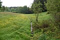
The Murach in the headwaters near Oberlangau
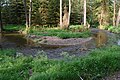
Murach loop near Wutzelstein

The Murach in Teunz
The Murach in Niedermurach

The Murach near Pertolzhofen

The Murach south of Fronhof

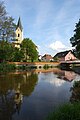
The Murach flows into the Schwarzach near Zangenstein (2011)


Individual evidence
- ↑ a b Height according to the contour diagram on the BayernAtlas. See the → web links .
- ↑ a b Length and catchment area according to: Directory of creek and river areas in Bavaria - Naab river area, page 136 of the Bavarian State Office for the Environment, as of 2016 (PDF; 4.0 MB)
- ^ Bavarian flood news service
- ↑ Bavarian State Surveying Office, Map L 6540, Oberviechtach, M: 1: 50,000
literature
- Bavarian Land Surveying Office, Map L 6540, Oberviechtach
- Bavarian Land Surveying Office, Map L 6538, Nabburg