Neujudenhof
|
Neujudenhof
City of Leverkusen
Coordinates: 51 ° 4 ′ 36 ″ N , 6 ° 55 ′ 35 ″ E
|
||
|---|---|---|
| Height : | 41 m above sea level NN | |
|
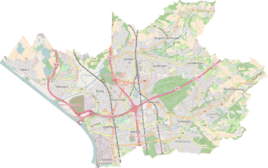
Location of Neujudenhof in Leverkusen |
||
Neujudenhof is a hamlet in the district Hitdorf of the municipality I of Leverkusen .
Location and description
Neujudenhof is located in western Leverkusen on Landesstrasse 43, right on the city limits of Monheim am Rhein and Langenfeld . To the farmstead several large were in the second half of the 20th century lakes ( Big Laachersee , Little Laachersee , Krapuhlsee , Busch Mountain Lake , Blue Danube , Hitdorfsee ) created.
Neighboring towns are Voigtslach , Umlag , Altenhof and Neusshof on Leverkusener, Altjudenhof and the Laacher Hof with Laach Castle on Monheimer, and Wildauen and Neurath on Langenfeld. Is gone on the heath .
history
Carl Friedrich von Wiebeking named the court on his charter of the Duchy of Berg in 1789 as Neu Iüdenhoff . It reveals that Neujudenhof part of his time to the Honschaft Blee in the court of Monheim Bergisch Office Monheim was.
Under the French administration between 1806 and 1813, the Monheim office was dissolved and Neujudenhof was politically assigned to Mairie Monheim in the canton of Richrath in the Düsseldorf arrondissement . In 1816 the Prussians converted the Mairie to the mayor's office in Monheim in the Opladen district . With the dissolution of the district on April 30, 1819, the town and the mayor's office of Monheim became part of the Solingen district .
In 1820 the place, classified as a peasantry , had 28 inhabitants together with Altjudenhof. The place is recorded on the topographical survey of the Rhineland from 1807/1808 as Neuer Judenhof and on the Prussian first survey of 1845 as Judenhof . From the Prussian new admission in 1892, it is regularly recorded on measuring table sheets as Neu-Judenhof or Neujudenhof .
In 1815/1816 28, in 1830 a total of 29 people lived together in the Alt- and Neujudenhof. In 1832 the twin town was part of the village of Monheim within the Monheim mayor. The double village, which was categorized as an arable farm according to the statistics and topography of the Düsseldorf administrative district , had three residential buildings and seven agricultural buildings at that time. At that time, 17 residents lived in the place, all of them Catholic faith.
The municipal and Gutbezirksstatistik the Rhine Province leads Neujudenhof alone in 1871 with a house and seven inhabitants on. In the municipality lexicon for the Rhineland province of 1888, a house with 13 residents was specified for Neu Judenhof . In 1895 the place owned a house with ten inhabitants, in 1905 one house and three inhabitants were given for Neujudenhof .
In the course of the North Rhine-Westphalian regional reform , the municipality of Monheim was incorporated into the city of Düsseldorf in accordance with the Düsseldorf Act with effect from January 1, 1975 , with the Hitdorf district and the neighboring Neujudenhof farm being separated and incorporated into the city of Leverkusen. Even when the city of Monheim became independent again on July 1, 1976 after a successful lawsuit before the State Constitutional Court in Münster , the previously separated city area remained with Leverkusen, so that Neujudenhof, in contrast to the historically strongly linked Altjudenhof, is now a Leverkusen district.
Individual evidence
- ^ Wilhelm Fabricius : Explanations for the Historical Atlas of the Rhine Province. Second volume: The map from 1789. Division and development of the territories from 1600 to 1794. Bonn 1898.
- ↑ JC Dänzer: Décret impérial sur la circonscription territoriale du grand-duché de Berg… Imperial decree on the division of the Grand Duchy of Berg . 1808, urn : nbn: de: hbz: 061: 1-84858 .
- ↑ Alexander A. Mützell: New topographical-statistical-geographical dictionary of the Prussian state . tape 2 . Karl August Künnel, Halle 1821.
- ↑ a b c Johann Georg von Viebahn : Statistics and Topography of the Düsseldorf Government District , 1836
- ↑ Friedrich von Restorff : Topographical-statistical description of the Royal Prussian Rhine Province , Nicolai, Berlin and Stettin 1830
- ↑ Royal Statistical Bureau Prussia (ed.): The communities and manor districts of the Prussian state and their population . The Rhine Province, No. XI . Berlin 1874.
- ↑ Königliches Statistisches Bureau (Prussia) (Ed.): Community encyclopedia for the Rhineland Province, based on the materials of the census of December 1, 1885 and other official sources, (Community encyclopedia for the Kingdom of Prussia, Volume XII), Berlin 1888.
- ↑ Königliches Statistisches Bureau (Prussia) (Ed.): Community encyclopedia for the Rhineland Province, based on the materials of the census of December 1, 1895 and other official sources, (Community encyclopedia for the Kingdom of Prussia, Volume XII), Berlin 1897.
- ↑ Royal Statistical Bureau (Prussia) (Ed.): Community encyclopedia for the Rhineland Province, based on the materials of the census of December 1, 1905 and other official sources, (Community encyclopedia for the Kingdom of Prussia, Volume XII), Berlin 1909

