
Niederneukirchen
|
Niederneukirchen
|
||
|---|---|---|
| coat of arms | Austria map | |
 |
|
|
| Basic data | ||
| Country: | Austria | |
| State : | Upper Austria | |
| Political District : | Linz Land | |
| License plate : | LL | |
| Surface: | 20.78 km² | |
| Coordinates : | 48 ° 10 ' N , 14 ° 20' E | |
| Height : | 336 m above sea level A. | |
| Residents : | 2,108 (January 1, 2020) | |
| Population density : | 101 inhabitants per km² | |
| Postal code : | 4491 | |
| Area code : | 07224 | |
| Community code : | 4 10 15 | |
| NUTS region | AT312 | |
| Address of the municipal administration: |
Dorfplatz 1 4491 Niederneukirchen |
|
| Website: | ||
| politics | ||
| Mayor : | Christoph Gallner ( ÖVP ) | |
|
Municipal Council : (2015) (25 members) |
||
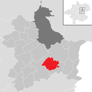
| Location of Niederneukirchen in the Linz-Land district | ||
  |
||
 The place coming from St. Marien . (2005) |
||
| Source: Municipal data from Statistics Austria | ||

Niederneukirchen is a municipality in Upper Austria in the Linz-Land district with 2108 inhabitants (as of January 1, 2020). The community was originally part of the Enns judicial district , since January 1, 2014, the community has been part of the Steyr judicial district .
geography
Niederneukirchen is located at an altitude of 336 m in the Upper Austrian central area , approx. 25 km outside of Linz . The extension is 6.9 km from north to south, and 5.2 km from west to east. The total area is 20.78 km². 10% of the area is forested, 80.4% of the area is used for agriculture. Several small brooks flow through the municipality; the most important is the Ipfbach .
climate
| Niederneukirchen | ||||||||||||||||||||||||||||||||||||||||||||||||
|---|---|---|---|---|---|---|---|---|---|---|---|---|---|---|---|---|---|---|---|---|---|---|---|---|---|---|---|---|---|---|---|---|---|---|---|---|---|---|---|---|---|---|---|---|---|---|---|---|
| Climate diagram | ||||||||||||||||||||||||||||||||||||||||||||||||
| ||||||||||||||||||||||||||||||||||||||||||||||||
|
Average monthly temperatures and rainfall for Niederneukirchen
Source: climate-data.ord
|
||||||||||||||||||||||||||||||||||||||||||||||||||||||||||||||||||||||||||||||||||||||||||
Community structure
The municipality includes the following seven localities (residents in brackets as of January 1, 2020):
- Dörfl (307)
- Grunbrunn (220)
- Niederneukirchen (1089)
- Obereglsee (95)
- Ruprechtshofen (318)
- Ditch (19)
- Untereglsee (60)
The community consists of the cadastral communities Dörfl, Grünbrunn, Niederneukirchen and Ruprechtshofen.
coat of arms
Official description of the municipal coat of arms: In silver from a red shield base, in it a silver daisy flower with a golden lug, two outwardly inclined branches with green leaves growing; above it a blue heraldic lily. The municipality colors are green-white-blue. The blue lily is the symbol of the pilgrimage church in Ruprechtshofen.
history
The earliest written testimony is from 889 and means "Noua ecclesia" (Latin for new church ). In German, the place name appears for the first time in the 11th century as "Niunchirchin". The name refers to the Christianization of Upper Austria in the 9th century.
Originally located in the eastern part of the Duchy of Bavaria, the place belonged to the Duchy of Austria since the 12th century. Since 1490 it has been assigned to the Principality of Austria ob der Enns .
During the Napoleonic Wars , the place was occupied several times.
Since 1918 the place belongs to the federal state of Upper Austria. After the annexation of Austria to the German Reich on March 13, 1938, the place belonged to the Gau Oberdonau . After 1945 the restoration of Upper Austria took place.
politics
Municipal council
The municipal council consists of 25 members and has been composed of mandates from the following parties since the 2015 municipal council election:
In the election on September 27, 2015, Christoph Gallner was elected mayor of the ÖVP, while the vice-mayor is Gertraud Gallner of the ÖVP and Kurt Ebner of the SPÖ. Head of office is Helga Templ.
Population development
In 1991 the municipality had 1,562 inhabitants according to the census, in 2001 it had 1,780 inhabitants. In 2010 the place had 1,902 inhabitants.

Culture and sights

Web links
- Official homepage of the community of Niederneukirchen
- 41015 - Niederneukirchen. Community data, Statistics Austria .
- Further information about the community of Niederneukirchen can be found on the geographic information system of the federal state of Upper Austria .
societies
- Sport Union http://www.union-nnk.at/de
- Mountain Bike Club http://www.mtb-niederneukirchen.at/
- Lovable Niederneukirchen http://www.liebenswertes-nnk.at/
Individual evidence
- ↑ Statistics Austria: Population on January 1st, 2020 by locality (area status on January 1st, 2020) , ( CSV )
- ↑ Minutes of the municipal council meeting on October 28, 2015 ( Memento of the original from January 24, 2017 in the Internet Archive ) Info: The archive link was inserted automatically and has not yet been checked. Please check the original and archive link according to the instructions and then remove this notice. (PDF)

Allhaming | Ansfelden | Branches | Eggendorf im Traunkreis | Enns | Hargelsberg | Hofkirchen im Traunkreis | Hörsching | Kematen an der Krems | Kirchberg-Thening | Kronstorf | Leonding | Neuhofen an der Krems | Niederneukirchen | Oftering | Pasching | Piberbach | Pucking | St. Florian | St. Mary's | Traun | Wilhering