Reichenbach (Klipphausen)
|
Reichenbach
Community Klipphausen
Coordinates: 51 ° 7 ′ 25 ″ N , 13 ° 29 ′ 45 ″ E
|
|
|---|---|
| Incorporation : | July 1, 1950 |
| Incorporated into: | Scharfenberg |
| Postal code : | 01665 |
| Area code : | 03521 |
|
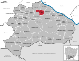
Location of the Reichenbach district in Klipphausen
|
|
Reichenbach is a district of the village Scharfenberg in the municipality of Klipphausen in the district of Meißen , Saxony .
geography
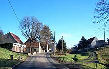
Reichenbach is located south of Meißen in the Meißner highlands . The village is surrounded by the other villages belonging to Scharfenberg and Klipphausen, respectively, Reppnitz in the east, Naustadt in the southeast, Riemsdorf in the southwest, Spittewitz in the west, Bockwen in the northwest and Batzdorf in the north. On the south side of the street there are four original four-sided courtyards , some of which have lost their shape due to the demolition of buildings. On the north side there are smaller farms. Several buildings in the village are protected as cultural monuments (see list of cultural monuments in Reichenbach ).
Reichenbacher Teich is located about 200 meters west of the village. This flood protection basin, through which Riemsdorf water flows, drains via the Rehbock Valley to the nearby Elbe and was created in the 1970s as a water reservoir for the LPG Bockwen.
history
Reichenbach was first mentioned in a document in 1271 as "Richenbach"; the place name means "settlement on the water-rich stream or on the fertile valley floor". The village was administered by the Meissen Hereditary Authority . The lords of the manor Batzdorf exercised the manorial rule . The road Angersdorf decreed in 1884 over a 141-hectare won similar block and strip corridor . Since the 19th century, "Reichenbach bei Meißen", as the rural community was called to distinguish it from about five other places with the same name in Saxony, also included the district of Spittewitz. When the community of Reichenbach lost its independence on July 1, 1950, it was divided for geographical reasons. The main town joined Scharfenberg, Spittewitz came to Bockwen. When Bockwen-Polenz was also incorporated into Scharfenberg on April 1, 1993, Spittewitz and Reichenbach were reunited in one community. Since the incorporation of Scharfenberg on January 1, 1999, Reichenbach has belonged to Klipphausen.
Population development
|
Web links
- Reichenbach (Klipphausen) in the Digital Historical Directory of Saxony
- Reichenbach district on the website of the municipality of Klipphausen
- Newspaper article about the Reichenbacher pond
Individual evidence
- ↑ a b Elbe valley and Lößhügelland near Meißen (= values of our homeland . Volume 32). 1st edition. Akademie Verlag, Berlin 1979, p. 198.
- ↑ Municipalities 1994 and their changes since January 1, 1948 in the new federal states , Metzler-Poeschel publishing house, Stuttgart, 1995, ISBN 3-8246-0321-7 , publisher: Federal Statistical Office
- ↑ StBA: Changes in the municipalities in Germany, see 1999


