Roitzschen
|
Roitzschen
Community Klipphausen
Coordinates: 51 ° 6 ′ 37 ″ N , 13 ° 25 ′ 0 ″ E
|
|
|---|---|
| Height : | 173 m above sea level NN |
| Residents : | 175 (December 31, 2011) |
| Incorporation : | November 1, 1935 |
| Incorporated into: | Miltitz |
| Postal code : | 01665 |
| Area code : | 035245 |
|
Location of the Roitzschen district in Klipphausen
|
|
Roitzschen is a district of the municipality of Klipphausen in the district of Meißen , Saxony .
geography


Roitzschen is located in the Meißner highlands between Nossen and Meißen , west of Dresden . The village is surrounded by the other districts belonging to Klipphausen Robschütz in the north, Sönitz in the east, Weitzschen in the southeast and Miltitz in the southwest. Neighboring northwest is the Käbschützaler district of Luga .
The relaxed farmer Weiler Roitzschen is located in the Triebisch valley at the confluence of the Wiesengrund coming from Zwuschwitz . The town center is along Talstrasse ( State Road 83 ) and on the “Wiesengrund” road. Outside the village center with its four-sided courtyards , there is a small settlement character. Grown together with Roitzschen is the day belonging to the district settlement Roitzschwiese which lies along the same road. Another street connects Roitzschen with Krögis . In the north of the corridor, on the orographically right side, the Gallenbach coming from Seeligstadt and Piskowitz flows into the Triebisch. To the public transport Roitzschen is on the bus lines 413 and 418 of the Meissen transport company connected. At the breakpoint Miltitz-Roitzschen along the railway line Borsdorf-Coswig make regional rail station.
Local history
Roitzschen was first mentioned in 1071 as "Rocina in burgwardo Trebista "; however, the assignment is considered uncertain. What is certain, however, is that the "Reschen" mentioned in 1264 is today's Klipphausen district. The place name changed over the centuries via the forms "Reczen", "Recschen", "Retzin", "Retzschen" and "Retzen" to the current spelling, which is attested in 1768, among other things. The place name is derived from the Old Sorbian * rěka, German Bach , and means "place on the brook", which is in line with the location of Roitzschen.
Around Roitzschen, whose residents earned their income from agriculture, stretched a 147 hectare block and striped field . Roitzschen was an official village; For centuries the estate and administration was the responsibility of the Meissen inheritance . In 1856 Roitzschen belonged to the Meißen court office and then joined the Meißen district administration , from which the district of the same name emerged. On the basis of the rural community order of 1838 , Roitzschen gained independence as a rural community. The Roitzschwiese settlement on the orographically right Triebischufer , which had previously belonged to Robschütz, was connected to Roitzschen in 1925 through a reorganization . Through incorporation , Roitzschen and Roitzschwiese became part of the Miltitz community on November 1, 1935, which in turn merged with Burkhardswalde-Munzig and Garsebach on March 1, 1994 to form the new community of Triebischtal. With the incorporation of Triebischtal on July 1, 2012, Roitzschen became a part of the municipality of Klipphausen.
Neidmühle and other cultural monuments
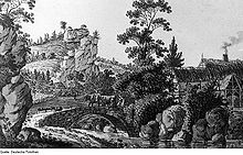
The Neidmühle is in the north of the corridor, near the confluence of the Gallenbach in the Triebisch. It has existed since 1516 and was in service as a water-powered flour mill until 1965. About two years later, the ZBO Aufbau Miltitz moved into the area, converted parts of the building for residential and administrative purposes and set up workshops. The mill yard has survived to the present day, and drive shafts of the two overshot water wheels can still be seen in the cellar. A small exhibition shows everyday objects and illustrates the history of the mill, which is now owned by a stonemason and monument preservation company.
In addition to the Neidmühle, several other buildings in the village are protected as cultural monuments (see list of cultural monuments in Roitzschen ).
Population development
| year | Residents |
|---|---|
| 1551 | 6 possessed men , 29 residents |
| 1764 | 5 possessed men, 4 cottagers |
| 1834 | 91 |
| 1871 | 112 |
| 1890 | 187 |
| 1910 | 257 |
| 1925 | 337 |
| 1939 | see Miltitz |
Web links
Individual evidence
- ^ Ernst Eichler / Hans Walther : Historical book of place names of Saxony. Vol. 2, Berlin 2001. p. 303.
- ^ Michael Rademacher: German administrative history from the unification of the empire in 1871 to the reunification in 1990. City and district of Meißen. (Online material for the dissertation, Osnabrück 2006).
- ↑ Elbe valley and Loesshügelland near Meißen (= values of our homeland . Volume 32). 1st edition. Akademie Verlag, Berlin 1979, p. 195.
- ^ Roitzschen in the Digital Historical Directory of Saxony


