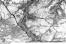
Sachsdorf
|
Sachsdorf
Community Klipphausen
Coordinates: 51 ° 4 ′ 6 ″ N , 13 ° 32 ′ 13 ″ E
|
|
|---|---|
| Height : | 250 m above sea level NN |
| Incorporation : | July 1, 1950 |
| Postal code : | 01665 |
| Area code : | 03521 |
|
Location of the Sachsdorf district in Klipphausen
|
|
Sachsdorf is a district of the village of Klipphausen in the municipality of the same name in the district of Meißen , Saxony .
geography
Sachsdorf is located in the part of the Meissen highlands known as Wilsdruffer Land . The village is surrounded by the other districts belonging to Klipphausen, Hühndorf in the east, Kleinschönberg in the northeast and Klipphausen itself in the northwest. The town of Wilsdruff lies to the south .
Agriculturally used plateaus surround the village, which is located in a flat side valley of the Wild Sau , which separates the place from Klipphausen. The federal motorway 4 runs through the south of the Sachsdorfer Flur in an east-west direction and roughly forms the border to Wilsdruff.
The center of the street tanger village lies along the Hühndorfer Straße. Near the junction of Wilsdruffer Straße is a small chapel, newly built in 1796, and the Klipphausener elementary school at the eastern end of the village. To the public transport Sachs village is by the bus lines 331 of the regional transport Dresden and 428 of the transport company Meissen connected.
history
The place was first mentioned in 1350 as a "Saxon village". It is named after either the Saxon tribal association or a locator whose name was derived from this tribal name. In the centuries that followed, the spellings guaranteed were “Saxindorf”, “Sachsendorff” and “Sachsdorff”.
Around the village, whose inhabitants earned their income from agriculture, a 458 hectare large corridor stretched . With the village, the Reger and the castle mill, three water mills were also in operation. Sachsdorf was parish first to Weistropp , from 1903 to Wilsdruff. The manorial rule was exercised by the respective owners of the manor in the neighboring Klipphausen; for centuries, management was the responsibility of the Meissen inheritance . In 1856 Sachsdorf was part of the Wilsdruff court office and then joined the Meißen district administration , from which the district of the same name emerged. Sachsdorf lost its independence on July 1, 1950 when it was incorporated into Klipphausen.
Several buildings in the village are protected as cultural monuments.
Population development
| year | Residents |
|---|---|
| 1551 | 26 possessed men , 37 residents |
| 1764 | 28 possessed men, 1 gardener, 2 cottagers |
| 1834 | 250 |
| 1871 | 312 |
| 1890 | 295 |
| 1910 | 274 |
| 1925 | 284 |
| 1939 | 264 |
| 1946 | 333 |
| 1950 | see Klipphausen |
literature
- Cornelius Gurlitt : Sachsdorf. In: Descriptive representation of the older architectural and art monuments of the Kingdom of Saxony. 41. Issue: Administrative Authority Meißen-Land . CC Meinhold, Dresden 1923, p. 446.
Web links
- Sachsdorf in the Digital Historical Directory of Saxony
- Sachsdorf district on klipphausen.de
- Sachsdorf address book from 1888
Individual evidence
- ↑ The Sachsdorf chapel is now part of the Wilsdruffer Land parish .
- ^ Website of the Klipphausen primary school .
- ^ Ernst Eichler / Hans Walther : Historical book of place names of Saxony. Vol. 2, Berlin 2001. p. 328.
- ↑ Municipalities 1994 and their changes since January 1, 1948 in the new federal states , Metzler-Poeschel publishing house, Stuttgart, 1995, ISBN 3-8246-0321-7 , publisher: Federal Statistical Office


