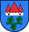
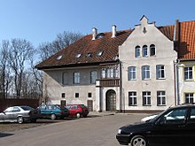
Jeziorany
| Jeziorany | ||
|---|---|---|

|
|
|
| Basic data | ||
| State : | Poland | |
| Voivodeship : | Warmia-Masuria | |
| Powiat : | Olsztyński | |
| Gmina : | Jeziorany | |
| Area : | 3.41 km² | |
| Geographic location : | 53 ° 59 ′ N , 20 ° 46 ′ E | |
| Residents : | 3264 (December 31, 2016) | |
| Postal code : | 11-320 | |
| Telephone code : | (+48) 89 | |
| Economy and Transport | ||
| Street : | Ext. 593 : Miłakowo - Dobre Miasto ↔ Reszel | |
| Ext. 595 : Barczewo → Jeziorany | ||
| Next international airport : | Danzig | |
Jeziorany [ jɛʑɔˈranɨ ] (German Seeburg , Polish formerly Zybork ) is a small town in the Polish Warmian-Masurian Voivodeship . It is the seat of the town-and-country community of the same name and has been a partner community of the Neuenkirchen integrated community since August 2006 .
Geographical location
The small agricultural town, through which the small river Symsarna (Simser) flows, is located in historic Warmia on the northeastern edge of the Allenstein Lake District, which in turn belongs to the Masurian Lake District , about 33 kilometers northeast of Olsztyn (Allenstein) and 80 kilometers southeast of Kaliningrad (Königsberg) .
Agricultural areas in the immediate vicinity merge into a hilly forest and lake landscape. There are three smaller lakes within a five-kilometer radius, and the 6.92 km² lake Ławki (Lauternsee) extends just a little further to the east . Heidenberg rises five kilometers to the southwest at 179 meters .
history
After the Warmian bishops began to settle the southeast of the diocese, described as wilderness, in the second half of the 13th century, they built a castle on a small hill on the bank of the Simser River to protect and as a refuge for the settlers who lived there . These were repeatedly exposed to attacks by Lithuanian intruders. A Castle is the developed under the direction locator Heinrich turning priest soon already on 5 February 1338 after an emerging settlement Kulm law city rights awarded by the Bistumsverweser Nicholas and the bailiff Heinrich von Luther under the name Seeburg. There are different versions of the origin of the place name, which either refer to the area rich in lakes or to the origin of many settlers from the central German Seeburg . The Warmian bishop Hermann von Prag donated the building of a church in Seeburg in 1345, which was carried out between 1360 and 1390. A three-aisled hall church was built on a solid field stone base, which was consecrated to St. Bartholomew . Around 1370 the city was provided with a defensive wall made of field stones.
In the years from 1350 to 1400 the castle was built on the initiative of the bishops Johann I. von Meißen , Johann II. Stryprock and Heinrich III. Sorbom expanded into one of the strongest castles in Warmia. Until the 16th century the castle served as the seat of the bailiffs , who were also the commanders in command of the Warmia troops. Because of its military importance, the castle was provided with an armory and armed with guns. My more than 30 meters high keep was the highest tower of the diocese, the castle but was struck on July 7, 1783. doom, when lightning that made the entire castle in flames. The fire also spread to the city, which was also largely destroyed. The castle was not rebuilt, its stones were used to rebuild the city. The town built a new town hall on the foundations of the west wing of the castle in 1790, after the old town hall, which used to stand on the market, burned down in the first half of the 17th century and could not be rebuilt due to lack of money.
After the Thirteen Years of City War , the Duchy of Warmia, which had been part of the Teutonic Order , and with it Seeburg as well, came to the autonomous Prussian Royal Share , which had voluntarily submitted to the sovereignty of the Polish crown. On the occasion of the establishment of the Union of Lublin on the Lublin Sejm , on March 16, 1569 , King Sigismund II unilaterally terminated the autonomy of the Prussian Royal Part under threat of severe penalties, which is why the sovereignty of the Polish king in this part of the former territory of the Teutonic Order of From 1569 to 1772 it was felt to be foreign rule.
During the period of sovereignty of the Diocese of Warmia, Seeburg was the seat of a chamber office for the administration of its region . During the first Polish partition in 1772, Seeburg became part of Prussia ; the chamber offices were replaced by larger districts in 1818, Seeburg lost its status as administrative center and was assigned to the district of Rößel . At that time, Seeburg was the smallest town in Warmia with around 3,000 inhabitants. Because of the predominantly Catholic orientation of the Warmia, the small Protestant community was only able to build its own church, the Hedwig Church, in 1887. Since the connection to the Heilsberg - Rothfließ railway line did not take place until after 1899, the upswing of industrialization in the 19th century passed Seeburg by and the city remained in the state of an agricultural town where 2,965 people lived in 1910. At the beginning of the 20th century Seeburg had a Protestant church, two Catholic churches, a synagogue , an old castle, a district court, three sawmills and a brick factory.
After the end of the First World War , Seeburg was one of the areas for which the Versailles Treaty had determined a referendum on belonging to East Prussia or Poland. In 1920, 2,380 Seeburg residents voted to remain with East Prussia, Poland received no vote. In 1939 the number of residents increased only slightly to 3,036.
Towards the end of the Second World War , Seeburg was occupied by the Red Army in January 1945 . Half of the city was destroyed. In the summer of 1945, Seeburg was placed under Polish administration by the Soviet occupying power in accordance with the Potsdam Agreement . The Poles introduced the place name Jeziorany for Seeburg . As far as the German natives had not fled, most of them were expelled from Seeburg in the following period .
Population development until 1945
| year | Residents | Remarks |
|---|---|---|
| 1782 | 1,534 | including the suburbs, with a total of 228 fireplaces (households) |
| 1802 | 1,453 | |
| 1810 | 1,134 | |
| 1816 | 1,519 | 119 Protestants, 1,333 Catholics and 67 Jews |
| 1821 | 1,465 | |
| 1831 | 1,900 | |
| 1852 | 2,389 | |
| 1858 | 2,422 | including 153 Evangelicals, 2,206 Catholics and 63 Jews |
| 1864 | 2,972 | on December 3rd |
| 1871 | 2,916 | including 160 Evangelicals and 70 Jews |
| 1875 | 2,926 | |
| 1880 | 2,960 | |
| 1905 | 2,955 | mostly Catholics |
| 1910 | 2,965 | |
| 1933 | 3,069 | |
| 1939 | 3,036 |
Gmina Jeziorany
Today the town, which after the takeover by the Polish administration received the place name Jeziorany (jezioro = lake) translated from German, is the center of the town-and-country municipality of the same name , which has about twice as many inhabitants as the town.
traffic
Several voivodship roads meet in the city , connecting them with the neighboring towns of Dobre Miasto ( Guttstadt ), Lidzbark Warmiński ( Heilsberg ) and Kętrzyn ( Rastenburg ).
The town is located on the former railway line from Czerwonka ( Rothfließ ) to Lidzbark Warmiński .
Personalities
- Johannes Leo (1572–1635), canon at the Guttstädter Kollegiatstift and author of the "Historia Prussiae"
- Joseph Ambrosius Geritz (1783–1867), Roman Catholic Bishop of Warmia from 1841 to 1867
- Eduard Anton Lossau , from 1869 to 1888 the longest-serving mayor of the city of Seeburg
- Hermann Skolaster (1877–1968), Pallottine monk and writer
- Karl Kunkel (1913–2012), pastor in the resistance
- Wolfgang Tarnowski (1931–2018), doctor, politician and author
- Armin Klein (* 1939), politician and member of the Hessian state parliament
- Aleksander Szczygło (1963–2010), former Minister of Defense of Poland
literature
- Johann Friedrich Goldbeck : Complete topography of the Kingdom of Prussia . Part I: Topography of East Prussia . Königsberg / Leipzig 1785, p. 22, point VI, 4).
- August Eduard Preuss : Prussian country and folklore or description of Prussia. A manual for primary school teachers in the province of Prussia, as well as for all friends of the fatherland . Bornträger Brothers, Königsberg 1835, p. 511, no.105.
Web links
- GenWiki: Seeburg (Rößel district)
- City of Seeburg (Rolf Jehke, 2004)
- Official website of the city and municipality (Polish)
- Website about the city and municipality (Polish)
Individual evidence
- ^ Hans Prutz : History of the Neustadt district in West Prussia . Danzig 1872, p. 104 .
- ^ A. Reusch: West Prussia under Polish scepter. Ceremonial speech given at the Elbinger Gymnasium on 13th Spt. 1872 . In: Altpreußieche Monatsschrift , NF, Volume 10, Königsberg 1873, pp. 140–154, especially p. 146 .
- ^ Hans Prutz : History of the Neustadt district in West Prussia . Danzig 1872, p. 104 ff .
- ↑ a b Meyer's Large Conversation Lexicon . 6th edition, Volume 18, Leipzig and Vienna 1909, p. 251
- ↑ jeziorany.com (Polish)
- ^ Johann Friedrich Goldbeck : Complete topography of the Kingdom of Prussia . Part I: Topography of East Prussia . Königsberg / Leipzig 1785, p. 22, point VI, 4).
- ↑ a b c d Alexander August Mützell and Leopold Krug : New topographical-statistical-geographical dictionary of the Prussian state . Volume 5: T – Z , Halle 1823, pp. 378–379, item 671.
- ^ August Eduard Preuss : Prussian country and folklore or description of Prussia. A manual for primary school teachers in the province of Prussia, as well as for all friends of the fatherland . Bornträger Brothers, Königsberg 1835, p. 511, no.105.
- ^ Kraatz: Topographical-statistical manual of the Prussian state . Berlin 1856, p. 569.
- ↑ Adolf Schlott: Topographical-statistical overview of the government district of Königsberg, based on official sources . Hartung, Königsberg 1861, p. 219.
- ↑ Prussian Ministry of Finance: The results of the property and building tax assessment in the Königsberg administrative district : Berlin 1966, 19th district of Roessel, page 18, item 101.
- ^ Gustav Neumann: Geography of the Prussian State . 2nd edition, Volume 2, Berlin 1874, p. 18, item 12.
- ^ A b c d Michael Rademacher: German administrative history from the unification of the empire in 1871 to the reunification in 1990. roessel.html # ew33rsslseeburg. (Online material for the dissertation, Osnabrück 2006).
- ↑ http://wiki-de.genealogy.net/Seeburg_(Landkreis_R%C3%B6%C3%9Fel)


