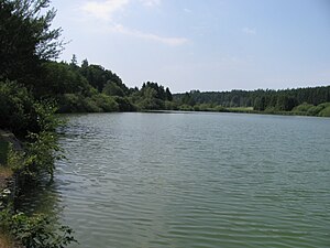
Sießener See (landscape protection area)
|
Landscape protection area
"Sießener See" |
||
| location | Bad Saulgau , Sigmaringen district , Baden-Württemberg , Germany | |
| surface | 17,543 hectares | |
| Identifier | 4.37.011 | |
| WDPA ID | 324572 | |
| Geographical location | 48 ° 0 ' N , 9 ° 28' E | |
|
|
||
| Sea level | from 609.7 m to 625 m ( ø 618 m) | |
| Setup date | September 25, 1940 | |
| administration | District Office Sigmaringen | |
The Sießener See area is a protected landscape area (LSG number 4.37.011) in the area of the Baden-Württemberg city of Bad Saulgau in the Sigmaringen district in Germany .
location
The 17.5 hectare nature reserve “Sießener See” belongs to the natural area “ Donau-Ablach-Platten ”. It is located between the Bad Saulgau districts of Wagenhausen and Sießen , about 3.2 kilometers southwest of Bad Saulgau city center, at an average altitude of 618 m above sea level. NHN
Protection purpose
The main protection purpose is the preservation of the Wagenhauser Weiher , which was built in the 19th century as part of a pond of the Sießen monastery , and its bank areas with their typical plant and animal species .
Flora and fauna
flora
In the southern shore area of the pond is found next to reeds reeds and sedge including the Specular pondweed ( Potamogeton lucens ), the expansion end Water crowfoot ( Ranunculus circinatus ), the narrow-waterweed ( Elodea nuttallii ), the water knotweed ( Persicaria amphibia ) and Krause pondweed ( Potamogeton crispus )
fauna
The lake is populated with pikeperch , pike and carp ; In addition, roach , perch , tench and rudd can be found in the lake.
Numerous species of dragonflies and birds can be observed in the bank area .
See also
- List of landscape protection areas in the district of Sigmaringen
- List of landscape protection areas in Baden-Württemberg
Web links
- Ordinance, data evaluation sheet and map in the profile of the landscape protection area in the protected area directory of the LUBW
Individual evidence
- ↑ Top25 Viewer - [Top. Map 1: 25000 Baden-Württemberg (South)]


