Wagenhauser Weiher
| Wagenhauser Weiher | |
|---|---|

|
|
| Wagenhauser Weiher | |
| Geographical location | Germany , Baden-Wuerttemberg , Sigmaringen district |
| Drain | via Wagenhauser Bach , Krähenbach , Sodenbach and Schwarzach into the Danube |
| Places on the shore | Wagenhausen and Sießen |
| Location close to the shore | Bad Saulgau |
| Data | |
| Coordinates | 48 ° 0 '24 " N , 9 ° 27' 40" E |
| Altitude above sea level | 609 m above sea level NHN |
| surface | 6.2 ha |
| volume | 96,800 m³ |
| Maximum depth | 3.5 m |
| Middle deep | 1.6 m |
| Catchment area | 40 ha |
|
particularities |
Landscape protection area ; Action program for the rehabilitation of Upper Swabian lakes |
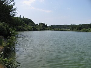
The Wagenhauser Weiher is a small lake in the area of the Baden-Württemberg city of Bad Saulgau in the district of Sigmaringen . It is partially surrounded by forest, relatively warm in summer and has a lido. In addition to bathing, the lake is also used as a fishing spot.
location and size
The Wagenhauser Weiher, which was built in the 19th century as part of a pond for the Sießen monastery , is located about three kilometers southwest of Bad Saulgau city center, between the districts of Wagenhausen and Sießen at an altitude of 609 m above sea level. NHN . The size of the lake is 6.2 hectares , its shore length about 1,050 meters. With an average depth of 1.6 meters (maximum depth = 3.5 m), the lake volume is around 96,800 cubic meters .
biology
The Wagenhauser Weiher is located in the “ Sießener See ” landscape protection area , the surrounding forest and agricultural areas (78 percent grassland, 40% arable land) are used intensively, which, combined with the slope of the usable areas, leads to a considerable input of nutrients.
| 2000 | 2003 | 2007 | ||
| Total PO 4 - phosphorus | (µg / l) | 15th | 23 | 24 |
| Chlorophyll a | (µg / l) | 9 | 14th | 16 |
| Chlorophyll a tip | (µg / l) | 15th | 24 | 27 |
| anorg. Total nitrogen | (mg / l) | 2.40 | 1.32 | |
| Depth of view | (m) | 2.2 | 1.7 | 1.3 |
| 2003 | 2007 | ||
| o-PO 4 phosphorus | (µg / l) | 48 | 29 |
| Total PO 4 phosphorus | (µg / l) | 70 | 53 |
| Nitrate- nitrogen | (mg / l) | 7.14 | 6.23 |
| total inorganic nitrogen | (mg / l) | 7.20 | 6.31 |
| Water flow | (l / s) | 20-150 | 38 |
Flora and fauna
flora
In the southern shore area of the pond is found next to reeds reeds and sedge including the Specular pondweed ( Potamogeton lucens ), the expansion end Water crowfoot ( Ranunculus circinatus ), the narrow-waterweed ( Elodea nuttallii ), the water knotweed ( Persicaria amphibia ) and Krause pondweed ( Potamogeton crispus )
fauna
The lake is populated with pikeperch , pike and carp ; In addition, roach , perch , tench and rudd can be found in the lake.
Numerous species of dragonflies and birds can be observed in the bank area .
Web links
- Action program for the rehabilitation of Upper Swabian lakes , accessed on July 6, 2010
