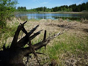
Lake Volzer
| Lake Volzer | |
|---|---|

|
|
| Geographical location | Illmensee , Sigmaringen district , Baden-Württemberg , Germany |
| Tributaries | over ditches in the southwest and southeast, partly from Andelsbach from Ruschweiler See |
| Drain | Andelsbach → Ablach → Danube → Black Sea |
| Data | |
| Coordinates | 47 ° 52 '0.1 " N , 9 ° 21' 37.8" E |
| Altitude above sea level | 691.1 m above sea level NHN |
| surface | 4.7 hectares |
| volume | 58,000 m³ |
| Maximum depth | 1.6 m |
| Middle deep | 1.2 m |
| Catchment area | 91 ha |
|
particularities |
Stone Age bank settlements |
The Volzer See is a still water in the area of the Baden-Württemberg community Illmensee in the district of Sigmaringen in Germany .
geography
General
The approximately five hectares large Volzer lake is one of three separate areas by the silting glacial lakes in the municipality of Illmensee, together with the Illmensee and Rusch hamlet lake it forms a lake district. It is located around one kilometer northwest of the Illmenseer town center at an altitude of 691.1 m above sea level. NHN and is used today for fishing purposes.
Emergence
The Volzer See is a residual lake of a larger coherent tongue basin lake between the terminal moraines of the main and the first retreat stage of the last ice age, the so-called Würme Ice Age, around 18,000 years ago.
Hydrology
The catchment area of Lake Volzer extends to 91 hectares. The size of the water surface is 4.7 hectares , with an average depth of 1.2 meters and a maximum depth of 1.6 meters results in a volume of around 58,000 cubic meters.
The main inflow of the lake comes from trenches in the southwest and southeast and now and then from the Andelsbach from Ruschweiler See and Illmensee , the outflow via Andelsbach and Ablach to the Danube and thus into the Black Sea .
ecology
Since 1989 the Illmensee community has been involved in the action program for the rehabilitation of Upper Swabian lakes with the three lakes . An important goal of this program is to reduce nutrient inputs in streams, lakes and ponds and thereby improve and maintain the condition of the water bodies.
30 percent of the catchment area of Lake Volzer is used for forest and 63 percent for agriculture - 33% of which is grassland and 67% arable land.
| year | 1985 | 1987 | 1988 | 1994 | 2001 | 2009 |
| Total PO 4 - phosphorus (µg / l) | 81 | - | 84 | 97 | 201 | 157 |
| Chlorophyll a (µg / l) | 22nd | 32 | 47 | - | 66 | 84 |
| Chlorophyll a peak (µg / l) | 27 | 24 | 75 | - | 112 | 170 |
| total inorganic nitrogen a (mg / l) | 1.00 | 1.15 | 0.89 | 0.36 | 0.67 | 0.29 |
| Viewing depth (m) | - | 0.9 | 1.1 | - | 0.8 | 0.7 |
Protected areas
Together with the Rusch hamlet lake is the Volzer Lake since 1987, the 70-hectare nature reserve " Rusch hamlet and Volzer Lake " and, added to the Illmensee, the 263.1-hectare conservation area " Illmensee, Rusch hamlet lake and Volzer lake ". Since 2005 the three lakes have belonged to the FFH area “ Pfrunger Ried and Seen bei Illmensee ”.
