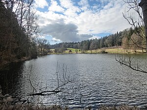
Zellerweiher
| Zellerweiher | |
|---|---|

|
|
| View to the south | |
| Geographical location | Bad Saulgau , Sigmaringen district , Baden-Württemberg , Germany |
| Tributaries | above the sedimentation basin of a former fish farm |
| Drain | Wiesengraben → Stadtbach → Schwarzach → Danube → Black Sea |
| Data | |
| Coordinates | 47 ° 59 '25.1 " N , 9 ° 28' 48.8" E |
| Altitude above sea level | 626.6 m above sea level NHN |
| surface | 1.2 ha |
| volume | 23,100 m³ |
| Maximum depth | 3.4 m |
| Middle deep | 1.9 m |
| Catchment area | 1.97 km² |
|
particularities |
+ Action program for the rehabilitation of Upper Swabian lakes |

|
|
| North view | |
The Zellerweiher is a still water in the area of the Baden-Württemberg city Bad Saulgau in the district of Sigmaringen in Germany .
location
The 1.2 hectare large Zeller pond is located about 3.3 kilometers southwest of Bad Saulgau city center at an altitude of 626.6 meters above sea level. NHN , south of the connecting road from Sießen in the northwest to Wilfertsweiler in the southeast.
Hydrology
The catchment area of the pond extends over 197 hectares. The size of the water surface is 1.2 hectares , with an average depth of 1.9 meters and a maximum depth of 3.4 meters, the volume is around 23,100 cubic meters.
The inflow of the pond takes place via a sedimentation basin of a former fish farm, the outflow via a meadow ditch into the Saulgauer Stadtbach , further into the Schwarzach , the Danube and finally into the Black Sea .
The pond is now privately owned and leased to a local fishing club .
ecology
From 2000 to 2005, and since 2010 Bad Saulgau is the Zeller pond on action program for the rehabilitation of Upper Swabian lakes involved. An important goal of this program is to reduce nutrient inputs in streams, lakes and ponds and thereby improve and maintain the condition of the water bodies.
27 percent of the pond's catchment area is used for agriculture - 40 percent of which is green and 23 percent arable land - the rest of the area is divided between forests and a golf course .
| year | 2000 | 2003 | 2009 |
| Total PO 4 - phosphorus (µg / l) | 19th | 26th | 27 |
| Chlorophyll a (µg / l) | 10 | 12 | 12 |
| Chlorophyll a peak (µg / l) | 18th | 20th | 24 |
| total inorganic nitrogen a (mg / l) | - | 4.99 | 2.95 |
| Viewing depth (m) | 1.7 | 1.5 | 1.5 |
