State Road 2101
| State road 2101 in Bavaria | |
| St 2101 | |
| Basic data | |
| Operator: | Free State of Bavaria |
| Start of the street: |
Bad Reichenhall ( 47 ° 43 ′ N , 12 ° 52 ′ E ) |
| End of street: |
Obernesselgraben ( 47 ° 42 ′ N , 12 ° 48 ′ E ) |
|
Circles : |
|
| Development condition: | Two lanes |

The state road 2101 (St 2101) of the Free State of Bavaria connects the B 20 , the B 21 and the Reichenbachstraße at the traffic distributor south on the Kretabrücke with the B305 - part of the German Alpine Road - at the junction Weinkaser in Obernesselgraben.
prehistory
Part of the route taken by State Road 2101 today has been used by traders and muleers since the Bronze Age . The Celts had an extensive trade network, for which the settlements in Karlstein were an important hub. Even then, salt was extracted from the brine springs of the city of Bad Reichenhall , which gave the settlements in the valley basin an above-average size and importance. In Roman times, these old trade routes continued to be used and some of them were expanded and paved .
In the Middle Ages, too, the route over the Thumsee and the Antoniberg was used to transport the salt out of the city in the direction of Tyrol and Lower Bavaria . There are many military structures along this route that testify to a centuries-long struggle for white gold . The Castle Kirchberg ( departed ), the castle Vague (departed), the toll to Karlstein (departed), the ruined tower Amerang (mostly departed) and the ruined castle Karlstein , registered as a building or floor monument in the monument list, bear witness to the clashes this time. Some of these fortified structures only survived for a very short period of time of less than a hundred years and stood in the field of tension between the Bavarian dukes on the one hand and the archbishops of Salzburg on the other.
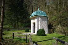
Between 1617 and 1619 the brine pipeline from Bad Reichenhall to Traunstein was built by Hanns Reiffenstuel and his son Simon . Using water power, the brine was pumped up through several wells into an elevated tank, in order to then, using the natural gradient, flow through wooden dykes to the next well. There was a lack of firewood in the city, which is why branch salt pans were built in Traunstein and Rosenheim to use the wood from the forests on the upper reaches of the Traun and Inn to fire the brew pans. The state road follows the course of the brine line between the former Kaitl inn in Karlstein to the end at the Weinkaser junction . Of the fountain houses in Bad Reichenhall, only the Fager fountain house (about a hundred meters south of the state road at the confluence with Thumseestrasse) and the Seebichl fountain house , which is located directly on the state road, are preserved. Both wells are now a listed building. At the same time as the state road was being built, the brine pipeline to Rosenheim also ended; operations ceased on July 1, 1958.
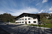
Until the construction of the state road 2101, the Kretabrücke over the Saalach and the traffic distributor south , the traffic moved from Bad Reichenhall in the direction of Schneizlreuth , the Salzburg Pinzgau and Tyrol as well as in the direction of Karlstein, Weißbach an der Alpenstraße , Inzell and Traunstein over the listed Luitpoldbrücke , along the northern slopes of the eastern foothills of the Müllnerberg via Thumseestrasse - which is now also known as the old Thumseestrasse for better differentiation - to Karlstein. At the Moserwirt , about which Wolfgang Amadeus Mozart already reported from one of his trips, the road led past, on over the Seebach , past the Seebach chapel up to the Thumsee. At that time the road still ran along the shore of the lake, where the footpath is today. The road wound on the southern slopes of the Heuberg up into the upper basin ditch and crossed the mountain Antoni before the establishment of the tunnel is still above when Antoni mountain chapel .
course
State road 2101 runs between the traffic distributor south in Bad Reichenhall , first over the Kretabrücke and then as far as possible in a straight line between the residential areas of Kirchberg and the Weitwiese to Karlstein . From there it roughly follows the route of the old road connections up to the Antonibergtunnel and the Weinkaser junction . Between the eastern end of the Thumsee and the Antonibergtunnel, the road was raised by structural measures in order to compensate for differences in the gradient.
use
The 2101 state road - with the extension by the B305 - represents the only direct traffic connection between Bad Reichenhall and Weißbach on the Alpine road and is therefore also the only road connection that connects the Reichenhall valley basin by the shortest possible route with German territory in the north-west. Since the route on the state road is around two kilometers shorter than on the B21 , many commuters between Salzburg and the Pinzgau use this road on their way through the small German corner .
speed limit
Today the maximum speed is limited on the entire state road. Between Reichenbachstraße and Langegasse also the scheme has built-up areas , as well as in Karlstein between the confluence of the Thumseestraße and Seebach chapel .
Since September 2019, the section between the end of Bad Reichenhall at the junction of Langen Gasse and the start of Karlstein near the Gasthof Kaitl has been subject to a maximum speed of 50 km / h as a noise protection measure .
Between Karlstein and the end of the road at the Weinkaser junction , there was no speed limit until about 2010, only between the western end of the Thumsee and the village of Karlstein was a speed limit of 60 in both directions in the summer months between May and October due to the increased traffic by bathers. Due to many serious accidents on the winding part of the road between Thumsee and the Antonibergtunnel, the speed there was initially limited to 80 km / h and later to 60 km / h. Meanwhile, a maximum speed of 60 km / h applies to the entire route between the Weinkaser junction and the entrance to Karlstein.
Tonnage restriction
After years of discussions about using State Road 2101 as an alternative route for heavy traffic - to bypass toll roads such as the A 8 between Piding and Traunstein and to save around two kilometers of driving on the B 21 along the Saalaxis - Bad Reichenhall's Lord Mayor Herbert Lackner ruled March 6, 2020 a tonnage limit. This restriction applies to vehicles with a permissible total weight of more than 7.5 tons in through traffic and applies to the entire state road 2101. Corresponding signs should be at the roundabout on Reichenbachstraße, at the “Kretabrücke” grinder on the B 20 / B 21 and at the “junction Weinkaser ”on the B 305 . Lackner justified the restriction with the fact that it was agreed with the state government to wait for the numbers of truck traffic along the Thumsee until January. Due to the significant increase, the time has come to act.
source
- Bavaria atlas with layer classified road network Bavaria
Individual evidence
- ^ Hubert Vogel: History of Bad Reichenhall , published by the city of Bad Reichenhall 1995; Printed by Anton Plenk KG, Berchtesgaden
- ^ Johannes Lang : History of Bad Reichenhall , Ph.CW Schmidt, Neustadt / Aisch 2009, ISBN 978-3-87707-759-7 ; 2009, p. 100ff
- ^ Herbert Pfisterer: Bad Reichenhall in its Bavarian history Motor + Touristik-Verlag, Munich, 1988
- ^ Fritz Hofmann: Bad Reichenhall as it used to be ; Sutton Verlag Erfurt, 1st edition 1999
- ↑ Tempo 50 signs posted on bgland24.de, accessed on December 27, 2019
- ↑ Bad Reichenhall orders tonnage restrictions for trucks on bgland24.de, accessed on March 6, 2020

