Steyr-Land district
| location | |
|---|---|
| Basic data | |
| state | Upper Austria |
| NUTS III region | AT-314 |
| Administrative headquarters | Steyr |
| surface | 973 km² |
| Residents | 60,717 (January 1, 2020) |
| Population density | 62 inhabitants / km² |
| License Plate | SE |
| District Commission | |
| District chief | Carmen Breitwieser |
| website | www.bh-steyr-land.gv.at |
| map | |
The district of Steyr-Land is a political district of the state of Upper Austria .
It is located in the Traunviertel around the city of Steyr , on the border with Lower Austria .
history
The district was established in 1868. In 1903 the Neuhofen judicial district was attached to the Linz-Land district. In 1938 the judicial districts of Grünburg and Kremsmünster were redistributed to the district authorities of Kirchdorf and Steyr-Land.
District Commission
The district administration is located in the city of Steyr (Spitalskystraße 10a, 4400 Steyr). Steyr itself is a statutory town and therefore has its own district administration.
Administrative division
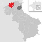
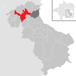
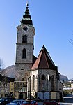
The Steyr-Land district is divided into 20 municipalities , including one town and six market towns . The population figures are from January 1st, 2020.

|
| local community | location | Ew | km² | Ew / km² | Judicial district | region | Type
|
photo | Metadata |
|---|---|---|---|---|---|---|---|---|---|
Adlwang
|

|
1,874 | 17.18 | 109 | Steyr | local community
|

|
According to code: 41501 |
|
Aschach an der Steyr
|

|
2,312 | 21.92 | 105 | Steyr | local community
|

|
Acc. To code: 41502 |
|
Bad Hall
|

|
5,494 | 13.3 | 413 | Steyr | urban community
|

|
According to code: 41503 |
|
Dietach
|

|
3,270 | 20.7 | 158 | Steyr | local community
|

|
Acc. To code: 41504 |
|
Gaflenz
|

|
1.931 | 58.98 | 33 | Steyr | market community
|

|
According to code: 41505 |
|
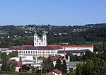
Cooked
|

|
6,640 | 53.29 | 125 | Steyr | market community
|
|
Acc. To code: 41506 |
|
Large framing
|

|
2,677 | 108.02 | 25th | Steyr | local community
|

|
Acc. To code: 41507 |
|
Laussa
|

|
1,232 | 34.48 | 36 | Steyr | local community
|

|
Acc. To code: 41508 |
|
Losenstein
|

|
1,627 | 19.39 | 84 | Steyr | local community
|

|
According to code: 41509 |
|
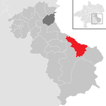
Maria Neustift
|
|
1,614 | 45.87 | 35 | Steyr | local community
|

|
According to code: 41510 |
|
Parish churches near Bad Hall
|

|
2,309 | 11.13 | 207 | Steyr | local community
|

|
Acc. To code: 41511 |
|
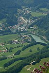
Rich raming
|

|
1,708 | 102.61 | 17th | Steyr | local community
|
|
Acc. To code: 41512 |
|
Rohr in the Kremstal
|

|
1,422 | 13.59 | 105 | Steyr | local community
|

|
Acc. To code: 41513 |
|
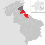
Ortisei near Steyr
|
|
3,043 | 39.1 | 78 | Steyr | local community
|

|
Acc. To code: 41514 |
|
Schiedlberg
|
|
1,249 | 30.01 | 42 | Steyr | local community
|

|
According to code: 41515 |
|
Sierning
|
|
9,375 | 38.28 | 245 | Steyr | market community
|

|
According to code: 41516 |
|
Ternberg
|

|
3,389 | 62.07 | 55 | Steyr | market community
|
|
According to code: 41517 |
|
Waldneukirchen
|

|
2,230 | 26.56 | 84 | Steyr | local community
|

|
Acc. To code: 41518 |
|
|
Weyer
|

|
4.143 | 223.76 | 19th | Steyr | market community
|

|
Acc. To code: 41522 |
|
Wolfern
|

|
3,178 | 32.57 | 98 | Steyr | market community
|

|
Acc. To code: 41521 |
Focus
The main area of the Steyr-Land district is in the cadastral municipality of Stiedelsbach , municipality of Losenstein ( ⊙ ).
Population development

tourism
Tourist highlights in the Steyr-Land district are the Eurotherme Bad Hall and the Kalkalpen National Park , which offers an unspoilt landscape and is ideal for cycling, hiking and horse riding. The Ennstal National Park Visitor Center serves as a contact point.
Web links
Individual evidence
- ↑ Statistics Austria - Population at the beginning of 2002–2020 by municipalities (area status 01/01/2020)
- ↑ center point
Coordinates: 47 ° 57 ' N , 14 ° 24' E


