US Highway 180
| map | |
|---|---|

|
|
| Basic data | |
| Overall length: | 1092 mi / 1757 km |
| Opening: | 1926 |
| States: |
Arizona New Mexico Texas |
| Starting point: |
|
| End point: |
|
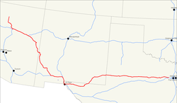
The US Highway 180 is an east-west connection in the western United States . It begins on Arizona State Route 64 in Valle near Grand Canyon National Park and ends on Interstate 20 in Hudson Oaks , Texas . Originally a side route to US Highway 80 , it no longer touches it today.
There are four national parks on his way: the Grand Canyon National Park, the Petrified Forest National Park , the Guadalupe Mountains National Park and the Carlsbad Caverns National Park .
Web links
- End of US Highways (English)
