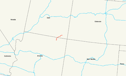
US Highway 163
| map | |
|---|---|

|
|
| Basic data | |
| Overall length: | 64 mi / 103 km |
| Opening: | 1971 |
| States: |
Arizona Utah |
| Starting point: |
|
| End point: |
|
The US Highway 163 (in short: US 163) is a United States highway in the United States km in length 103rd
It runs in a north-south direction with the endpoints Bluff in the north and Kayenta in the south. The road crosses the states of Arizona and Utah on the Colorado Plateau with its well-known erosion forms in red sandstone . A 77 km section, also designated a National Scenic Byway for its spectacular scenery , runs through the Navajo Nation . This includes the section along Monument Valley , which has often been shown in famous films, or the view of the volcanic vent Agathla Peak and some other manifestations of the Navajo Volcanic Field immediately north of Kayenta .
Contrary to the AASHTO's usual numbering system , according to which US 163 should actually be a feeder or bypass route to US Highway 63 , there is no relationship between them.
history
Between 1962 and 1971 the road was named Arizona State Route 464 and was upgraded to the US Highway in 1971.
Web links
- Arizona Roads (English)
- End of US Highways (English)


