
Kalimantan Barat
| Kalimantan Barat | |
|---|---|
 |
|
| Basic data | |
| Area : | 147,307 km² |
| Residents : | 5,440,030 |
| Population density : | 37 inhabitants / km² |
| Capital : | Pontianak |
| governor | H. Sutarmidji |
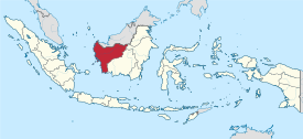
| Location in Indonesia | |
  |
|
| Website : | www.kalbarprov.go.id |

Kalimantan Barat (German West Kalimantan ), sometimes abbreviated to Kalbar , is one of the five Indonesian provinces on the island of Borneo . It was formed at the beginning of 1957 and is the fourth largest province in the country with 147,307 square kilometers.
geography
Kalimantan Barat is located in the southwest of the island of Borneo and borders in the north on the Malaysian state of Sarawak , in the east on the province of Kalimantan Timur , in the south on the Java Sea ( Laut Java ) and in the west on the Natuna Sea ( Laut Natuna ) and the Karimata Strait ( Selat Karimata ). The province is cut by the equator , the capital Pontianak lies on both hemispheres .
The landscape of the province is mainly characterized by flat land. The province is flanked by two mountain ranges: the Kalingkang / Kapuas-Hulu Mountains in the north and the Schwaner Mountains in the south. The highest mountain is the Baturaya (2278 m) in the Serawai subdistrict of the Sintang administrative district, followed by the Batusambung (1770 m) in the Ambalau subdistrict of the same administrative district and close to the border with Malaysia, the Gunung Lawit (1767 m) in the Ambalau Hulu subdistrict of the administrative district Hooda's Hulu.
Most of the land area consists of forest (42.32%) and grassland / bush (34.11%). The settlement area only makes up a small proportion (0.83%).
The coastal regions are characterized by large swamps. Numerous rivers brought the province the name "Land of a Thousand Rivers" (indones. Seribu Sungai). With a length of 1086 km, the Kapuas is also the longest river in Indonesia, 942 km of which are navigable. Other important rivers are the Melawi (471 km navigable), Pawan (197 km), Kendawagan (128 km), Jelai (135 km), Sekadau (117 km), Sambas (233) and Landak (178 km).
There are only two significant lakes: Sentarum (117,500 hectares) and Luar I (5,400 hectares), both of which are located in Kapuas Hulu Governorate. Both lakes are well-visited tourist destinations, the former is also a national park.
The province includes 21 islands, of which Karimatan, Maya, Penebangan, Bawal and Gelam in the Karimata Strait are the largest, they belong to the administrative district of Ketapang. Some of them form the Gunung Palung National Park in this administrative district. Other important islands are Laut, Betangin Tengah, Butung, Nyamuk and Karunia.
Administrative division
The province is divided into twelve administrative districts ( Kabupaten ) and two equivalent cities ( Kota ):
| Code Wilayah area code |
coat of arms | Kabupaten / Kota administrative district / city |
Ibu Kota seat of government |
Kecamatan Sub- District |
Keluruhan / Desa municipality |
Area [km²] | Population [2019] |
Inh. / Km² [2019] |
|---|---|---|---|---|---|---|---|---|
| 61.01 |  |
Kabupaten Sambas | Sambas | 19th | - / 193 | 6,716.52 | 636.848 | 94.8 |
| 61.02 |  |
Kabupaten Mempawah | Mempawah | 9 | 7/60 | 2,797.88 | 306.358 | 109.5 |
| 61.03 |  |
Kabupaten Sanggau | Sanggau | 15th | 6/163 | 12,857.80 | 487.313 | 37.9 |
| 61.04 |  |
Kabupaten Ketapang | Ketapang | 20th | 9/253 | 31,240.74 | 573.074 | 18.3 |
| 61.05 |  |
Kabupaten Sintang | Sintang | 14th | 16/390 | 21,638.20 | 410.734 | 19th |
| 61.06 |  |
Kabupaten Kapuas Hulu | Putussibau | 23 | 4/278 | 29,842.00 | 246,772 | 8.3 |
| 61.07 |  |
Kabupaten Bengkayang | Bengkayang | 17th | 2/122 | 5075.48 | 288,589 | 56.9 |
| 61.08 |  |
Kabupaten Landak | Ngabang | 13 | - / 156 | 8915.10 | 401.147 | 45 |
| 61.09 |  |
Kabupaten Sekadau | Sekadau | 7th | - / 87 | 5444.20 | 214297 | 39.4 |
| 61.10 |  |
Kabupaten Melawi | Nanga Pinoh | 11 | - / 169 | 10640.80 | 233673 | 22nd |
| 61.11 |  |
Kabupaten Kayong Utara | Sukadane | 6th | - / 43 | 4568.26 | 127301 | 27.9 |
| 61.12 |  |
Kabupaten Kubu Raya | Sungai Raya | 9 | - / 117 | 6,958.22 | 607.560 | 87.3 |
| 61.71 |  |
Kota Pontianak | Pontianak | 6th | 29 / - | 107.80 | 668.935 | 6,205.3 |
| 61.72 |  |
Kota Singkawang | Singkawang | 5 | 26 / - | 504.00 | 237.429 | 471.1 |
| 61 | Kalimantan Barat | Pontianak | 174 | 99/2031 | 147,307.00 | 5,440,030 | 36.9 | |
Source of the administrative and area data: Peraturan Menteri Dalam Negeri RI Nomor 72 Tahun 2019 (Ordinance of the Minister of the Interior of October 2019):
The population data are based on updates by the regional civil registration offices and are from the end of 2019
population
The population is made up of immigrated Javanese , Madurese and the native Dayak , who mainly live inland. There are also Chinese who mostly live in the big cities. The capital is Pontianak with almost 670,000 inhabitants, the city of Singkawang has around 237,000 inhabitants.
religion
| religion | Population (2019) | proportion of |
|---|---|---|
| Islam | 3,263,658 | 59.99% |
| Catholics | 1,206,585 | 22.18% |
| Protestants | 627.063 | 11.53% |
| Buddhists | 325.075 | 5.98% |
economy
The most important branches of the economy include oil production and the copra , rubber , wood and palm oil industries . As in many other Indonesian provinces, clearing forests to create plantations is a major ecological problem.
history
The location on the South China Sea and thus along the shipping route from China to India has sparked numerous cultural impulses. The Hinduism shaped the province since the 4th century, was in the 15th century, starting from Brunei and South Sumatra of Islam spread. In 1771 Arab adventurers founded the Sultanate of Pontianak, which came under Dutch administration in the 19th century . Since 1950 Kalimantan Barat has been a province of the now independent Indonesia.
Attractions

The mosque was built on the banks of the Kapuas River in 1771

Singkawang City

A typical Baluk house protects against flooding

Bridge over the Kapuas in Pontianak

The Sentarum Lake

Toah Pek Kong Temple in Sanggau

.jpg)


Web links
- E-books on the statistics page of the province (BPS - Badan Pusat Statistics Provinsi Kalimantan Barat) (Indonesian / English)
- English language tourism site
Individual evidence
- ↑ Geographical Aspects of the Province
- ↑ Peraturan Menteri Dalam Negeri RI Nomor 72 Tahun 2019: page 6, 2448
- ↑ a b Visualisasi Data Kependudukan , clickable map
Aceh | Bali | Bangka Belitung | Banten | Bengkulu | Gorontalo | Jakarta | Jambi | Jawa Barat | Jawa Tengah | East Java | Kalimantan Barat | Kalimantan Selatan | Kalimantan Tengah | Kalimantan Timur | Kalimantan Utara | Lampung | Maluku | Maluku Utara | Nusa Tenggara Barat | Nusa Tenggara Timur | Papua | Papua Barat | Riau | Kepulauan Riau | Sulawesi Barat | Sulawesi Selatan | Sulawesi Tengah | Sulawesi Tenggara | Sulawesi Utara | Sumatra Barat | Sumatra Selatan | Sumatra Utara | Yogyakarta
Coordinates: 0 ° 0 ′ N , 110 ° 30 ′ E