Wichita Falls
| Wichita Falls | |
|---|---|
| Nickname : The City that Faith Built | |
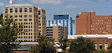
 Downtown Wichita Falls |
|
| Located in Wichita County and Texas | |
| Basic data | |
| State : | United States |
| State : | Texas |
| County : | Wichita County |
| Coordinates : | 33 ° 54 ′ N , 98 ° 31 ′ W |
| Time zone : | Central ( UTC − 6 / −5 ) |
|
Inhabitants : - Metropolitan Area : |
104,724 (as of 2016) 150,734 (as of 2016) |
| Population density : | 572.3 inhabitants per km 2 |
| Area : | 183.1 km 2 (approx. 71 mi 2 ) of which 183.0 km 2 (approx. 71 mi 2 ) are land |
| Height : | 289 m |
| Postcodes : | 76301-76310 |
| Area code : | +1 940 |
| FIPS : | 48-79000 |
| GNIS ID : | 1376776 |
| Website : | www.wichitafallstx.gov |
| Mayor : | Lanham Lyne |
Wichita Falls is a city in Wichita County, Texas in the United States of America . A census from 2000 showed a total population of 104,197 people. The city is the county seat of Wichita County .
Sheppard Air Force Base is located in Wichita Falls .
Wichita Falls is the twin town of the Bavarian major district town of Fürstenfeldbruck . Reason for the intimate connection was the local air base and pilot training ENJJPT (Euro Nato Joint Jet Pilot Training), get their "wings" (jet pilots badge) in all German jet pilots of the Bundeswehr in 12 months of training.
The main newspaper in town is the Times Record News . The incumbent mayor is Lanham Lyne.
geography
The city is only 15 miles from the Oklahoma border . According to the United States Census Bureau , the city has a total area of 183.1 km 2 .
Demographics
| growth of population | |||
|---|---|---|---|
| Census | Residents | ± in% | |
| 1890 | 1978 | - | |
| 1900 | 2480 | 25.4% | |
| 1910 | 8200 | 230.6% | |
| 1920 | 40,079 | 388.8% | |
| 1930 | 43,690 | 9% | |
| 1940 | 45.112 | 3.3% | |
| 1950 | 68,042 | 50.8% | |
| 1960 | 101,724 | 49.5% | |
| 1970 | 96,265 | -5.4% | |
| 1980 | 94.201 | -2.1% | |
| 1990 | 96.259 | 2.2% | |
| 2000 | 104.197 | 8.2% | |
| 2010 | 104,553 | 0.3% | |
| 1890-2000, 2010 | |||
According to the 2000 census, Wichita Falls had 104,197 people in 37,970 households and 24,984 families at that time. The population density was 569.1 / km 2 .
24.7% of the population were under 18 years old, 15.2% were 18 to 24, 29.3% 25 to 44, 18.6% 45 to 64, and 12.3% of the population were 65 or more years old. The average age was therefore 32 years. For every 100 women in Wichita Falls, there were statistically 106.2 men.
The median income for a household was $ 32,554 and the median income for a family was $ 39,911. The median income for male residents was $ 27,609 and that of female residents was $ 21,877. The per capita income was $ 16,761.
13.9% of the population and 10.8% of families are below the poverty line .
traffic
Highways
Wichita Falls is at the west end of Interstate 44 . Some highways connect the city with places near and far: US Highways 287 , 277 , 281 and 82 . The Texas State Route 240 ends in Wichita Falls and State Route 79 crosses the city.
Air traffic
The American Eagle airline connects the city to Dallas International Airport with three daily flights via Wichita Falls Municipal Airport .
sons and daughters of the town
- Frances Reid (1914-2010), actress
- Don Cherry (1924-2018), pop singer and golf professional
- Phyllis Coates (born 1927), actress
- Lloyd Ruby (1928–2009), racing car driver
- John Barron (1930-2005), journalist (KGB revealer)
- Leo Wright (1933–1991), jazz musician
- Larry McMurtry (* 1936), writer and screenwriter
- R. John Collier (* 1938), microbiologist and biochemist
- Tommy Tune (* 1939), dancer, choreographer and theater director
- C. William Kilpatrick (* 1944), mammal loge
- Mike Mullane (* 1945), astronaut
- Chuck Wilson (1948-2018), jazz musician
- John Berg (1949–2007), actor
- Rex Tillerson (* 1952), manager and US Secretary of State
- Steve LaSpina (* 1954), jazz musician
- Greg Abbott (* 1957), lawyer and politician
- Rob S. Bowman (* 1960), film director and film producer
- Stefan Kölsch (* 1968), German-American-Norwegian neuroscientist
- Bingo Merriex (* 1980), basketball player
- Christiane Seidel (* 1982), German-American actress
- Courtney Felinski (* 1992), volleyball player
- Greyson Chance (born 1997), singer
- Laramie Eppler (born 1997), actor
Climate table
| Wichita Falls, Texas | ||||||||||||||||||||||||||||||||||||||||||||||||
|---|---|---|---|---|---|---|---|---|---|---|---|---|---|---|---|---|---|---|---|---|---|---|---|---|---|---|---|---|---|---|---|---|---|---|---|---|---|---|---|---|---|---|---|---|---|---|---|---|
| Climate diagram | ||||||||||||||||||||||||||||||||||||||||||||||||
| ||||||||||||||||||||||||||||||||||||||||||||||||
|
Monthly average temperatures and rainfall for Wichita Falls, Texas
|
|||||||||||||||||||||||||||||||||||||||||||||||||||||||||||||||||||||||||||||||||||||||||||||||||||||||||
See also
Web links
- City website
- Wichita Falls in the Handbook of Texas (English)
- Statistics Wichita Falls (English)
Individual evidence
- ↑ Texas Almanac (PDF; 1.2 MB). Retrieved October 4, 2012
- ↑ US Census ( Memento of the original from May 8, 2012 in the Internet Archive ) Info: The archive link was inserted automatically and has not yet been checked. Please check the original and archive link according to the instructions and then remove this notice. . Retrieved October 16, 2012

