Záskalie
| Záskalie | ||
|---|---|---|
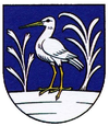
| coat of arms | map | |

|
|
|
| Basic data | ||
| State : | Slovakia | |
| Kraj : | Trenčiansky kraj | |
| Okres : | Považská Bystrica | |
| Region : | Severné Považie | |
| Area : | 2.388 km² | |
| Residents : | 194 (Dec. 31, 2019) | |
| Population density : | 81 inhabitants per km² | |
| Height : | 470 m nm | |
| Postal code : | 017 05 (Post Office Považská Bystrica 5) | |
| Telephone code : | 0 42 | |
| Geographic location : | 49 ° 8 ' N , 18 ° 31' E | |
| License plate : | PB | |
| Kód obce : | 513822 | |
| structure | ||
| Community type : | local community | |
| Administration (as of November 2018) | ||
| Mayor : | František Koleno | |
| Address: | Obecný úrad Záskalie 33 017 05 Považská Teplá |
|
| Website: | zaskalie.webnode.sk | |
| Statistics information on statistics.sk | ||
Záskalie (Hungarian Sziklahát - until 1907 Zászkal ) is a municipality in north-western Slovakia with 194 inhabitants (as of December 31, 2019) and belongs to the Okres Považská Bystrica , a district of the Trenčiansky kraj .
geography
The community is located in the Súľovské vrchy mountains in a small basin surrounded by the Manínsky potok brook . The place can only be reached via two narrow gorges: the Manínska tiesňava westward to Považská Teplá (part of Považská Bystrica ) or Kostolecká tiesňava eastward to Kostolec and Vrchteplá . The center of the village lies at an altitude of 470 m nm and is eight kilometers from Považská Bystrica.
history
Záskalie was first mentioned in writing in 1397 as Chonkakwmegye , which means something like "place closed by truncated rocks".
population
Results after the 2001 census (184 inhabitants):
|
By ethnicity:
|
By religion:
|

