
Zinzenzell
|
Zinzenzell
Community Wiesenfelden
|
|
|---|---|
 |
|
| Height : | 650 m above sea level NHN |
| Area : | 14.37 km² |
| Residents : | 335 (May 25 1987) |
| Population density : | 23 inhabitants / km² |
| Incorporation : | May 1, 1978 |
| Postal code : | 94344 |
| Area code : | 09966 |
 Division of the former community of Zinzenzell to Wiesenfelden and Stallwang
|
|
 View of town with St. Michael church
|
|
Zinzenzell is a parish village in the Lower Bavarian community of Wiesenfelden in the Straubing-Bogen district .
geography
Zinzenzell is located in the Falkensteiner Vorwald on State Road 2147 . The closest cities are Roding (16 km) and Cham (22 km) to the north , Wörth an der Donau (19 km) to the south in the Upper Palatinate and Bogen (24 km) to the south and Straubing (27 km) in Lower Bavaria. The highest elevations of the Zinzenzell district are in Hochriedholz ( 719 m ), in Hochholz ( 703 m ) between Kieselhaus and Beinstreich and the Kammerlsperg ( 701 m ).
The watershed between the Danube and the Regen runs right through the town. While the Miethnach north as Perlbach empties into the rain flowing War Bach in the lower reaches as Schönsteiner Bach to the southeast on the Kinsach the Danube. The Kinsach itself formed the eastern municipal boundary to Loitzendorf and Gittensdorf from the border with Upper Palatinate to Ödling .
history
The place name of Zinzenzell ( Bavarian Zinznzej ), as well as that of the nearby Zinzendorf , is used in the literature of Zinzo , one of the seven witnesses in the so-called "Opi donation" to the monastery Sankt Emmeram in Regensburg (still under Duke Tassilo III. , i.e. shortly before 788).
Geographically, a possible clearing line can be drawn along the Mietnach ( Perlbach ), which could go back to Zinzo. If you follow the course of the Mietnach from Zinzenzell or Mittnach, you will first find the Zinzenberg , which is now completely forested , east of the hamlet of Mietnach (north of the Sengersberg castle ruins ) , and the hamlet of Zinzenthal just before the confluence of the Perlbach north of Trasching into the Regen .
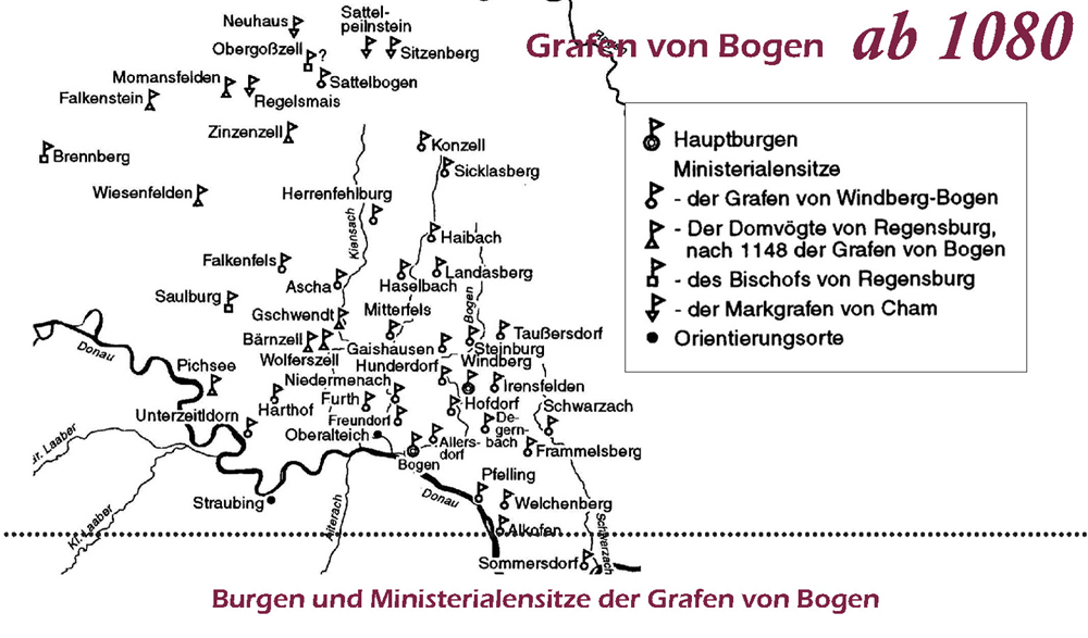
Between 1115 and 1137 Zinzenzell was first mentioned in the annals of the Oberalteich monastery , when the Ministeriale Getwin de Sinzencella appeared as a witness. Zinzenzell was the official seat of the Regensburg cathedral bailiffs . Their castle is said to have stood on the Kammerlsperg, on the southern slope of which Zinzenzell extends. The field name Burgstock equal to Burgstall is the only remaining reference to this so far. In the ducal and electoral times, Zinzenzell was the seat of a chairmanship , and after its dissolution from 1808 to 1818 a tax district as a preliminary stage of today's communities. The Zinzenzell supervisory board with the nursing court in Mitterfels and the Oberamt in Kriseszell included: Beinstreich, Eben (hof), Eggersberg, Emmerszell, Geraszell, Zirnberg. The Zinzenzell tax districts included the following towns: Eben (hof), Edenhof, Engelbarzell, Geraszell, Haunsbach, Kagerhof, Kuchlhof, Rothenberg.
The community was founded by the community edict of May 18, 1818. Until the compulsory dissolution on April 30, 1978 as part of the local government reform in Bavaria , the place was the seat of the community of the same name in what is now the Straubing-Bogen district .


Zinzenzell and its surrounding places were originally from the Kgl. Bayer. Post expedition from Stallwang, until around 1900 Zinzenzell began its 80-year history with the establishment of a Royal Bavarian Post Agency . It had its own post office until post office I 8411 Zinzenzell was closed at the beginning of 1980 (as a result of the regional reform). In addition to the Zinzenzell municipality, the Geraszell district was also supplied by Zinzenzell. The Zinzenzell post office (like the Wiesenfelden post office until 1980) was subordinate to the Falkenstein post office .
On May 1, 1978, a large part of the area of the municipality of Zinzenzell (then 1437 hectares with 611 inhabitants) was incorporated into the municipality of Wiesenfelden, after the application of the municipality of Zinzenzell to join the Stallwang administrative community had been rejected by the government of Lower Bavaria . A smaller part (the six districts Altenhofen, Eggersberg, Haselmühle, Kuglmühl, Ödling and Schleißersgrub with an area of 207 ha) came to Stallwang .
Former municipality of Zinzenzell
Hochödgarten , Kieselhof and Weiherödgarten were listed in the official registers up to and including 1925. The deserted area around 700 meters east of Zinzenzell was called Krieghaus until 1970.
Until 1978 Zinzenzell was an independent municipality with the following districts: Altenhofen , leg match , bleach House , Bühlhaus , Ebenhof , Edenhof , Eggerberg , misery, Emmer cell, Geller village Haselmühle , Haselstein, Hochried, Kager, Kagerhof Pebble House, Kuglmühl , Mittnach, Ödling , prommer Mountain , Schleissersgrub , Weiherhaus, Wullendorf, Zieger , Zinzenzell, Zirnberg.
The municipality of Zinzenzell has had its own coat of arms since 1968. It is formed from the coat of arms of the family of the Zinzenzeller (shield split in silver and red and a helmet from the helmet ornament) and the barons of Magerl, from whose coat of arms the poppy capsules are taken. Officially, the coat of arms is now only worn by the Zinzenzell volunteer fire brigade (in accordance with Appendix 3 to Section 19 Paragraph 2 Sentence 2 2nd HS AVBayFwG) .
Population development in Zinzenzell
| year | 1871 | 1885 | 1900 | 1925 | 1950 | 1961 | 1970 | 1987 |
|---|---|---|---|---|---|---|---|---|
| Inhabitants (place Zinzenzell / district Zinzenzell) | 200/638 | 235/679 | 233/696 | 234/676 | 277/762 | 215/564 | 221/571 | 335 / --- |
Zinzenzell and its former districts form a closed district , whereby the districts of Altenhofen, Eggersberg, Haselmühle, Kuglmühl, Ödling and Schleißersgrub , which have been added to the municipality of Stallwang , have been reclassified into the district of Schönstein after the completion of the land consolidation process TG Zinzenzell .
The Catholic Expositur Zinzenzell
In Zinzenzell there used to be only one chapel, from the furnishings of which the figures of Saints Vitus and Dionysius probably originate from around 1480 and can still be seen on the south wall of the nave of the current church building. In 1836 a "new field chapel" was built, which quickly became too small, so that it had to be enlarged in 1853.
In 1871 the construction of today's church began, dedicated to St. Michael is consecrated. Since one forgot at the Kgl. Bayer. In order to have the construction approved by the district office in Bogen , the "black building" was initially discontinued in 1874, but it was finally allowed to continue building, so that the nave could be completed in 1875. The construction cost 7,325 guilders and 32 cruisers, which corresponds to 69.88 kg of fine silver.
On March 26, 1877, the Zinzenzell Catholic Expositur was founded with extensive rights (weddings, baptisms, funerals). The elevation to a completely independent parish, which had been sought for a long time, was never achieved.
In 1878 the tower was finally completed in its current shape and height. In 1883 the church was modernized in the neo-Gothic style.
The Zinzenzell parishes include: Bleichhaus, Ebenhof, Elend, Gellersdorf, Haunsbach, Hochried, Kagerhof, Kothmühle, Krieghaus, Mittnach, Plenting, Ruppertshof, Stadlberg, Weiherhaus.
The north-eastern parts of the parish of Zinzenzell have always belonged to the parish of Wetzelsberg.
Associations and associations
- Zinzenzell volunteer fire brigade, founded in 1874
- Zinzenzell Warrior and Soldier Association, founded in 1919
- BRK local group Zinzenzell, founded in 1951
- CSU local association Zinzenzell founded in the 1950s as one of the first in the Bogen district
- Löwenschützen Zinzenzell, founded in 1971
- Zinzenzell sports club, founded in 1976
- Zinzenzell fruit and horticultural association, founded in 1990 as a village beautification association and the KLJB and MMC Zinzenzell as church associations
literature
- Max Piendl, Ludwig Holzfurtner: Mitterfels . Historical Atlas of Bavaria. Ed .: Commission for Bavarian State History at the Bavarian Academy of Sciences. Part of Altbayern, issue 62. Munich 2002, ISBN 3-7696-9695-6 .
Individual evidence
- ↑ a b Bavarian State Office for Statistics and Data Processing (Ed.): Official local directory for Bavaria, territorial status: May 25, 1987 . Issue 450 of the articles on Bavaria's statistics. Munich November 1991, DNB 94240937X , p. 241 ( digitized version ).
- ↑ Bavaria Atlas of the Bavarian State Government ( notes )
- ↑ Main publications: Writings of the younger Zinzendorf, Nicolaus Ludwig Zinzendorf (Graf von), G. Olms Verlagsbuchhandlung, 1966, p. 260.
- ↑ Historical Atlas of Bavaria. Part of old Bavaria. Volumes 41–42, p. 22.
- ↑ Monumenta Boica , Volume XII p. 27.
- ^ Max Piendl, Ludwig Holzfurtner: Mitterfels . Historical Atlas of Bavaria. Ed .: Commission for Bavarian State History at the Bavarian Academy of Sciences. Part Altbayern, issue 62. Munich 2002, ISBN 3-7696-9695-6 , p. 69 (note 88).
- ↑ Work group home history Mitterfels ministerial offices .
- ^ Max Piendl, Ludwig Holzfurtner: Mitterfels . Historical Atlas of Bavaria. Ed .: Commission for Bavarian State History at the Bavarian Academy of Sciences. Part Altbayern, issue 62. Munich 2002, ISBN 3-7696-9695-6 , p. 128 .
- ^ Max Piendl, Ludwig Holzfurtner: Mitterfels . Historical Atlas of Bavaria. Ed .: Commission for Bavarian State History at the Bavarian Academy of Sciences. Part Altbayern, issue 62. Munich 2002, ISBN 3-7696-9695-6 , p. 125, 128 .
- ^ Max Piendl, Ludwig Holzfurtner: Mitterfels . Historical Atlas of Bavaria. Ed .: Commission for Bavarian State History at the Bavarian Academy of Sciences. Part Altbayern, issue 62. Munich 2002, ISBN 3-7696-9695-6 , p. 588, 607-609 .
- ↑ M. Gross: Wiesenfelden 1977.
- ^ Federal Statistical Office (ed.): Historical municipality directory for the Federal Republic of Germany. Name, border and key number changes in municipalities, counties and administrative districts from May 27, 1970 to December 31, 1982 . W. Kohlhammer, Stuttgart / Mainz 1983, ISBN 3-17-003263-1 , p. 633 .
- ↑ The district of Bogen. Home of the Bavarian diamond coat of arms. 1968, p. 24 (Editor: District Office Bogen).
- ↑ Our Bavaria. Local supplement of the Bayerische Staatszeitung. 1969, p. 32 (on Zinzenzell).
- ↑ Kgl. Statistical Bureau (ed.): Complete list of localities of the Kingdom of Bavaria. According to districts, administrative districts, court districts and municipalities, including parish, school and post office affiliation ... with an alphabetical general register containing the population according to the results of the census of December 1, 1875 . Adolf Ackermann, Munich 1877, 2nd section (population figures from 1871, cattle figures from 1873), Sp. 408–409 , urn : nbn: de: bvb: 12-bsb00052489-4 ( digital copy ).
- ↑ K. Bayer. Statistical Bureau (Ed.): Localities directory of the Kingdom of Bavaria. According to government districts, administrative districts, ... then with an alphabetical register of locations, including the property and the responsible administrative district for each location. LIV. Issue of the contributions to the statistics of the Kingdom of Bavaria. Munich 1888, Section III, Sp. 387-388 ( digitized version ).
- ↑ K. Bayer. Statistical Bureau (Ed.): Directory of localities of the Kingdom of Bavaria, with alphabetical register of places . LXV. Issue of the contributions to the statistics of the Kingdom of Bavaria. Munich 1904, Section II, Sp. 394-396 ( digitized version ).
- ↑ Bavarian State Statistical Office (ed.): Localities directory for the Free State of Bavaria according to the census of June 16, 1925 and the territorial status of January 1, 1928 . Issue 109 of the articles on Bavaria's statistics. Munich 1928, Section II, Sp. 408 ( digitized version ).
- ↑ Bavarian State Statistical Office (ed.): Official place directory for Bavaria - edited on the basis of the census of September 13, 1950 . Issue 169 of the articles on Bavaria's statistics. Munich 1952, DNB 453660975 , Section II, Sp. 384 ( digitized version ).
- ↑ Bavarian State Statistical Office (ed.): Official city directory for Bavaria, territorial status on October 1, 1964 with statistical information from the 1961 census . Issue 260 of the articles on Bavaria's statistics. Munich 1964, DNB 453660959 , Section II, Sp. 286 ( digitized version ).
- ^ Bavarian State Statistical Office (ed.): Official place directory for Bavaria . Issue 335 of the articles on Bavaria's statistics. Munich 1973, DNB 740801384 , p. 117 ( digitized version ).
- ↑ Page no longer available , search in web archives: Website of the Zinzenzell branch
Web links
- Zinzenzell in the location database of the Bavarian State Library Online . Bavarian State Library