Čerhov: Difference between revisions
Content deleted Content added
m →Genealogical resources: Cleanup/Typo fixing, typo(s) fixed: Romancatholic → Roman Catholic using AWB |
m #article-add-desc Tags: Mobile edit Mobile app edit iOS app edit |
||
| (6 intermediate revisions by 6 users not shown) | |||
| Line 1: | Line 1: | ||
{{Short description|Village and municipality in Slovakia}} |
|||
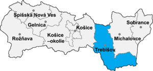
[[Image:Okres trebisov.png|thumb|right|300px|Location of Trebišov District in the [[Region]]]] |
[[Image:Okres trebisov.png|thumb|right|300px|Location of Trebišov District in the [[Region]]]] |
||
[[File:Čerhov - stanica.jpg|thumb|300px|Train station]] |
[[File:Čerhov - stanica.jpg|thumb|300px|Train station]] |
||
| Line 21: | Line 22: | ||
* Roman Catholic church records (births/marriages/deaths): 1849-1922 (parish B) |
* Roman Catholic church records (births/marriages/deaths): 1849-1922 (parish B) |
||
* Greek Catholic church records (births/marriages/deaths): 1770-1895 (parish B) |
* Greek Catholic church records (births/marriages/deaths): 1770-1895 (parish B) |
||
* Reformated church records (births/marriages/deaths): 1770-1933 (parish B) |
* Reformated church records (births/marriages/deaths): 1770-1933 (parish B) |
||
==See also== |
==See also== |
||
* [ |
* [[List of municipalities and towns in Slovakia]] |
||
==External links== |
==External links== |
||
| Line 35: | Line 34: | ||
{{Trebisov District}} |
{{Trebisov District}} |
||
{{coord|48|28|N|21|39|E|region:SK_type:city|display=title}} |
{{coord|48|28|N|21|39|E|region:SK_type:city|display=title}} |
||
{{authority control}} |
|||
{{DEFAULTSORT:Cerhov}} |
{{DEFAULTSORT:Cerhov}} |
||
[[Category:Villages and municipalities in Trebišov District]] |
[[Category:Villages and municipalities in Trebišov District]] |
||
[[Category:Zemplín (region)]] |
|||
Latest revision as of 13:31, 5 March 2024


Čerhov (Hungarian: Csörgő) is a village and municipality in the Trebišov District in the Košice Region of eastern Slovakia.
History[edit]
In historical records the village was first mentioned in 1076.
Geography[edit]
The village lies at an altitude of 123 metres and covers an area of 8.528 km². It has a population of about 820 people.
Ethnicity[edit]
The village is about 95% Slovak.
Facilities[edit]
The village has a public library and a swimming pool.
Genealogical resources[edit]
The records for genealogical research are available at the state archive "Statny Archiv in Kosice, Slovakia"
- Roman Catholic church records (births/marriages/deaths): 1849-1922 (parish B)
- Greek Catholic church records (births/marriages/deaths): 1770-1895 (parish B)
- Reformated church records (births/marriages/deaths): 1770-1933 (parish B)
See also[edit]
External links[edit]
48°28′N 21°39′E / 48.467°N 21.650°E
