Luhyňa

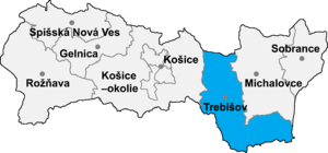
Luhyňa (Slovak pronunciation: [ˈluɦiɲa]; Hungarian: Legenye) is a village and municipality in the Trebišov District in the Košice Region of south-eastern Slovakia.
History[edit]
In historical records the village was first mentioned in 1263.
Geography[edit]
The village lies at an altitude of 187 metres and covers an area of 6.835 km². It has a population of about 315 people.
Ethnicity[edit]
The village is about 98% Slovak.
Facilities[edit]
The village has a public library and a football pitch.
External links[edit]
- https://web.archive.org/web/20070427022352/http://www.statistics.sk/mosmis/eng/run.html
- http://www.gymtv.sk
48°29′N 21°38′E / 48.483°N 21.633°E
