Arnold's Park
| Arnold's Park | |
|---|---|
|
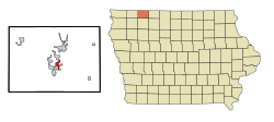
Location in Iowa
|
|
| Basic data | |
| Foundation : | 1897 (incorporated) |
| State : | United States |
| State : | Iowa |
| County : | Dickinson County |
| Coordinates : | 43 ° 22 ′ N , 95 ° 7 ′ W |
| Time zone : | Central ( UTC − 6 / −5 ) |
| Residents : | 1,126 (as of 2010) |
| Population density : | 276.7 inhabitants per km 2 |
| Area : | 4.07 km 2 (approx. 2 mi 2 ) |
| Height : | 437 m |
| Postcodes : | 51331, 51351 |
| Area code : | +1 712 |
| FIPS : | 19-03025 |
| GNIS ID : | 454240 |
| Website : | www.arnoldsparkcity.com |
| Mayor : | Jim Hussong |
Arnolds Park is a city (with the status " City ") in Dickinson County in the US -amerikanischen State Iowa . In 2010 , Arnolds Park had 1,126 residents, which increased to 1,184 by 2013.
geography
Arnold's Park is located in the middle of the Iowa Great Lakes region in northwest Iowa. The city is located on five lakes: West and East Okoboji Lake , Lake Minnewashta, and Upper and Lower Gar Lake . The lakes are part of the Missouri river basin via Milford Creek and Little Sioux River . The Minnesota state line is 160 km north of the city; the Iowa border with South Dakota , formed by the Big Sioux River , runs around 120 km to the west.
The geographical coordinates of Arnolds Park are 43 ° 22'22 "north latitude and 95 ° 07'26" west longitude. The city extends over an area of 4.07 km² and is completely within the Center Grove Township .
Neighboring towns to Arnolds Park are Okoboji (3.1 km northwest), Spirit Lake (7 km north), Estherville (26.5 km east-northeast), Terril (19.9 km southeast), Milford (on the southern city limits) and West Okoboji (6.2 km southwest).
The closest major cities are the Twin Cities in Minnesota ( Minneapolis and Saint Paul ) (290 km northeast), Rochester , Minnesota (275 km east northeast), Waterloo (323 km east southeast), Cedar Rapids (423 km in the same direction), Iowas Capital Des Moines (318 km southeast), Nebraska's largest city, Omaha (286 km south-southwest), Sioux City (174 km southwest) and South Dakota's largest city, Sioux Falls (142 km west-northwest).
traffic
The US Highway 71 runs north-south-west as the main road through Arnolds Park. All other roads are subordinate country roads, some unpaved roads and inner-city connecting roads.
With the Spirit Lake Municipal Airport is located 2 km north-west a small airfield. The nearest commercial airports are Minneapolis-Saint Paul International Airport (287 km northeast), Des Moines International Airport (324 km southeast), Eppley Airfield in Omaha (279 km south-southwest), Sioux Gateway Airport in Sioux City (187 km southwest ) and the Sioux Falls Regional Airport (149 km west-northwest).
population
| Population development | |||
|---|---|---|---|
| Census | Residents | ± in% | |
| 1900 | 251 | - | |
| 1910 | 273 | 8.8% | |
| 1920 | 478 | 75.1% | |
| 1930 | 597 | 24.9% | |
| 1940 | 855 | 43.2% | |
| 1950 | 1078 | 26.1% | |
| 1960 | 953 | -11.6% | |
| 1970 | 970 | 1.8% | |
| 1980 | 1051 | 8.4% | |
| 1990 | 953 | -9.3% | |
| 2000 | 1162 | 21.9% | |
| 2010 | 1126 | -3.1% | |
| 2013 estimate | 1184 | 5.2% | |
| 1900-2000 2010-2013 | |||
According to the 2010 census , Arnolds Park had 1,126 people in 590 households. The population density was 276.7 inhabitants per square kilometer. Statistically, 1.9 people lived in each of the 590 households.
The racial the population was composed of 99.1 percent white, 0.2 percent African American, 0.1 percent (one person) Native American and 0.1 percent from other ethnic groups; 0.5 percent were descended from two or more races. Regardless of ethnicity, 0.3 percent of the population was Hispanic or Latino of any race.
10.1 percent of the population were under 18 years old, 41.4 percent were between 18 and 64 and 32.1 percent were 65 years or older. 48.5 percent of the population were female.
The average annual income for a household was 46,176 USD . The per capita income was $ 34,907. 6.7 percent of the population lived below the poverty line.
Individual evidence
- ↑ City of Arnolds Park - Mayor an Council ( Memento of the original from February 3, 2015 in the Internet Archive ) Info: The archive link was automatically inserted and has not yet been checked. Please check the original and archive link according to the instructions and then remove this notice. Retrieved January 3, 2015
- ↑ a b c American Fact Finder. Retrieved January 3, 2015
- ↑ Distance information according to Google Maps. Accessed January 3, 2015
- ↑ AirNav.com - Spirit Lake Municipal Airport Retrieved on January 3, 2015
- ↑ State Data Center of Iowa (PDF; 86 kB) Retrieved January 3, 2015
