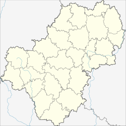
Babynino (Kaluga, settlement)
| settlement
Babynino
Бабынино
|
||||||||||||||||||||||||||||||||
|
||||||||||||||||||||||||||||||||
|
||||||||||||||||||||||||||||||||
Babynino ( Russian Бабы́нино ) is a settlement (possjolok) in the Kaluga Oblast in Russia with 3725 inhabitants (as of October 14, 2010).
geography
The place is about 40 km as the crow flies southwest of the Kaluga Oblast Administrative Center on the watershed between the east-flowing Wyssa , a left tributary of the Oka , and the southeast-flowing Serjona , a left tributary of the left Oka tributary Schisdra .
Baby Nino is the administrative center Rajons Babyninski and seat of the rural community (selskoje posselenije) Possjolok Baby Nino, also owns the one kilometer west facing little village of Sloboda to.
history
The history of the place begins with the construction of the railway line from Moscow to Brjansk in 1897, when a station was built two kilometers west of the village of Babynino (until today independent and seat of the rural community Selo Babynino ). After its opening in 1899, an initially small settlement was built there, in the extreme east of the Ujesd Meschtschowsk , not far from the border to Ujesd Peremyshl in the Kaluga governorate .
The settlement, which was still administratively part of the village at that time, developed more rapidly from the 1920s. In 1926 at the latest, the place became the seat of a Volost , which in 1927 came to Ujesd Kaluga before the Gouvernement and Ujesde were dissolved in 1929. On July 12, 1929, the Babyninski rajon was built with its headquarters in Babynino, as part of Moscow Oblast , initially owned by the Kaluga Okrug until 1930 . From September 26, 1937 to the formation of Kaluga Oblast on July 5, 1944, the Rajon belonged to Tula Oblast . After 1939 the settlement and the original village were administratively separated, and the Rajonsitz was since then in the meanwhile larger station settlement.
During the Second World War , the settlement was occupied by the German Wehrmacht on October 8, 1941 , but was recaptured by the Red Army on December 29, 1941 as part of their counter-offensive in the Battle of Moscow .
Population development
| year | Residents |
|---|---|
| 1939 | 2759 |
| 1959 | 1904 |
| 1970 | 2775 |
| 1979 | 3817 |
| 1989 | 4148 |
| 2002 | 4054 |
| 2010 | 3725 |
Note: census data (1939 today's settlement and village together)
traffic
The station of the same name is located in the Babynino at kilometer 215 of the main line Moscow - Bryansk - Kiev .
To the northwest of Babynino the federal trunk road M3 Ukraina runs from Moscow via Bryansk to the Ukrainian border. The regional road 29K-002 runs through Vorotynsk to Rosva in the western part of the Kaluga district through the town and further northeast along the railway line .
Web links
Individual evidence
- ↑ a b Itogi Vserossijskoj perepisi naselenija 2010 goda. Tom 1. Čislennostʹ i razmeščenie naselenija (Results of the All-Russian Census 2010. Volume 1. Number and distribution of the population). Tables 5 , pp. 12-209; 11 , pp. 312–979 (download from the website of the Federal Service for State Statistics of the Russian Federation)

