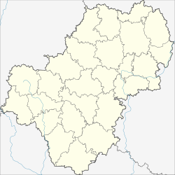
Schisdra
| city
Zhizdra
Жиздра
|
||||||||||||||||||||||||||||||||||||||||||
|
||||||||||||||||||||||||||||||||||||||||||
|
||||||||||||||||||||||||||||||||||||||||||
| List of cities in Russia | ||||||||||||||||||||||||||||||||||||||||||
Schisdra ( Russian Жиздра ) is a small town in the Kaluga Oblast ( Russia ) with 5585 inhabitants (as of October 14, 2010).
geography
The city is located about 180 km southwest of the Oblast capital Kaluga on the Schisdra of the same name , a left tributary of the Oka, which flows into the Volga .
Schisdra is the administrative center of the Rajons of the same name .
history
The first mention of Schisdra comes from the year 1146. The village Schisdra received the town charter in 1777 as the administrative center of a district (see: Ujesd ). The name derived from the river is of Baltic origin and means coarse sand or gravel .
In the 18th and 19th centuries, the city was the center of the timber trade. During this time, the establishment of factories in the region west of the city (e.g. in Lyudinowo ) by the Malzow family, for which iron ore, coal and clays for refractory building materials were mined in the vicinity of Schisdras, was of great importance for the city's economy .
As a result, however, this development did not continue, and Schisdra remained a relatively insignificant small town.
During the Second World War , Schisdra was occupied by the German Wehrmacht on October 5, 1941 . The city was then largely destroyed. Recaptured on August 16, 1943 from the Western Front by the Red Army as part of the Oryol Operation .
The city of Schisdra is located within the Ugra National Park, founded in 1997 .
Population development
| year | Residents |
|---|---|
| 1897 | 6004 |
| 1926 | 6600 |
| 1939 | 8109 |
| 1959 | 5144 |
| 1970 | 5794 |
| 1979 | 5549 |
| 1989 | 5439 |
| 2002 | 5719 |
| 2010 | 5585 |
| 2017 | 5489 |
Note: census data (1926 rounded)
Culture and sights
The city has a local museum.
Economy and Infrastructure
There are companies in the wood processing, textile and food industries in Schisdra.
The Sikejewo station on the Moscow - Brjansk - Kiev railway line, which opened in 1899, is ten kilometers east of the city (km 313). A connecting line to the city opened at the same time was destroyed in World War II and not restored afterwards.
The M3 Moscow – Brjansk – Ukrainian border (from there to Kiev) also runs east of the city. From this a road branches off to Lyudinowo.
Personalities
- Alexei Jelissejew (* 1934 in Schisdra), cosmonaut
Web links
- City administration website (Russian)
- Shizdra on mojgorod.ru (Russian)
Individual evidence
- ↑ a b Itogi Vserossijskoj perepisi naselenija 2010 goda. Tom 1. Čislennostʹ i razmeščenie naselenija (Results of the All-Russian Census 2010. Volume 1. Number and distribution of the population). Tables 5 , pp. 12-209; 11 , pp. 312–979 (download from the website of the Federal Service for State Statistics of the Russian Federation)
- ↑ Sputniknews: The cityscape of Schisdra in central Russia is being restored


