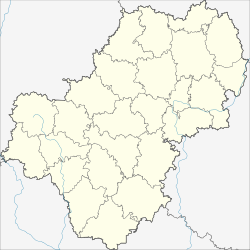
Vorotynsk (Kaluga, Babyninsky)
| Urban-type settlement
Vorotynsk
Воротынск
|
||||||||||||||||||||||||||||||||
|
||||||||||||||||||||||||||||||||
|
||||||||||||||||||||||||||||||||
| List of large settlements in Russia | ||||||||||||||||||||||||||||||||
Vorotynsk ( Russian Вороты́нск ) is an urban-type settlement in the Kaluga Oblast ( Russia ) with 11,288 inhabitants (as of October 14, 2010).
geography
The settlement belongs to the Babyninsky district . It is located a little below the confluence of the Oka and Ugra , about 15 km as the crow flies west-southwest of the city center of the Kaluga oblast administrative center and a good 20 km northeast of the Babynino Rajon center .
Vorotynsk is the seat of the municipality (gorodskoje posselenije) Posjolok Vorotynsk, which also includes the six surrounding villages Kharskoye, Doroponowo, Kumovskoye, Ryndino, Scheinaya Gora and Ukolowka.
history
The settlement emerged from 1899, when the railway line from Moscow to Bryansk was passed there and a station for the then small town of Vorotynsk , located about four kilometers to the south, was opened. The city, first mentioned in the Hypatius Chronicle in 1155 , was the seat of the Vorotynski family in the Middle Ages . In 1480, the city of Akhmat Khan , the leader of the Golden Horde , served as a camp while standing on the Ugra .
The town, which was already insignificant in the 18th century, lost its town status in 192r, has been a village (selo) ever since and today belongs to the neighboring Peremyschlski district . On the other hand, the importance of the town, which is more conveniently located in terms of transport, grew, additionally due to the opening of a military airfield east of the town in the 1930s.
In the 1990s, Vorotynsk received urban-type settlement status.
Population development
| year | Residents |
|---|---|
| 2002 | 11,099 |
| 2010 | 11,288 |
Note: census data
economy
There is a ceramic factory in Vorotynsk. The military airfield, also known as Oreshkovo , was closed in 2013 after the last unit stationed there, the 45th Independent Helicopter Regiment , was relocated to Vyazma in 2010 .
Individual evidence
- ↑ a b Itogi Vserossijskoj perepisi naselenija 2010 goda. Tom 1. Čislennostʹ i razmeščenie naselenija (Results of the All-Russian Census 2010. Volume 1. Number and distribution of the population). Tables 5 , pp. 12-209; 11 , pp. 312–979 (download from the website of the Federal Service for State Statistics of the Russian Federation)
Web links
- Settlement website (Russian)


