Kirov (Kaluga)
| city
Kirov
Киров
|
||||||||||||||||||||||||||||||||||||||
|
||||||||||||||||||||||||||||||||||||||
|
||||||||||||||||||||||||||||||||||||||
| List of cities in Russia | ||||||||||||||||||||||||||||||||||||||
Kirov ( Russian Киров ) is a city in the Kaluga Oblast ( Russia ) with 31,882 inhabitants (as of October 14, 2010).
geography
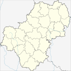
The city is located about 160 km southwest of the Oblast capital Kaluga at the confluence of the Pessochnaja river into the Bolwa in the river system of the Dnieper .
Kirov is the administrative center of the Rajons of the same name .
history
Kirov was in 1745 as a settlement Pessotschnja ( Песочня , after the river; name of Russian pessok for sand ) in connection with the construction of ironworks Pessotschenski Sawod .
In the 19th century, the current owner of the ironworks, Iwan Malzow, also had a faience factory built.
In 1925 the place was given the status of an urban-type settlement , and in 1936 city rights were granted under its current name in honor of Sergei Kirov, who was murdered in 1934 .
During the Second World War , Kirov was occupied by the German Wehrmacht on October 4, 1941 and recaptured on January 11, 1942 by the Western Front of the Red Army as part of the Rzhev-Vyazma operation .
In 1959, the settlement Fajansowy ( Фаянсовый ; with the status of an urban-type settlement since 1940) was incorporated at the railway station Fajansowaja in Kirow (both derived from Russian fajans for "faience").
Population development
| year | Residents |
|---|---|
| 1897 | 4,300 |
| 1939 | 15,313 |
| 1959 | 16,647 1 |
| 1970 | 29,355 |
| 1979 | 33,492 |
| 1989 | 35,962 |
| 2002 | 38,893 |
| 2010 | 31,882 |
Note: census data; 1 and Fajansowy 6,956
Culture and sights

In Kirov, the Church of the Mother of God Nativity ( церковь Рождества Богородицы / zerkow Roshdestva Bogorodizy) from the end of the 18th century and the Alexander Nevogo Church ( церковь Александра Невсerkow93. Alexandra.
Nearby, in the villages Prudki , Wysselzy , Nagornoje and others are Kurgane the vyatichi and krivichs from the 10th to 12th centuries.
Economy and Infrastructure
The most important companies in the city are emerging from the works of the 18th and 19th century farms Kirowski zavod for steel tanks and boilers and Kirowski stroifarfor , which today produces sanitary ceramics and tiles. There are also companies in the textile and food industries as well as in the construction industry.
The city lies at the intersection of the railway lines Vyazma - Bryansk and Sukhinichi - Roslavl, opened in 1934 and 1935 respectively . The city's station is called Fajansowaja and is located on the south-eastern outskirts of the formerly independent settlement Fajansowy.
By Kirov regional road leads R68 Bryansk Lyudinovo -Kirow-highway A130 .
Sons and daughters of the place
- Pyotr Demichev (1918-2010), politician
- Ekaterina Atalık (* 1982), Turkish-Russian chess player
Web links
- Kirov on mojgorod.ru (Russian)
Individual evidence
- ↑ a b Itogi Vserossijskoj perepisi naselenija 2010 goda. Tom 1. Čislennostʹ i razmeščenie naselenija (Results of the All-Russian Census 2010. Volume 1. Number and distribution of the population). Tables 5 , pp. 12-209; 11 , pp. 312–979 (download from the website of the Federal Service for State Statistics of the Russian Federation)


