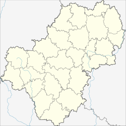
Jermolino
| city
Jermolino
Ермолино
|
||||||||||||||||||||||||||||||||||
|
||||||||||||||||||||||||||||||||||
|
||||||||||||||||||||||||||||||||||
| List of cities in Russia | ||||||||||||||||||||||||||||||||||
Jermolino ( Russian Ермо́лино ) is a small town in the Kaluga Oblast ( Russia ) with 10,409 inhabitants (as of October 14, 2010).
geography
The city is located about 75 km as the crow flies north-northeast of the Oblast capital Kaluga on the Oka tributary Protwa . The city center is on the right (southern) bank in a bend in the river , several districts a few kilometers apart on the left bank.
Jermolino belongs to Borowsk Rajon and is seven kilometers east of its administrative center Borowsk . Just about five kilometers east of Jermolino is the center of another city, Balabanowo .
history
The former village of Jermolino developed into an industrial location when the merchant Fyodor Issajew founded a cotton fabric factory there in 1880. By the end of the 19th century, the company already had 500 employees. After the October Revolution of 1917 he was nationalized; the place continued to grow and in 1928 received urban-type settlement status .
During the Second World War , the settlement was occupied by the German Wehrmacht from October 1941 to January 1942 . The destroyed textile factory started operations in 1946 after it was rebuilt. As a result , further industrial companies were set up in Yermolino, in the urban area around Obninsk- Balabanowo-Borowsk. On December 28, 2004 the place received city rights.
Population development
| year | Residents |
|---|---|
| 1939 | 5,833 |
| 1959 | 5,703 |
| 1970 | 7,356 |
| 1979 | 8,015 |
| 1989 | 10,573 |
| 2002 | 9,454 |
| 2010 | 10,409 |
Note: census data
Culture and sights
In a district of Yermolino, the former village of Russinowo on the left bank of the Protva, there are the ruins of the Nikolai Church, built in 1812 (Russian Zerkow Nikolaja Tschudotworza ). The church is being rebuilt.
Economy and Infrastructure
In addition to the textile factory (now owned by OAO Jermolino ), there has been a fiber optic cable factory in Jermolino since 1996 ( SAO Transwok / JSC Transvoc ).
The nearest railway station is in Balabanowo on the Moscow - Bryansk - Kiev route . North of Jermolino runs the highway A108 , the Moscow Big Ring , which crosses the trunk road M3 at Balabanowo , which also connects Moscow with the Ukrainian border in the direction of Kiev. At Jermolino the road branches off from the A108 to the Borovsk district administrative center.
To the north of the city there is a military airfield ( ICAO code UUWE ), which is used by an air regiment of the Ministry of the Interior (MWD) and the flight readiness of the Strategic Missile Forces (RWSN) of the Russian Federation.
Individual evidence
- ↑ a b Itogi Vserossijskoj perepisi naselenija 2010 goda. Tom 1. Čislennostʹ i razmeščenie naselenija (Results of the All-Russian Census 2010. Volume 1. Number and distribution of the population). Tables 5 , pp. 12-209; 11 , pp. 312–979 (download from the website of the Federal Service for State Statistics of the Russian Federation)
- ↑ History of the company (Russian)
- ↑ Nikolai Church in Jermolino (Russinowo) at sobory.ru (Russian)
- ↑ Company website ( Memento of the original from July 6, 2010 in the Internet Archive ) Info: The archive link was inserted automatically and not yet checked. Please check the original and archive link according to the instructions and then remove this notice. (English, Russian)
Web links
- Jermolino at mojgorod.ru (Russian)


