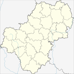
Kremjonki
| city
Kremjonki
Кремёнки
|
||||||||||||||||||||||||||||||||||||||||||
|
||||||||||||||||||||||||||||||||||||||||||
|
||||||||||||||||||||||||||||||||||||||||||
| List of cities in Russia | ||||||||||||||||||||||||||||||||||||||||||
Kremjonki ( Russian: Кремёнки ) is a small town in Kaluga Oblast ( Russia ) with 11,582 inhabitants (as of October 14, 2010).
geography
The city is located about 70 km northeast of the Oblast capital Kaluga on the left bank of the Protwa , a left tributary of the Oka, which flows into the Volga .
Kremjonki belongs to the Zhukov district and is 30 kilometers southeast of its administrative center Zhukov .
history
A village of Kremjonki was established at the beginning of the 18th century not far from the older village of Troitskoye on the opposite bank of the Protva river. It initially belonged to the Ujesd of the city of Serpukhov , 20 kilometers to the east , which is now in the neighboring Moscow Oblast .
The place remained relatively insignificant for a long time, but became the seat of a village soviet during the Soviet period . During the Second World War , the front line ran near Kremjonki from mid-October 1941. The 260th Infantry Division of the Wehrmacht had left there (north) of the Protva two bridgeheads captured. At the end of October it was replaced by the 52nd Infantry Division , whose further advance on the left of the Oka from the direction of Tarussa to Serpuchow could be prevented by the Soviet troops. On December 16, 1941, the 194th Rifle Division of the 49th Army of the Western Front of the Red Army counterattacked in the Kremjonki area during the Battle of Moscow and pushed the German troops back several dozen kilometers in this area.
East during and after the construction of extensions of the Nuclear Research Institute in a few kilometers, already in the Moscow Oblast located Protvino the original village was built from the 1970s to the northwest, a housing estate for construction workers and employees of the Institute and other institutions. At the beginning of the 1980s the place had about 2,600 inhabitants, by the end of the decade the number grew to about 10,000. In 1989 the place received the status of an urban-type settlement , and on December 28, 2004 finally the city charter.
Population development
| year | Residents |
|---|---|
| 2002 | 12,128 |
| 2010 | 11,582 |
Note: census data
Culture and sights
In Kremjonki there is a Military History Museum with a memorial complex, which was opened in 1975, as well as a Ekaterina Daschkowa Museum. The Ekaterina Daschkowa depicted in the city arms was a close confidante of Tsarina Catherine the Great and an important figure in the Enlightenment in Russia in the 18th century. She spent the last years of her life in a family estate near the village of Troitskoye, until 1810. In Troitskoye there is the Trinity Church (Troitskaya zerkow) , where Yekaterina Dashkova was buried. Only ruins remain of the property.
Economy and Infrastructure
Kremjonki is primarily a housing estate for employees of companies and institutions in the neighboring cities of Serpukhov and Protvino. There are also factories for insulating materials and glass containers. Not far from the town is the sanatorium Wjatitschi .
The nearest railway station is in Serpukhov on the Moscow - Tula - Kursk line . The Oblast Road runs through Kremjonki and connects the M3 trunk road at Obninsk with the M2 trunk road near Serpukhov along the left bank of the Protva .
Individual evidence
- ↑ a b Itogi Vserossijskoj perepisi naselenija 2010 goda. Tom 1. Čislennostʹ i razmeščenie naselenija (Results of the All-Russian Census 2010. Volume 1. Number and distribution of the population). Tables 5 , pp. 12-209; 11 , pp. 312–979 (download from the website of the Federal Service for State Statistics of the Russian Federation)
- ↑ Soviet General Staff Map 1: 100,000. Sheet N-37-39 (1984 edition)
- ↑ Information about the museum at museum.ru (Russian)
- ↑ Sights of Kremjonki and the surrounding area ( Memento of the original from November 19, 2010 in the Internet Archive ) Info: The archive link was automatically inserted and has not yet been checked. Please check the original and archive link according to the instructions and then remove this notice. (Russian, photos)
Web links
- Official website of the city administration (Russian)
- Kremjonki at mojgorod.ru (Russian)


