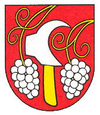
Blatné
| Blatné | ||
|---|---|---|
| coat of arms | map | |

|
|
|
| Basic data | ||
| State : | Slovakia | |
| Kraj : | Bratislavský kraj | |
| Okres : | Senec | |
| Region : | Bratislava | |
| Area : | 16.323 km² | |
| Residents : | 1,801 (Dec. 31, 2019) | |
| Population density : | 110 inhabitants per km² | |
| Height : | 131 m nm | |
| Postal code : | 900 82 | |
| Telephone code : | 033 | |
| Geographic location : | 48 ° 16 ' N , 17 ° 25' E | |
| License plate : | SC | |
| Kód obce : | 507822 | |
| structure | ||
| Community type : | local community | |
| Administration (as of November 2018) | ||
| Mayor : | Rastislav Pero | |
| Address: | Obec Blatné Šarfická 300/37 900 82 Blatné |
|
| Website: | blatne.sk | |
| Statistics information on statistics.sk | ||
Blatné (Slovak until 1948 "Šarfia"; German Scharfing , Hungarian Pozsonysárfő - until 1907 Sárfő ) is a municipality in the Senec district , the westernmost region of Slovakia . It is located at an altitude of 131 meters above sea level in the Bratislavský kraj . The administrative seat of the Okres in Senec is about six kilometers south of Blatné.
The earliest mention of the place comes from the year 1245. Until 1913 several names are recorded historically, but they go back to the same tribe, including Sarfy, Sarfew, Saarfo and Ssárfia .
Web links
Commons : Blatné - collection of images, videos and audio files

