Hamuliakovo
| Hamuliakovo | ||
|---|---|---|
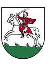
| coat of arms | map | |

|
|
|
| Basic data | ||
| State : | Slovakia | |
| Kraj : | Bratislavský kraj | |
| Okres : | Senec | |
| Region : | Podunajsko | |
| Area : | 10.947 km² | |
| Residents : | 2,335 (Dec. 31, 2019) | |
| Population density : | 213 inhabitants per km² | |
| Height : | 128 m nm | |
| Postal code : | 900 43 | |
| Telephone code : | 0 2 | |
| Geographic location : | 48 ° 2 ' N , 17 ° 15' E | |
| License plate : | SC | |
| Kód obce : | 507903 | |
| structure | ||
| Community type : | local community | |
| Administration (as of November 2018) | ||
| Mayor : | Ludmila Goldbergerová | |
| Address: | Obecný úrad Hamuliakovo 127 90043 Hamuliakovo |
|
| Website: | obechamuliakovo.sk | |
| Statistics information on statistics.sk | ||
Hamuliakovo (until 1927 Slovak "Gutora" - 1927-1948 "Gutor"; German Gutern , Hungarian Gutor - until 1907 Gútor ) is a municipality in Okres Senec in Slovakia . The place is about 20 km southeast of Bratislava at the beginning of the Gabčíkovo reservoir on the Danube and has about 1200 inhabitants.
The village was 1222 (1249?) The first time as Gutt mentioned in writing and in 1948 from national political reasons in honor of the Slovak Nationalerweckers Martin Hamuljak in Hamuliakovo renamed.
Holy Cross Church
The Roman Catholic Church of the Holy Cross in Hamuliakovo dates from the 13th century and is one of the most important Romanesque churches in Slovakia. Its current appearance is the result of several repairs in the Baroque period and in the 19th and 20th centuries.
The frescoes from the second half of the 14th century are unique. These are Gothic wall paintings with motifs of old church symbols.

