Hurbanova Ves
| Hurbanova Ves | ||
|---|---|---|
| coat of arms | map | |

|
|
|
| Basic data | ||
| State : | Slovakia | |
| Kraj : | Bratislavský kraj | |
| Okres : | Senec | |
| Region : | Bratislava | |
| Area : | 5.413 km² | |
| Residents : | 414 (Dec. 31, 2019) | |
| Population density : | 76 inhabitants per km² | |
| Height : | 125 m nm | |
| Postal code : | 903 01 ( Hrubý Šúr Post Office ) | |
| Telephone code : | 0 2 | |
| Geographic location : | 48 ° 9 ' N , 17 ° 26' E | |
| License plate : | SC | |
| Kód obce : | 503819 | |
| structure | ||
| Community type : | local community | |
| Administration (as of November 2018) | ||
| Mayor : | Ľubomír Petrák | |
| Address: | Obecný úrad Hurbanova Ves 48 90301 Hurbanova Ves |
|
| Website: | www.hurbanovaves.sk | |
| Statistics information on statistics.sk | ||
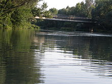
Hurbanova Ves is a small community in Okres Senec within Bratislavský kraj in southwestern Slovakia . It is located in the Danube lowlands on the left bank of the Little Danube , ten kilometers southeast of the city of Senec .
The present-day community originated in the first Czechoslovak republic on the former Meierhöfen of the Hungarian large estate owner family Pálffy in the municipality of Rastice (then Veľký Mager). The first colonists came from the Myjava and Moravia area in 1924 and farmed here. In 1929 the settlement had 138 inhabitants. 1938–45 it belonged to Hungary due to the First Vienna Arbitration Award, in 1956 the place then became independent as a municipality and separated from the municipality of Rastice.
The community name refers to the Slovak writer and politician Jozef Miloslav Hurban .

