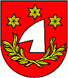
Kostolná pri Dunaji
| Kostolná pri Dunaji | ||
|---|---|---|
| coat of arms | map | |

|
|
|
| Basic data | ||
| State : | Slovakia | |
| Kraj : | Bratislavský kraj | |
| Okres : | Senec | |
| Region : | Bratislava | |
| Area : | 8.072 km² | |
| Residents : | 735 (Dec. 31, 2019) | |
| Population density : | 91 inhabitants per km² | |
| Height : | 128 m nm | |
| Postal code : | 903 01 (post office Senec ) | |
| Telephone code : | 0 2 | |
| Geographic location : | 48 ° 11 ' N , 17 ° 26' E | |
| License plate : | SC | |
| Kód obce : | 503851 | |
| structure | ||
| Community type : | local community | |
| Administration (as of November 2018) | ||
| Mayor : | Igor Šillo | |
| Address: | Obecný úrad Kostolná pri Dunaji 59 90301 Senec |
|
| Website: | www.kostolnapd.sk | |
| Statistics information on statistics.sk | ||
Kostolná pri Dunaji (until 1948 Slovak "Hasvár"; German Gaswar , Hungarian Egyházfa ) is a municipality in western Slovakia near the city of Senec .
The place was mentioned in writing for the first time in 1332. The place Malý Šúr (incorporated in 1943; German Klein-Schur , Hungarian Pénteksúr ) belongs to it .
Until 1918 the community belonged to the Kingdom of Hungary and then came to the newly formed Czechoslovakia , through the First Vienna Arbitration , it came back to Hungary for a short time from 1938 to 1945.
The place is grouped around the Church of the Rosary of St. Mary from the 13th century.
Culture
Web links
Commons : Kostolná pri Dunaji - collection of images, videos and audio files

