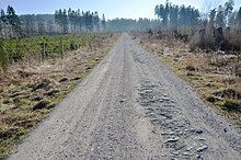
Brilon plateau

The Brilon plateau is a plateau in the Hochsauerlandkreis in North Rhine-Westphalia ( Germany ). It is surrounded by the Brilon heights , the mountains of which are up to 670.2 m above sea level. NHN are high.
geography
location
The landscape of the Brilon plateau and Brilon heights surrounds the core city of Brilon and includes several districts. Administratively it belongs mainly to the Hochsauerlandkreis , in the northeast it belongs to the Paderborn district near Bleireinigung . It has roughly the shape of an ellipse; the longitudinal axis runs from east-northeast to west-southwest.
In the north and northeast it merges gently over the Alme bergland into the Sintfeld . In the east and south-east it falls into the deeply cut valley of the Hoppecke . In the south, the Sauerland and Upland (landscapes of the Rothaargebirge ) join, in the west the Warsteiner Wald (eastern part of the Arnsberger Wald ) and in the northwest the narrow hair strand . In the north the terrain (beyond Sintfeld and Haarstrang) slopes more or less gently towards the Westphalian Bay towards the Lippe . The plateau forms an arable island in the middle of wooded mountain and hilly landscapes.
Natural allocation
The Brilon plateau belongs to the natural spatial main unit group Süderbergland (No. 33), in the main unit North Sauerland Oberland (334) and in the subunit Briloner Land (334.7) to the natural area Briloner Kalkplatten or (Briloner Kalkplateau) (334.70).
mountains
The mountains of the Brilon Heights include - sorted by height in meters (m) above sea level (NHN):
- Borberg (670.2 m) - southwest of Brilon (natural area 333.83 Habuch , Rothaargebirge )
- Bilstein (620.1 m) - northwest of Brilon- Hoppecke (332.70 Padberger Schweiz, Ostsauerland mountain range )
- Poppenberg (605.0 m) - south of Brilon (335.0 Oberruhrgesenke , Sauerländer Senken )
- Eisenberg (596.2 m) - southwest of Brilon (Oberruhrgesenke)
- White woman (562.1 m) - east of Rösenbeck (Padberger Schweiz)
- Heimberg (536.6 m) - east of Brilon (334.70 Brilon limestone plates)
- Totenkopf (504.2 m) - west of Marsberg (334.8 Fürstenberger Wald , North Sauerland Oberland )
- Schaaken (497.2 m) - east-northeast of Brilon (334.70 Brilon limestone plates)
- Schälhorn (499.2 m) - east of Scharfenberg (Oberruhrgesenke)
- Bulstern (482.1 m) - west of Wülfte (334.70 Brilon limestone plates)
- Schweinskopf (481.4 m) - east-south-east of lead washing
- Schellberg (472 m)
Flowing waters
The flowing waters of the Brilon plateau include the Alme , which rises at Ober-Alme , leaves the plateau to the north and finally flows into the Lippe as a southern tributary , and the Möhne , which rises on the eastern slope of the Poppenberg , as part of an upper course section of the plateau in Flows through south-north direction and represents a tributary of the Ruhr. In addition, indulgence and unfaithfulness flow over the Brilon plateau, the water of which disappears underground as the stream disappears.
Watershed
A section of the Rhine-Weser watershed runs across the parts of the Brilon Heights to the south of the Brilon plateau : while the water of all the streams that flow north or west turn towards the Rhine via Alme and Lippe or Möhne and Ruhr , that of all flows short flowing waters that run in southerly directions, via Hoppecke and Diemel into the Weser .
Localities
The localities of the Brilon plateau include the core town of Brilon, the localities Alme , Altenbüren , Madfeld , Nehden , Radlinghausen , Rixen , Rösenbeck , Thülen and Wülfte . In addition, the Wünnenberg village of Bleiwasher is located on the Brilon plateau.
geology
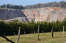
The geology of the Brilon plateau and the Brilon heights is shaped by the "Brilon mass limestone", which was created by limestone deposits from corals in the Devonian Age . Volcanic activity left behind iron deposits, among other things.
traffic
The Brilon plateau and Brilon heights are traversed by sections of federal highways 7 , 251 and 480 , from which state and district roads branch off, which connect the localities of the plateau with each other. A section of the Ruhr Valley Railway runs past between Olsberg in the west and Marsberg in the east and is connected to the nearby Brilon Wald train station .
literature
- Gerd Petermeyer: On the morphogenesis of the Brilon plateau and the Sintfeld . Düsseldorf 1982 (dissertation).
- Wolfgang Feige: The Brilon plateau . Ed .: Geographical regional studies department of the Westphalian Heimatbund (= landscape guide of the Westphalian Heimatbund . Issue 7). Aschendorffsche Verlagbuchhandlung, Münster 1970, ISBN 3-402-06343-3 .
References and comments
- ↑ a b c d e f g h i Topographical Information Management, Cologne District Government, Department GEObasis NRW ( information )
- ↑ a b c Map services of the Federal Agency for Nature Conservation ( information )
- ↑ Mountain height according to unknown / not researched source
Coordinates: 51 ° 25 ′ 12 ″ N , 8 ° 37 ′ 50 ″ E


