Cahnsdorf
|
Cahnsdorf
City of Luckau
Coordinates: 51 ° 51 ′ 20 ″ N , 13 ° 43 ′ 23 ″ E
|
|
|---|---|
| Height : | 61 m above sea level NHN |
| Area : | 9.24 km² |
| Residents : | 364 (Jun. 30, 2019) |
| Population density : | 39 inhabitants / km² |
| Incorporation : | October 26, 2003 |
| Postal code : | 15926 |
| Area code : | 03544 |
|
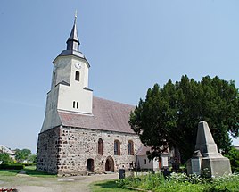
Cahnsdorf village church
|
|
Cahnsdorf ( Drobkowy in Lower Sorbian ) is a district of the city of Luckau in the south of the Brandenburg district of Dahme-Spreewald .
location
The place Cahnsdorf is in the Lower Lusatia . Neighboring towns are Karche-Zaacko in the north, Duben with the municipality of Freiimfelde in the northeast, Alteno and Willmersdorf-Stöbritz in the east, Garrenchen , Frankendorf and Freesdorf in the south and the city of Luckau in the west. The state road 526 runs through the place.
history
Cahnsdorf was first mentioned in a document in 1375 in the Landbuch of the Mark Brandenburg with the name Buckinsdorf , in 1400 the place name Kansdorf was written.
From 1952, Cahnsdorf belonged to the Luckau district . After reunification, Cahnsdorf formed the Luckau office together with 15 other communities . On December 6, 1993, Cahnsdorf came to the newly founded district of Dahme-Spreewald . On October 26, 2003, Cahnsdorf was incorporated into Luckau. A lawsuit by the municipality of Cahnsdorf against the incorporation was dismissed.
Population development
| Population development in Cahnsdorf from 1875 to 2002 | |||||||||||||
|---|---|---|---|---|---|---|---|---|---|---|---|---|---|
| year | Residents | year | Residents | year | Residents | ||||||||
| 1875 | 347 | 1890 | 405 | 1910 | 294 | ||||||||
| 1925 | 337 | 1933 | 377 | 1939 | 351 | ||||||||
| 1946 | 556 | 1950 | 530 | 1964 | 410 | ||||||||
| 1971 | 450 | 1981 | 429 | 1985 | 406 | ||||||||
| 1989 | 484 | 1992 | 655 | 1997 | 590 | ||||||||
| 2002 | 427 | ||||||||||||
Web links
- Cahnsdorf in the RBB program Landschleicher on November 8, 2015
proof
- ↑ a b Cahnsdorf district. City of Luckau, accessed on September 11, 2019.
- ↑ Reinhard E. Fischer : The place names of the states of Brandenburg and Berlin. Age - origin - meaning. be.bra Wissenschaft verlag, Berlin 2005, p. 39.
- ↑ Sixth law on state-wide municipal area reform relating to the districts of Dahme-Spreewald, Elbe-Elster, Oberspreewald-Lausitz, Oder-Spree and Spree-Neiße (6th GemGebRefGBbg) of March 24, 2003, Law and Ordinance Gazette for the State of Brandenburg, I ( Laws), 2003, No. 05, p. 93.
- ↑ Historical municipality register of the state of Brandenburg 1875 to 2005. (PDF; 331 kB) District Dahme-Spreewald. State Office for Data Processing and Statistics State of Brandenburg, December 2006, accessed on March 7, 2017 .
