Candelaria (Quezon)
| Municipality of Candelaria | ||
| Location of Candelaria in the Quezon province | ||
|---|---|---|

|
||
| Basic data | ||
| Region : | CALABARZON | |
| Province : | Quezon | |
| Barangays : | 25th | |
| District: | 2. District of Quezon | |
| PSGC : | 045608000 | |
| Income class : | 1st income bracket | |
| Households : |
May 1, 2000 census
|
|
| Population : | 117,434 August 1, 2015 census
|
|
| Population density : | 909.6 inhabitants per km² | |
| Area : | 129.10 km² | |
| Coordinates : | 13 ° 56 ' N , 121 ° 25' E | |
| Postal code : | 4323 | |
| Mayor : | FERDINAND REYES MALIWANAG | |
| Website: | www.candelaria.gov.ph | |
| Geographical location in the Philippines | ||
|
|
||
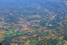
Candelaria is a Filipino municipality in the province of Quezon , in administrative region IV, Calabarzon. It has 117,434 inhabitants (August 1, 2015 census) who lived in 25 barangays . It is classified as the first income class community in the Philippines.
Its neighboring communities are Sariaya in the east, San Juan in the southwest, Tiáonğ and Dolores in the west, and Mount Banahaw in the north. The topography of the city is characterized by flat , hilly and mountainous landscapes. Parts of the Mounts-Banahaw-San-Cristobal National Park are on the territory of the municipality.
Candelaria is connected to the Bicol region and the metropolitan metropolitan area of Metro Manila by the Maharlika Highway and by rail .
Barangays
|
|

