Carboneros
| Carboneros municipality | ||
|---|---|---|
 Carboneros - Church
|
||
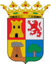
| coat of arms | Map of Spain | |

|
|
|
| Basic data | ||
| Autonomous Community : | Andalusia | |
| Province : | Jaén | |
| Comarca : | Sierra Morena | |
| Coordinates | 38 ° 14 ′ N , 3 ° 38 ′ W | |
| Height : | 400 msnm | |
| Area : | 58.61 km² | |
| Residents : | 615 (Jan. 1, 2019) | |
| Population density : | 10.49 inhabitants / km² | |
| Postal code : | 23211 | |
| Municipality number ( INE ): | 23021 | |
| administration | ||
| Website : | Carboneros | |
Carboneros is a smaller place and one from the main town, another village (La Mesa) and several hamlets (aldeas) existing and farmsteads municipality ( municipio ) with a total of 615 inhabitants (as of January 1 2019) in the north of the province of Jaen in the autonomous region of Andalusia .
location
The place Carboneros is on the south side of the Sierra Morena on the Autovía A-4 about 60 km (driving distance) north of the provincial capital Jaén at an altitude of about 400 m above sea level. d. M. The historic cities of Baeza and Úbeda are each about 60 km to the south-east. The climate in winter is temperate, while in summer it is warm to hot; the low amounts of precipitation (approx. 450 mm / year) fall - with the exception of the almost rainless summer months - distributed over the whole year.
Population development
| year | 1857 | 1900 | 1950 | 2000 | 2016 |
| Residents | 829 | 1,016 | 1,249 | 679 | 630 |
The significant population decline in the second half of the 20th century is essentially due to the mechanization of agriculture and the associated loss of jobs.
economy
Carboneros is located in the north of the seemingly endless olive tree plantations of the province of Jaén. In the past, cereals, vines, etc. were also planted for self-sufficiency ; Vegetables came from the house gardens. Cattle breeding (sheep, goats, chickens) and forestry (especially the extraction of charcoal ) were also operated. Small traders, craftsmen and service companies of all kinds have settled in the village. There are also several holiday homes (casas rurales) .
history
Silver mines were exploited in the municipality in Carthaginian and Roman times . The Visigoths probably did not penetrate into the formerly wooded area and the presence of the Moors is also not documented. After the end of the Caliphate of Cordoba (1031), the region became part of the Taifa Kingdom of Jaén . Around the year 1226 the area was recaptured by the Christians ( reconquista ) , but it was not until 1767 under Charles III. (r. 1759–1788) and his advisor Pablo de Olavide as part of the Nuevas Poblaciones in the Sierra Morena.
Attractions
- The townscape surprises with its straight streets.
- The Iglesia de la Inmaculada Concepción , built in the second half of the 18th century from stone and rubble, is dedicated to the Immaculate Conception of Mary . There are two niches to the side of the portal ; four round windows are lined up above it . The interior of the church has three aisles and is covered by an open roof structure . With the exception of the neoclassical altarpiece, the entire church interior is rather unadorned.
Web links
- Carboneros, Div. - Photos + information (Spanish)
- Carboneros - Video (Spanish)
Individual evidence
- ↑ Cifras oficiales de población resultantes de la revisión del Padrón municipal a 1 de enero . Population statistics from the Instituto Nacional de Estadística (population update).
- ↑ Carboneros - map with altitude information
- ↑ Carboneros - climate tables
- ↑ Carboneros - Population Development
- ↑ Carboneros - History
- ↑ Carboneros - History in Brief
- ^ Carboneros - Church
