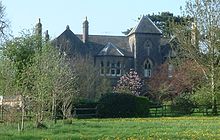
Chew Stoke
| Chew Stoke | ||
|---|---|---|
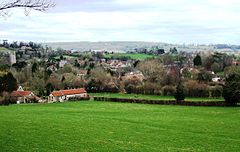
| View of Chew Stoke | ||
| Coordinates | 51 ° 21 ′ N , 2 ° 38 ′ W | |
| OS National Grid | ST555615 | |
|
|
||
| Residents | 991 (as of 2011) | |
| administration | ||
| Post town | BRISTOL | |
| ZIP code section | BS40 | |
| prefix | 01275 | |
| Part of the country | England | |
| region | South West England | |
| Ceremonial county | Somerset | |
| Unitary authority | Bath and North East Somerset | |
| Civil Parish | Chew Stoke | |
| British Parliament | North East Somerset | |
Chew Stoke is a small village and civil parish in the Chew Valley in Somerset , England, about eight miles south of Bristol . It is located on the northern edge of the Mendip Hills , a region classified by the UK Government as an Area of Outstanding Natural Beauty , and within the green belt around Bristol and Bath . The Parish includes the hamlet of Breach Hill , which is about 3 km southwest of the village of Chew Stoke.
Chew Stoke has a long history, which is reflected in the number and variety of listed buildings . The village is at the north end of Chew Valley Lake , which was created in the 1950s; There is a sailing club and a fishing hut near the dam and the pumping station. A tributary of the River Chew runs through the village.
A shop, two pubs , the elementary school and a bowling alley serve the 991 residents . Together with Chew Magna , Chew Stoke forms the Ward of Chew Valley North in the Unitary Authority of Bath and North East Somerset . There is an industrial area for light industry in the village, but many residents commute to the surrounding cities.
geography
Chew Stoke is surrounded by farmland and dairy pastures and is located in the Chew Valley, on Strode Brook , a tributary of the River Chew on the northwest side of Chew Valley Lake. Most of the landscape has been cleared to become farmland, with trees lining the waterways and roads. The village of Chew Stoke extends along the main street, Bristol Road, which runs northeast to southwest. An older settlement center is on Pilgrims Way, which branches off from Bristol Road. There is an old packhorse bridge that is now used by pedestrians and a low-water bridge built in the 1950s that can be used as a ford when the water level is high . Houses are on both of these streets, from which further side streets and dead ends with residential buildings branch off.
Chew Stoke is about 10 miles south of Bristol , 15 miles from Bath and 9 miles from Keynsham and 1.3 miles south of Chew Magna on the B3130, the road linking the A37 and A38 . The A368 crosses the valley west of the lake. In 2002, a 3 km long bike path was opened around the reservoir, the Chew Lake West Green Route. The route is part of the Padstow to Bristol end-to-end cycle route, Route 3 of the National Cycle Network . The construction was financed by the Bath and North East Somerset Council, Sustrans and the Chew Valley Recreational Trail Association. The side streets around the lake are also frequently used by cyclists.
Bristol Airport is 15 km away and the nearest train stations are Keynsham Station , Bath Spa and Bristol Temple Meads .
| Winford | Chew Magna | Stanton Drew |
| Nempnett Thrubwell |
|
Stanton Drew |
| Compton Martin | West Harptree | Stowey Sutton |
history
prehistory
Archaeological excavations carried out between 1953 and 1955 by Philip Rahtz and Ernest Greenfield of the Ministry of Works revealed evidence that the area was inhabited for thousands of years by people ranging from the Upper Paleolithic , Mesolithic and Neolithic to the Bronze and Iron Ages have left numerous artifacts . Stone knives, flint stones and the head of a mace were found , as well as buildings and graves.
Roman-British temple
Chew Stoke is the site of a Romano-British temple that may have been dedicated to the god Mercurius . The temple on Pagans Hill was excavated by Philip Rahtz between 1949 and 1951. It consisted of an inner wall, which formed the sanctuary, and an outer wall, which encloses a kind of walkway and has a diameter of 17 m. The temple was built at the end of the 3rd century and then rebuilt twice before it finally collapsed in the 5th century. The location of the earlier temple on Pagans Hill appears to be on purpose, but there is no evidence of a connection between the temple's existence and the current street name.
middle Ages
In the Middle Ages , agriculture was the main economic activity in the area, and both agriculture and dairy farming are still practiced today. There were also orchards where apples, peaches and plums were harvested. There are also references to lime kilns that were used to produce mortar in the construction of local churches.
In the Domesday Book of 1086 Chew Stoke was registered under the name Chiwestoche and belongs to Gilbert Fitz-Turold . He conspired with the Duke of Normandy against King William Rufus , and as a result all his lands were confiscated. The next known owner was Lord Beauchamp of Hache . He became lord of the manor when the Earls of Gloucester, who owned the inheritance rights to Chew Stoke, submitted to him. According to Stephen Robinson, the author of Somerset Place Names , the name of the village was then Chew Millitus , which suggests that it had military significance at the time. This theory is also supported by today's part of the name "Stoke", from Old English stoc , which means palisade .
The Parish belonged to the Hundred of Chew in the Middle Ages .
Bilbie family
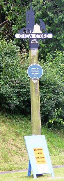
The Bilbie family was a family of bell founders and clockmakers who lived and worked in Chew Stoke for more than 200 years, making more than 1,350 church bells from the late 17th century to the 19th century, which were used in numerous West Country churches. The oldest bell still in existence was cast in 1698 and is still in service at the local St Andrew's Church . The Bilbies also made floor clocks from 1724 , of which the more expensive had a running time of eight days and could indicate the high tide in Bristol Harbor .
Modern modern times
Chew Stoke expanded little in the 20th century, especially when residents moved in in the 1950s from the area that was flooded when Chew Valley Lake was formed. During the Second World War , 42 students and three teachers from a school in London were evacuated here and housed in Chew Stoke. When on July 10, 1968 heavy rain with 175 mm of precipitation fell on Chew Stoke within 18 hours and thus twice the normal July precipitation was reached, extensive flooding occurred in the valley of the river, which reached up to the first floor in some buildings. The damage to property in Chew Stoke, however, did not reach the extent as in some surrounding villages, such as in Pensford ; however, it was feared that the dam at Chew Valley Lake would break.
On February 4, 2001, Princess Anne opened a Rural Housing Trust building at Salway Close. A festival is held each year on a weekend in September, including a horse parade, dog shows and a fair ; In 1997 this event called "Harvest Home" was canceled due to the death of Princess Diana the week before. The place where Radford used to manufacture refrigerators has been designated as an industrial wasteland, which was included in the 2002 Bath and North East Somerset Development Plan for residential conversion . This plan created controversy over the balanced use of land to balance residents' needs with social and labor market needs.
In the course of November 2012 large parts of Great Britain were hit by a series of floods. These also affected Chew Stoke, where on November 22, the water of a stream carried a car with it and wedged it under a bridge, where the man drowned.
administration
Chew Stoke has its own nine-member parish council responsible for local affairs, including running its own budget, reviewing building applications, and working with local police, community officials and neighborhood guards on crime, safety and traffic management issues. The task of the municipal council also includes the maintenance and repair of municipal facilities and the coordination with the district authorities in matters of maintenance, repair and improvement of country roads, local public transport and street cleaning. Preservation measures for trees and monuments are also the responsibility of the municipal council.
The village belongs to the Ward of Chew Valley North in the Unitary Authority of Bath and North East Somerset, which is responsible for education, garbage collection and tourism. Chew Stoke is part of the North East Somerset constituency .
Police in Chew Stoke are run by the Avon and Somerset Constabulary , assisted by two Community Support Officers, and the Avon Fire and Rescue Service has a fire station in Chew Magna that also covers Chew Stoke.
Demographics
According to the 1801 census data, Chew Stoke had 517 inhabitants. The population slowly rose to its maximum of 819 during the 19th century, but decreased to around 600 by the end of the century and then remained fairly stable until World War II. In the second half of the 20th century, the population grew to 905 people. The 2001 census showed the Ward Chew Valley North, to which both Chew Magna and Chew Stoke belong 2307 inhabitants who lived in 911 households. The median age was 42.3 years. 21% of the population between 16 and 74 years of age had no vocational training and the ward had an unemployment rate of 1.3%. A number of businesses have set up shop on the site of a former dairy farm. However, these offer only a small number of jobs, so that many residents commute to nearby cities.
| year | 1801 | 1811 | 1821 | 1831 | 1841 | 1851 | 1861 | 1871 | 1881 | 1891 |
|---|---|---|---|---|---|---|---|---|---|---|
| Residents | 517 | 524 | 681 | 693 | 825 | 819 | 758 | 693 | 696 | 653 |
| year | 1901 | 1911 | 1921 | 1931 | 1941 | 1951 | 1961 | 1971 | 1981 | 1991 |
| Residents | 635 | 598 | 622 | 654 | n / A | 738 | 819 | 841 | 818 | 866 |
| year | 2001 | 2011 | ||||||||
| Residents | 905 | 991 |
Attractions
St Andrews Church
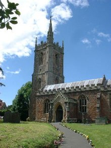
St Andrews Church, a Grade II * registered structure on the outskirts of Chew Stoke, was built in the 15th century and extensively renovated in 1862. The interior of the church is decorated with 156 angels made of wood and stone, and the church has a steeple with an unusual spire on the stairwell bay. The bells of the Bilbie family hang in the tower. The reconstructed cross in the churchyard was placed there when Chew Valley Lake was dammed, and the base of the cross, located about 24 m southwest of the church tower, is believed to date from the 14th century and is itself a Grade II * structure as well as the Webb tomb in the churchyard. The gate to the churchyard in the southeast bears a lantern that was donated by the public in 1897 to commemorate the 50th anniversary of the throne of Queen Victoria and is a grade II building.
Plaques from Bronze recall inside the church at the eleven villagers in the First World War have fallen and that in the six World War II were killed. In addition, a stained glass window commemorates those who lost their lives in World War II. Another plaque commemorates the bell founders and clockmakers Bilbie family. Directly at the entrance is a stone figure with an anchor that was removed from Walley Court before the reservoir was dammed. According to an unconfirmed tradition, Queen Elizabeth I gave . the figure of the Gilbert family then living there.
Old rectory
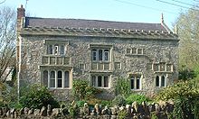
The rectory at the end of Church Lane, opposite the church, was probably built in 1529 by Sir John Barry. It has been fundamentally renovated since then, including the construction of a clock tower that was later removed. The south facade is decorated with stone carvings of the coats of arms of the St Loe, Fitzpane, Ancell, de la Rivere, and Malet families. The rectory is a Grade II * building.
New parish office
Reverend John Ellershaw had the new rectory built in the 1870s. It was last used from 1907 to 1945 by Lionel St Clair Waldy. Then it was bought by Douglas Wills, who gave it to Winford Hospital for use as a sanatorium for 16 children. It was later used as a retirement home before it was sold and has been used for private living since then.
Other structures
As in many localities in the UK, the age of a number of structures in Chew Stoke, including a church and schools, reflects the place's long history. Chew Stoke School and Chew Valley School were built in 1858 on the site of a previous school founded in 1718. The architect was SB Gabriel from Bristol. Additional classrooms were added in 1926, and in 1970 the schoolhouse was changed and expanded again.
An obelisk on Breach Hill Lane dates from the first half of the 19th century. It is about 10 m high and has a limestone base about one meter high .
The importance of agriculture is also reflected in the age of many farmhouses. Manor Farm on Scot Lane (not to be confused with at least two other farmhouses of the same name in the village) probably dates from 1495 and is arguably the oldest building in Chew Stoke. Rookery Farmhouse on Breach Hill Lane was built in 1720, with additions being made to both sides of the rear of the building in the late 18th century. An associated stable , 6 m northeast of the main house is also a Grade II building. The School Farmhouse on School Lane dates from the late 17th century and has a nailed oak door on the side. The Wallis Farmhouse, also on School Lane, dates back to 1782. The Yew Tree Farmhouse is one of the oldest buildings in the area and a bridge construction , of which there are few in northern Somerset. The Somerset Vernacular Building Research Group conducted a dendrochronological survey of buildings from 1996 to 1998 and found that the crock beams were felled in 1386. Over the centuries, the house has been greatly changed and expanded. The North Hill Farmhouse has origins in the 15th century and the Paganshill Farmhouse dates back to the 17th century. There is a plaque on the 18th century Fairseat Farmhouse that testifies that John Wesley preached in the house on September 10, 1790. In August of that year, Fairseat Farmhouse was "on the county's records as a house of worship and worship for Protestant deviants." In the garden of the house there is a large holm oak that was 30 m in diameter until part of it broke away in a storm in 1976.
The Methodist Chapel was first built in 1815/16; it was rebuilt at the end of the 19th century with walls made of limestone , a hipped roof made of slate, and eaves and chimneys made of bricks.
In the hamlet of Stoke Villice, south of the village, there is also a listed landmark from the 19th century with the inscription "8 miles to Bristol" (German: 8 miles to Bristol ).
education
The Chew Stoke Church of England Voluntary Aided Primary School is attended by 170 students between the ages of 4 and 11 from Chew Stoke and the surrounding areas. The school is run by the Church of England through the parish of St. Andrew. Most students then switch to Chew Valley School.
The school was originally founded as a charitable institution in 1718.
supporting documents
- ↑ a b Chew Stoke Parish . In: Neighborhood Statistics . Office for National Statistics. Retrieved December 31, 2013.
- ↑ a b c d e f g h i j k Hucker, Ernest: Chew Stoke Recalled in Old Photographs . Ernest Hucker, 1997, ISBN 0-9531700-0-4 .
- ↑ a b c d Lesley Ross (ed.): Before the Lake: Memories of the Chew Valley . The Harptree Historic Society, 2004, ISBN 0-9548832-0-9 .
- ↑ Michael Aston, Rob Iles: The archeology of Avon . Avon County Council, Bristol 1987, ISBN 0-86063-282-2 .
- ^ Robert Dunning: A History of Somerset . Phillimore & Co, Chichester 1983, ISBN 0-85033-461-6 .
- ↑ Stephen Robinson: Somerset Place Names . The Dovecote Press Ltd, Wimborne, Dorset 1992, ISBN 1-874336-03-2 .
- ^ Somerset Hundreds ( English ) GENUKI. Retrieved September 12, 2015.
- ↑ Bilbie - Bell founders and clockmakers ( English ) In: Troyte Ringing Center . Archived from the original on September 30, 2007. Info: The archive link was inserted automatically and has not yet been checked. Please check the original and archive link according to the instructions and then remove this notice. Retrieved November 5, 2006.
- ^ J. Moore, R. Rice, E. Hucker: Bilbie and the Chew Valley clockmakers. The story of the renowned family of Somerset bellfounder-clockmakers / Clockmakers . Self-published, 1995, ISBN 0-9526702-0-8 .
- ↑ a b Rob Richley: The Chew Valley floods of 1968 . Environment Agency, Exeter June 2008.
- ↑ Memories of Bristol's Weather - The Great Flood of 1968 ( English ) bristolhistory.com. Archived from the original on August 4, 2007. Retrieved September 13, 2015.
- ^ Bath & North East Somerset Local Plan Deposit Draft January 2002 ( English ) Bath & North East Somerset Council. Archived from the original on February 5, 2012. Retrieved September 13, 2015.
- ↑ Plans for Radford site to be unveiled ( English ) In: Chew Valley Gazette . Archived from the original on February 7, 2012. Retrieved September 13, 2015.
- ↑ Man dies as torrential rain and wind cause UK flood havoc ( English ) BBC. November 23, 2012. Retrieved September 13, 2015.
- ↑ Police preserve the scene after man dies in Somerset ( English ) ITV. November 21, 2012. Retrieved September 13, 2015.
- ↑ Chew Stoke Somerset through time: Population Statistics: Total Population ( English ) In: A Vision of Britain through Time . GB Historical GIS / University of Portsmouth. Retrieved September 13, 2015.
- ↑ Neighborhood Statistics LSOA Bath and North East Somerset 021A Chew Valley North ( English ) In: Office for National Statistics 2001 Census . Retrieved September 13, 2015.
- ^ Church of St. Andrew ( English ) In: Images of England . Archived from the original on November 11, 2007. Info: The archive link was automatically inserted and has not yet been checked. Please check the original and archive link according to the instructions and then remove this notice. Retrieved September 13, 2015.
- ^ A b Nikolaus Pevsner : The Buildings of England: North Somerset and Bristol . Penguin Books, 1958, ISBN 0-300-09640-2 .
- ↑ base of cross shaft ( English ) In: Images of England . Archived from the original on October 21, 2012. Info: The archive link was automatically inserted and has not yet been checked. Please check the original and archive link according to the instructions and then remove this notice. Retrieved September 13, 2015.
- ↑ Webb monument ( English ) In: Images of England . Archived from the original on October 21, 2012. Info: The archive link was automatically inserted and has not yet been checked. Please check the original and archive link according to the instructions and then remove this notice. Retrieved September 13, 2015.
- ^ Overthrow and gates ( English ) In: Images of England . Archived from the original on October 21, 2012. Info: The archive link was automatically inserted and has not yet been checked. Please check the original and archive link according to the instructions and then remove this notice. Retrieved September 13, 2015.
- ↑ Chew Stoke WWI Ref: 7488 ( English ) In: United Kingdom National Inventory of War Memorials . Retrieved September 13, 2015.
- ↑ Chew Stoke WWII Ref: 7489 ( English ) In: United Kingdom National Inventory of War Memorials . Retrieved September 13, 2015.
- ^ Edmund J. and Doreen Mason: Avon Villages . Robert Hale Ltd, 1982, ISBN 0-7091-9585-0 .
- ^ The Rectory ( English ) In: Images of England . Archived from the original on October 11, 2007. Info: The archive link was automatically inserted and not yet checked. Please check the original and archive link according to the instructions and then remove this notice. Retrieved September 13, 2015.
- ↑ Old Rectory ( English ) In: Images of England . Archived from the original on December 11, 2007. Info: The archive link was automatically inserted and not yet checked. Please check the original and archive link according to the instructions and then remove this notice. Retrieved September 11, 2015.
- ↑ a b Chew Stoke School ( English ) In: Images of England . Archived from the original on October 21, 2012. Info: The archive link was automatically inserted and has not yet been checked. Please check the original and archive link according to the instructions and then remove this notice. Retrieved September 11, 2015.
- ^ Obelisk, Breach Hill Lane ( English ) In: Images of England . Archived from the original on October 21, 2012. Info: The archive link was automatically inserted and has not yet been checked. Please check the original and archive link according to the instructions and then remove this notice. Retrieved September 13, 2015.
- ^ Rookery Farmhouse ( English ) In: Images of England . Archived from the original on October 14, 2007. Info: The archive link was inserted automatically and has not yet been checked. Please check the original and archive link according to the instructions and then remove this notice. Retrieved September 13, 2015.
- ^ Stable ( English ) In: Images of England . Archived from the original on October 21, 2012. Info: The archive link was automatically inserted and has not yet been checked. Please check the original and archive link according to the instructions and then remove this notice. Retrieved September 13, 2015.
- ^ School Farmhouse ( English ) In: Images of England . Archived from the original on October 21, 2012. Info: The archive link was automatically inserted and has not yet been checked. Please check the original and archive link according to the instructions and then remove this notice. Retrieved September 13, 2015.
- ^ Wallis Farmhouse ( English ) In: Images of England . Archived from the original on October 21, 2012. Info: The archive link was automatically inserted and has not yet been checked. Please check the original and archive link according to the instructions and then remove this notice. Retrieved September 13, 2015.
- ^ Yew Tree Farmhouse ( English ) In: Images of England . Archived from the original on November 9, 2007. Info: The archive link was automatically inserted and not yet checked. Please check the original and archive link according to the instructions and then remove this notice. Retrieved September 13, 2015.
- ^ North Hill Farmhouse ( English ) In: Images of England . Archived from the original on November 27, 2007. Info: The archive link was inserted automatically and has not yet been checked. Please check the original and archive link according to the instructions and then remove this notice. Retrieved September 13, 2015.
- ↑ Paganshill Farmhouse ( English ) In: Images of England . Archived from the original on October 21, 2012. Info: The archive link was automatically inserted and has not yet been checked. Please check the original and archive link according to the instructions and then remove this notice. Retrieved September 13, 2015.
- ↑ Fair Seat Farmhouse ( English ) In: Images of England . Archived from the original on March 4, 2016. Info: The archive link was inserted automatically and has not yet been checked. Please check the original and archive link according to the instructions and then remove this notice. Retrieved September 11, 2015.
- ↑ Methodist Chapel ( English ) In: Images of England . Archived from the original on March 4, 2016. Info: The archive link was inserted automatically and has not yet been checked. Please check the original and archive link according to the instructions and then remove this notice. Retrieved September 11, 2015.
- ↑ Milestone ( English ) In: Images of England . Archived from the original on March 4, 2016. Info: The archive link was inserted automatically and has not yet been checked. Please check the original and archive link according to the instructions and then remove this notice. Retrieved September 11, 2015.
bibliography
- I. and M. Durham: Chew Magna and the Chew Valley in old photographs. Redcliffe Press, 1991, ISBN 1-872971-61-X .
- Rowland Janes (Editor): The Natural History of the Chew Valley. Biografix, 1987, ISBN 0-9545125-2-9 .
- Ernest Hucker: Chew Stoke recalled in old photographs. 1997, ISBN 0-9531700-0-4 .
Web links
- Chew Stoke Harvest Home
- Chew Stoke village website
- Map of Chew Stoke around 1900 ( Memento from October 17, 2012 in the Internet Archive )
- Chew Valley School
- River Chew website
