Miraflores District (Arequipa)
| Miraflores district | |
|---|---|
 The district of Miraflores is located in the northern center of the province of Arequipa (marked in red) |
|
| Basic data | |
| Country | Peru |
| region | Arequipa |
| province | Arequipa |
| Seat | Miraflores |
| surface | 26.1 km² |
| Residents | 62,895 (2017) |
| density | 2410 inhabitants per km² |
| founding | January 2, 1857 |
| ISO 3166-2 | PE-ARE |
| Website | www.munimiraflores-arequipa.gob.pe (Spanish) |
| politics | |
| Alcalde District | Luis Magno Aguirre Chávez (2019-2022) |
| Political party | Partido Aprista Peruano |
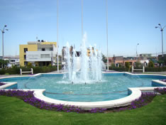
| Plaza Mayta Capac | |
Coordinates: 16 ° 23 ′ 41 ″ S , 71 ° 31 ′ 21 ″ W
The Miraflores district is located in the Arequipa Province of Arequipa region in southwestern Peru . The district was founded on January 2, 1857. It has an area of 26.1 km². In the 2017 census, 62,895 people lived in the district. In 1993 the population was 50,590, in 2007 50,704. The district administration is located in the town of Miraflores in the southwest of the district at an altitude of 2,430 m . This is part of the metropolitan area of the provincial and regional capital Arequipa and is 1.6 km east-northeast of the city center.
Geographical location
The Miraflores district is located in the northern center of the Arequipa Province. The district has a lengthwise extension in SW-NE direction of 16.5 km. It extends in the northeast to the 5822 m high summit of the Misti volcano . Much of the district is located on the southwest slope of the volcano, which is covered with former lava flows.
The Miraflores district borders on the Alto Selva Alegre district to the west, the Chiguata and Mariano Melgar districts to the east, and the Arequipa district to the southwest .
Web links
- Municipalidad de Miraflores
- Peru: Arequipa region (provinces and districts) at www.citypopulation.de
- INEI Perú
