San Juan de Siguas district
| San Juan de Siguas district | |
|---|---|
 The district of San Juan de Siguas is located in the far west of the province of Arequipa (marked in red) |
|
| Basic data | |
| Country | Peru |
| region | Arequipa |
| province | Arequipa |
| Seat | Tambillo |
| surface | 36.1 km² |
| Residents | 691 (2017) |
| density | 19 inhabitants per km² |
| founding | January 2, 1857 |
| ISO 3166-2 | PE-ARE |
| politics | |
| Alcalde District | Elard Jesús Valencia Obando (2019-2022) |
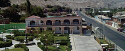
| District Administration Building | |
Coordinates: 16 ° 20 ′ 57 ″ S , 72 ° 7 ′ 36 ″ W
The district of San Juan de Siguas is located in the province of Arequipa in the Arequipa region in southwestern Peru . The district was founded on January 2, 1857. It has an area of 36.1 km². The 2017 census counted 691 residents. In 1993 the population was 879, in 2007 it was 1295. The district administration is located in the 1152 m high village of Tambillo with 501 inhabitants (as of 2017). Tambillo is just 65 km west of the provincial and regional capital Arequipa .
Geographical location
The district of San Juan de Siguas is located in the far west of the province of Arequipa. The Río Siguas, right tributary of the Río Vítor , crosses the district in a southerly direction. The national road 1S ( Panamericana ) from El Pedregal to La Joya runs through the district.
The district of San Juan de Siguas borders in the west on the district Majes ( province Caylloma ), in the north on the district Santa Isabel de Siguas , in the east on the district Santa Rita de Siguas and in the extreme south on the district Quilca ( province Camaná ).
Web links
- Peru: Arequipa region (provinces and districts) at www.citypopulation.de
