Yanahuara District
| Yanahuara District | |
|---|---|
 The district of Yanahuara is centrally located in the province of Arequipa (marked in red) |
|
| Basic data | |
| Country | Peru |
| region | Arequipa |
| province | Arequipa |
| Seat | Yanahuara |
| surface | 3.7 km² |
| Residents | 25,417 (2017) |
| density | 6926 inhabitants per km² |
| ISO 3166-2 | PE-ARE |
| Website | muniyanahuara.gob.pe (Spanish) |
| politics | |
| Alcalde District | Roger Anghelo Huerta Presbítero (2019-2022) |
| Political party | Juntos Por El Desarrollo de Arequipa |
| Mirador de Yanahuara, in the background the Misti volcano | |
Coordinates: 16 ° 23 ′ 13 ″ S , 71 ° 32 ′ 31 ″ W.
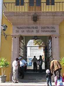
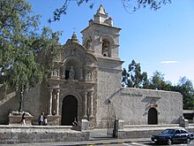
The Yanahuara district is located in the Arequipa Province of Arequipa region in southwestern Peru . The district has an area of 3.67 km². At the 2017 census, there were 25,417 residents in the district. In 1993 the population was 17,379, in 2007 22,890. The district is congruent with the city of Yanahuara , which forms a western suburb of the regional capital Arequipa and is located in the metropolitan area.
Geographical location
The district of Yanahuara is centrally located in the province of Arequipa at an altitude of 2390 m . The district is west of the Río Chili . The district is bordered to the east by the district and city of Arequipa , to the south by the Sachaca district , to the west by the Cerro Colorado district and to the north by the Cayma and Alto Selva Alegre districts .
Individual evidence
- ↑ a b Peru: Arequipa - Provinces & Districts . www.citypopulation.de. Retrieved February 26, 2020.


