
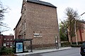
Effers
|
Effers
City of Huerth
|
|
|---|---|
 |
|
| Height : | 60 m |
| Residents : | 12,256 (May 31, 2015) |
| Incorporation : | October 1, 1933 |
| Postal code : | 50354 |
| Area code : | 02233 |

After Hermülheim and the city center, Efferen is the second largest district of Hürth in the Rhein-Erft district . Around 650 residents are registered as having second homes.
location
Efferen borders directly to the south-west of Cologne , from whose residential development in the Klettenberg district it is separated by the wide, forested Cologne green belt and the motorway ring ( A4 ).
history


A Roman chamber grave with two sarcophagi is located on the old Römerstraße Trier – Cologne , now known as Agrippa-Straße Köln – Trier (now Luxemburger Straße as part of the B 265 ) . Further finds from Roman settlements and graves indicate that the area was densely populated during this period. A stele modeled as a Leugenstein , a southern ambience and a piece of reconstructed Roman paving on the traffic circle between Efferen and Hermülheim has been reminiscent of Römerstrasse since 2008 . The overall design of the roundabout was based on the drafts of the Hürth landscape planner Reinhold Mengel. There are numerous traces of settlement from the Franconian times, such as a grave field with some unplanned burials (street "Frankenhof"). The original early medieval settlement core lay along the Duffesbach and in the direction of the Roman road.
Efferen has belonged to the Duchy of Jülich since the Middle Ages . After the French occupation of the Rhineland after 1794, the place formed together with the communities of Stotzheim and Kriel a Mairie ( mayor's office ) in the Département de la Roer . In 1888 the municipality of Kriel, where the town hall of the mayor's office was located, and parts of the municipality of Efferen were incorporated into Cologne. The mayor's office in Efferen was managed jointly with Hürth until 1919. After a brief period of independence, it was then united with the large community of Hürth, which was formed in 1930, with effect from October 1, 1933.
Efferen was strongly characterized by agriculture. The most important courtyards were the Brentengut (owned by the Teutonic Order , then by the von Efferen family and the other lords of the castle and finally by the St. Maria im Kapitol in Cologne), the Lupenaugut, the Weidenbachhof or Renneberghof opposite the castle (where meanwhile the Renneberg was created as a fair, market and parking lot; the courtyard fell victim to the Dutch in the Thirty Years War ), the Bredemargut, bought by the city of Cologne, in its manor house on Bachstrasse in the end of the Weimar Republic the administration of the The mayor's office in Efferen was located, later the local NSDAP office , the Lintlarhof, which was owned by the Destrée family for many years and on whose premises the Protestant church, the Große Hof or Mirweilerhof and the Fronhof, was built behind the primary school .
Along the Duffesbach there was only one mill in Efferen , the Lowenmühle (probably from Gerber- "Lohe") later, when weapons were also ground there, called the Schleifkottenmühle or just "the Schleifkotten". It stood a little outside the town in the direction of Cologne and was first mentioned in a document in 1211. Here too, the landlady was the monastery of St. Mary in the Capitol. After the mill was demolished, individual smaller businesses settled here, all of which no longer existed at the end of the Second World War. The last houses on the Schleifkotten residential area were demolished in 1976, the area was partially reforested and can no longer be distinguished from the Cologne green belt. The creation of the Cologne green belt , operated by Konrad Adenauer in 1924 , cost Efferen a third of its arable land.
During the Weimar period, the center was the dominant political force in the area, Karl Kuenen was the mayor. In the context of the global economic crisis , the financial situation in Efferen worsened to such an extent that only joining one of the clearly richer neighboring communities, i.e. Cologne or Hürth, could significantly improve the living conditions of the population. Huerth refused; The connection to the interested Cologne prevented the violent opposition of the other Land Cologne municipalities, who were afraid of being "swallowed up". It was not until 1933 that Efferen was forcibly incorporated into Hürth by decree of the Prussian Ministry of the Interior. At the same time, Kuenen was dismissed from the public service under the law to restore the civil service. A street in Efferen is named after him today. His tombstone from the Melaten cemetery was transferred to the old cemetery in 2014. In the 1970s there was a renewed attempt by Cologne with the municipal territorial reform in North Rhine-Westphalia to incorporate Efferen into Cologne, which was able to prevent a signature campaign and the intervention of local politicians.
On October 31, 1944, large parts of Efferen, including the church, the hospital and the monastery, were destroyed by a bomb attack. 36 people lost their lives.
Place name
There are three theories to explain the place name Efferens, which Hans Duell explains in his local history. For example, a wealthy Ubier named Eberhard or Eborin, federated with the Roman Empire, could have been called "Effer" in dialect, who could then have called his estate "Efferna sala". A second explanation is based on the Latin word for "carry out" (in the sense of "carry out of the house / town to the funeral"), "effere". Accordingly, Efferen was a Roman burial place. This theory is supported by the fact that it was the custom of the Romans to bury deceased citizens on the arterial roads in front of the city gates. In 1899 a Roman burial chamber was discovered in the local area of Efferen (see above "History"). The third theory relates to the septic tank or clarification basin, which is still preserved today, on Berrenrather Strasse in the green belt, an area that used to be part of the Efferen community. This clarifier was originally part of the Eifel aqueduct. The place name Efferen could thus be based on the word "everre" (Latin for "place of sweeping").
Churches


From the end of the 7th century, the Cologne nunnery of St. Maria in the Capitol was landlord and heiress of Efferen. There must have been a church back then. Efferen was first mentioned as a parish in 1189.
St. Anna and St. Donatus were highly venerated in the village. The Catholics initially settled for a simple wooden church. Only on June 6, 1869, this was replaced by a solid structure that stood on Kaulardstrasse, formerly Kirchstrasse, exactly opposite today's church; Auxiliary Bishop Baudri inaugurated the new church. This church was completely destroyed in 1944 (see below). One had to make do with an emergency church in which the evangelicals were given hospitality rights after the war.
A new Catholic church - designed by Cologne architects Wolfram Borgard and Fritz Volmer - was inaugurated by Auxiliary Bishop Wilhelm Cleven on November 25, 1956 on the site of the former cemetery at the corner of Bachstrasse and Kaulardstrasse . From the old church, the magnificent choir stalls originally from St. Maria in the Capitol and some sculptures could be saved. The parish church is named St. Mary's Birth .
Pastors in the parish of St. Mary's Birth in the last few decades were JA Kappenhagen (1825–1879), AA Schmitz (1889–1900), FW Esch (1900–1918), M. Kaulard (1919–1942, Dean), W. Halfen (1942–1956), P. Giesen (1956–1982, he died in Efferen in 2005 at the age of 90, some time after he had celebrated his 60th anniversary as a priest), E. Jansen (1982–2004), H. Müller (2004–2008) and F.-J. Lausberg August 1, 2008 - January 31, 2014, since then the parish association has been co-administered by Dean Michael Tillmann, Gleuel.
The few Evangelicals in Efferen belonged to the Cologne-Lindenthal community. It was not until 1926 that a small prayer room of their own could be built for the Effern community members on today's Kaulardstrasse, which was destroyed in the bombing. Today the Sparkasse is there. The Evangelical Church was built in stages. First a small meeting room for church service, youth home and community hall was built, which was opened on July 13, 1952 with a church service. Just a year and a half later, on December 20, 1953, Chief Church Councilor Boue inaugurated the simple Protestant church - designed by the architect Jürgen Körber - which was attached to the hall with many hours of voluntary work . 1956 ended the affiliation to Lindenthal. In 1994 the church was rebuilt and expanded. Since then it has been called the Friedenskirche . Evangelical pastors were Pastor Paul Mader and currently Pastor Tom Hennig.
Special districts

Noteworthy is the "initial donation" of DM one million made by Bayer AG board member Ulrich Haberland on the other side of Luxemburger Strasse by architect Joachim Schürmann for the University of Cologne and the Kölner Studierendenwerk , built between 1963 and 1966 and built several times over , 1990 to 1992, the student village Efferen was expanded and, from 1996 onwards, it was fundamentally refurbished, with around 1200 residents since 1996. It is open to students from all Cologne universities. With two 13-storey residential towers - in addition to its many two- to five-storey buildings - it is the two tallest buildings in Hürth. The Efferen gravel pit is located behind the student village .
One of the newer residential areas is the artist and media quarter with 350 apartments in the direction of Kalscheuren, which was built on an industrial wasteland by mid-2003 . Behind it is a medium-sized industrial park.
Worth seeing
Efferen Castle


The Efferen Castle was in 1391 in the course of disputes between the city of Cologne and its Archbishop Friedrich III. of Saar are strongly fortified by the Cologne residents and have since changed several times. In the 18th century, the architect Christian Birkenhus built a new, seven-axis, two-storey mansion on the medieval foundations. This is indicated by the year 1769 in the gable. The tower is medieval, the crowning baroque hood was added in the 17th century, originally the building was crenellated. The assumption that there were once four towers with Roman foundations could not be confirmed during the foundation work necessary due to the war damage; there were no traces of this. The moat carried water until 1962. From the 14th century on, the families of the lords of the castle can be identified:
- The Overstolzen , a Cologne patrician family, which later called themselves Overstolz von Efferen, later only von Efferen. This family gained some prominence in the following years, one Wilhelm von Efferen was Prince-Bishop of Worms , another Wilhelm von Efferen was a Teutonic Knight and Burgrave of Riga , another Privy Councilor of Emperor Ferdinand II in Vienna. A Gerhard Ludwig von Efferen was the great-grandfather of the German-American general Friedrich Wilhelm von Steuben .
- from 1393 the family v. Coesen or von Cuesin, now the castle estate was probably called the Kusinengut
- In 1439, the mayor of Cologne, Rüttgers von der Weyden, was enfeoffed with the estate that owned it
- Sold to Johann Rauftesch in 1461. Whose son,
- Johann v. Diepenbroich was properly enfeoffed with the estate in 1477.
- From 1535 to 1635 the respected Cologne family Orsbeck owned the castle.
- The von Bourtscheid family followed for two centuries until 1836.
- The Counts of Schaesberg owned the castle until 1870, when they sold it
- the Counts of Fürstenberg-Stammheim from Bonn, which they passed on to their tenants in 1894
- Matthias Koch passed on. His family still owns the property.
Many of these names can be found as street names around the castle.
Other sights
- Restored fountain in Efferen (Schulhof Bachstrasse)
- Roman grave in Efferen (at the train station)
- Old cemetery (Kolpingstrasse)
- Monument to the ex-madnesses of Efferen (Kaulardstrasse / corner of Steinstrasse)
Ahl Schull, Bachstrasse

Wayside shrine, the Villa Brückmann, Bachstrasse and Brentenstrasse

Old water pump, Bachstrasse backyard
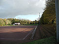
Efferen sports field
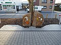
Monument to the Extollities Efferen


.jpg)
Green spaces
Efferen benefits from Cologne's green belt , which separates it from the city of Cologne. The noise from the A4 is also muffled here by a young strip of forest with forest and bridle paths. Particularly popular is the area around the Decksteiner Weiher and the sports park of 1. FC Köln , which can be reached via Berrenrather Straße or Decksteiner Straße (only within walking distance) and from the center of Efferen via Bellerstraße (sic) past the cemetery and an allotment garden. The Duffesbach flowing in an open canal bed is embedded in a narrow green corridor up to the former Hermülheim Castle . Larger open spaces are located northwest of the village in the Frielsweg and Decksteiner Straße area. Here a cycle path leads from Cologne to Lake Otto Maigler between the Hürth districts in the west of the city. Open spaces are also to the east of the village on the left Rhine route . The former Efferen gravel pit is "illegal" for swimming and legal for fishing.
Schools / sports
- Geschwister-Scholl-Schule, community elementary school, Im Wiesengrund 30.
- Don Bosco School, Catholic elementary school, also Im Wiesengrund 30.
- Adult education center of the association of four cities in the south of the Rhein-Erft district with a school building, the Ahl Schull , Bachstrasse 95-97.
economy

The former brickworks , which mined the alluvial clay from the older flood arms of the Rhine, have been abandoned since the late 1960s. The student village is in the last pit. The sand and gravel excavations were also stopped. The medium-sized iron processing industry has declined a lot. The artist and media district is now on the Kleefischgelände. On the Berrenrather Straße on the outskirts, the last metalworking company, Alucolor, was closed. The largest company in Efferen is the Rewe Group . REWE Deutscher Supermarket KGaA - ZNL West and REWE-Zentral AG - NL West have their administrative headquarters on the premises in Rewestrasse, in addition to their administrative headquarters, REWE-Zentral AG - NL West operates a food warehouse on site. Non-polluting industrial areas connect to Efferen in the direction of Kalscheuren . There is also the media district with numerous television production halls.
politics
mayor
- 1816-1845 Johann Huberty
- 1845–1846 Franz Andreas Klein (acting)
- 1846–1847 Tillmann Klein (acting)
- 1847–1864 Johann Peter Weygold
- 1864–1883 Franz Weygold
- 1883–1888 Gerhard Sugg
- 1888–1920 Heinrich Rosell (also Mayor of Hürth)
- 1920–1933 Karl Kuenen ( center )
Today's politicians
The mayor is Thomas Blank ( CDU ). Council members for Efferen are, as of June 2014, Gerald Wolter, Stephan Renner, Saleh Mati (all SPD ), Thomas Blank, Herbert Verbrüggen and Rüdiger Winkler (all CDU) and Kurt Martmann ( free voters ).
literature
- Clemens Klug: Hürth - how it was, how it was , Steimel Verlag, Cologne undated (1962)
- Hans Duell: 2000 years of Efferen through the ages , ed. from the local community Hürth-Efferen, Hürth o. J. (1990)
Individual evidence
- ^ City of Hürth (ed.): Population statistics - residents with main and secondary residence . Hürth May 31, 2015 ( huerth.de [PDF; 34 kB ; accessed on December 28, 2015]). PDF document ( Memento of the original dated December 28, 2015 in the Internet Archive ) Info: The archive link was inserted automatically and has not yet been checked. Please check the original and archive link according to the instructions and then remove this notice.
- ↑ Bernd Imgrund: 111 locations in the Cologne area. Emonds Verlag, Germany 2010, page 102.
- ↑ Hürth street directory ( Memento of the original from August 19, 2014 in the Internet Archive ) Info: The archive link was inserted automatically and has not yet been checked. Please check the original and archive link according to the instructions and then remove this notice.
- ↑ See Duell, Hans: 2000 years Efferen in the course of time, Hürth 1990, p. 5.
- ↑ Thomas Hennig, Paul Mader: The history of the evangelical church in Efferen , in Hürther Heimat , issue 74, 1995, pp. 36–41
- ↑ Clemens Klug: Hürth , p. 53 ff and Duell: 2000 years Efferen , p. 27 ff
Web links

Alstädten-Burbach | Alt-Huerth | Berrenrath | Efferen | Fischenich | Gleuel | Hermülheim | Kalscheuren | Kendenich | Knapsack | Sielsdorf | Stotzheim