
Eickesmühle
| Eickesmühle
|
||
|---|---|---|
 Former location of the Eickesmühle |
||
| Location and history | ||
|
||
| Coordinates | 51 ° 9 '36 " N , 6 ° 27' 30" E | |
| Location |
|
|
| Waters | Niers | |
| Built | 1442 first documented mention | |
| Shut down | 1943 Destroyed by aerial bombs | |
| technology | ||
| use | Oil mill , flour mill and grinder | |
| Grinder | 1 grind , 1 oil press | |
| drive | water wheel | |
| water wheel | undershot | |

The Eickesmühle was a water mill with an undershot water wheel on the upper reaches of the Niers in the Mönchengladbach district of Rheydt in the administrative district of Düsseldorf .
geography
The Eickesmühle was located on the left side of the Niers, on Römerstrasse, in the Mönchengladbach district of Rheydt. Above was the stone mill , below the Zoppenbroich mill . The area on which the mill building stood is at a height of approx. 52 m above sea level .
Waters
The Niers (GEWKZ 286) in its old river bed supplied numerous mills with water for centuries until the river was straightened . The Niers rises in Kuckum , a district of the city of Erkelenz . The Niers has a total length of 117.668 km and a total catchment area of 1,380.630 km 2 up to its confluence with the Meuse near Gennep (Netherlands) . The source is 73 m above sea level. NN , the mouth at 9 m above sea level. NN . The Niersverband is responsible for the care and maintenance of the water .
history
The Eickesmühle was first mentioned in a document in 1442, when its owner Gerhard, Herr zu Rheydt and Ritter von Heppendorf , gave the mill to Coen and his wife Gertrud to the owners of the Eickeshof as a lease . The mill up deme Eyckholtz was a pure oil mill that had to provide a lease of 35 pounds of oil. The originally small mill was expanded into an independent courtyard in 1700. In 1842 it consisted of an oil, grinding and grain mill , which a decade later was also used as a log mill. From 1849 the offshore mill pond could be used as a swimming pool . In 1856 the profitability of the mill was increased considerably with the installation of a turbine . During the Second World War , the mill was hit by aerial bombs and completely destroyed. The nearby industrial park An der Eickesmühle is still reminiscent of the former mill.
gallery
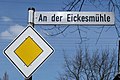
Street name An der Eickesmühle

Today's kidney course

Sign of the Niersverband

Weir on the Niers
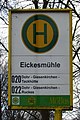
Bus stop Eickesmühle

Overflow at the weir

The Eickesmühle on the map new recording from 1912

The Eickesmühle on the original cadastral map from 1846

The Eickesmühle on the Tranchot map 1803–1820


literature
- Hans Vogt: Lower Rhine water mill guide 2nd edition. Verein Niederrhein, Krefeld 1998, ISBN 3-00-002906-0 , pages 489-490.
- Robert Lünendonk: The Niers and their mills 1st edition November 2012, ISBN 978-3-8375-0741-6 , pages 51-52, 99-102,.
Web links
Individual evidence
- ^ German basic map 1: 5000
- ↑ http://www.lanuv.nrw.de/fileadmin/lanuv/wasser/pdf/Gewaesserverzeichnis%20GSK3C.xls
- ↑ Archive link ( Memento of the original from October 17, 2013 in the Internet Archive ) Info: The archive link was inserted automatically and has not yet been checked. Please check the original and archive link according to the instructions and then remove this notice.
- ↑ http://www.Niersverband.de/
Am Mühlenbach :
Vollmühle
Am Gladbach :
Compesmühle |
Angel Mill |
Tile mill |
Yaw mill |
Krallsmühle |
Supreme Mill |
Tube mill |
Vitgesmühle
An der Niers :
Bellermühle |
Bottmühle Odenkirchen |
Broichmühle |
Burgmühle Odenkirchen |
Eickesmühle |
Güdderather Mühle |
Kappelsmühle |
Nun mill |
Odenkirchen paper mill |
Wickrath paper mill |
Pixmühle |
Pletschmühle |
Wetscheweller mill |
Wickrathberger Mill |
Wilderather Mill |
Rheydt Castle Mill |
Castle mill Wickrath |
Schwalmer Mill |
Stone mill |
Zoppenbroich Mill